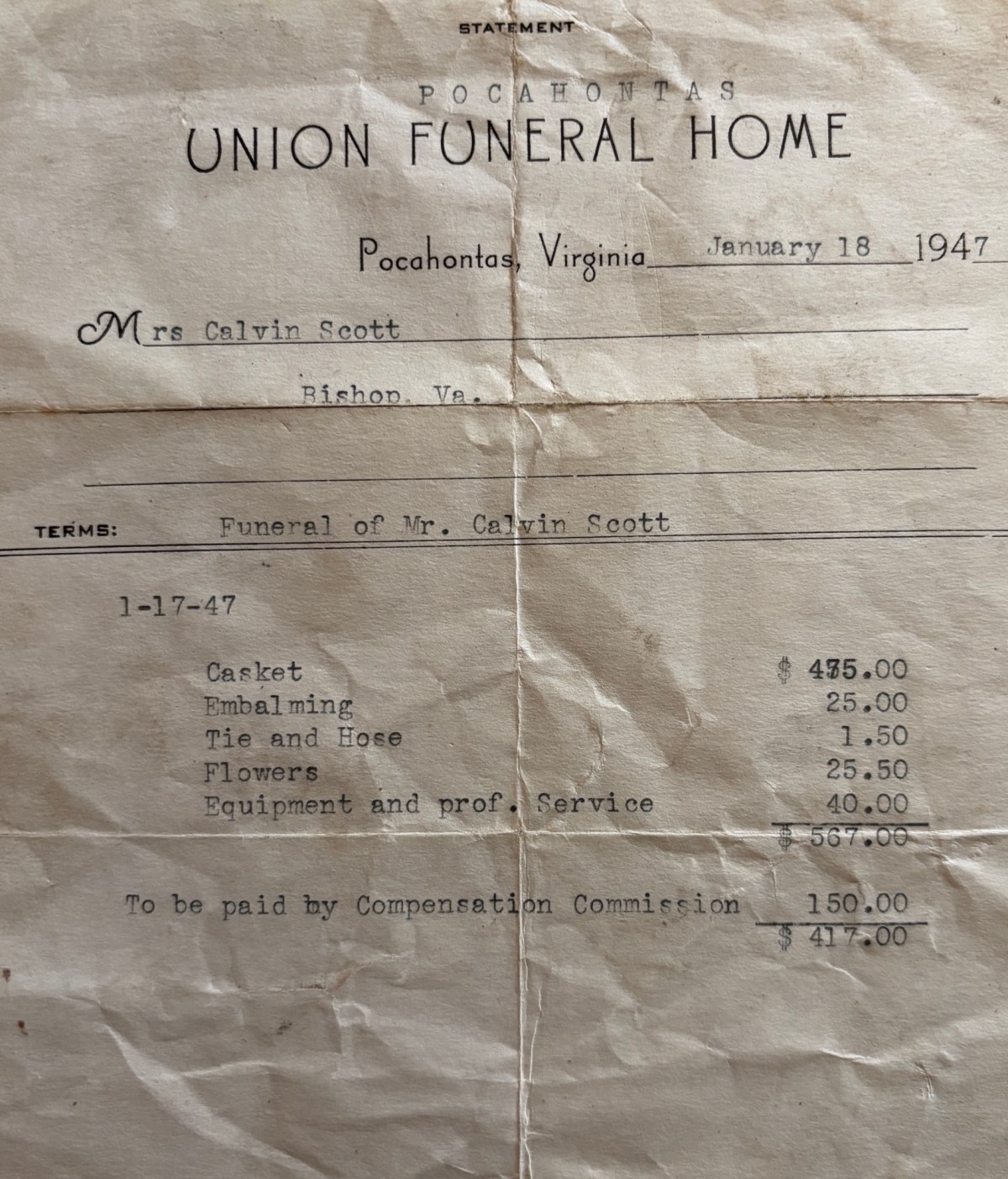
A 1947 funeral statement from Pocahontas, Virginia, reveals just how costly a funeral could be for working families. The $567 bill, equivalent to roughly $8,480 today, helps explain why mutual aid societies were so essential to Black communities across Central Appalachia.
What did it cost to bury someone in 1947?
This funeral statement from Union Funeral Home in Pocahontas, Virginia, gives us a rare, detailed answer, while also preserving a small piece of the story of Calvin Isaac Scott and his wife, Edith Scott.
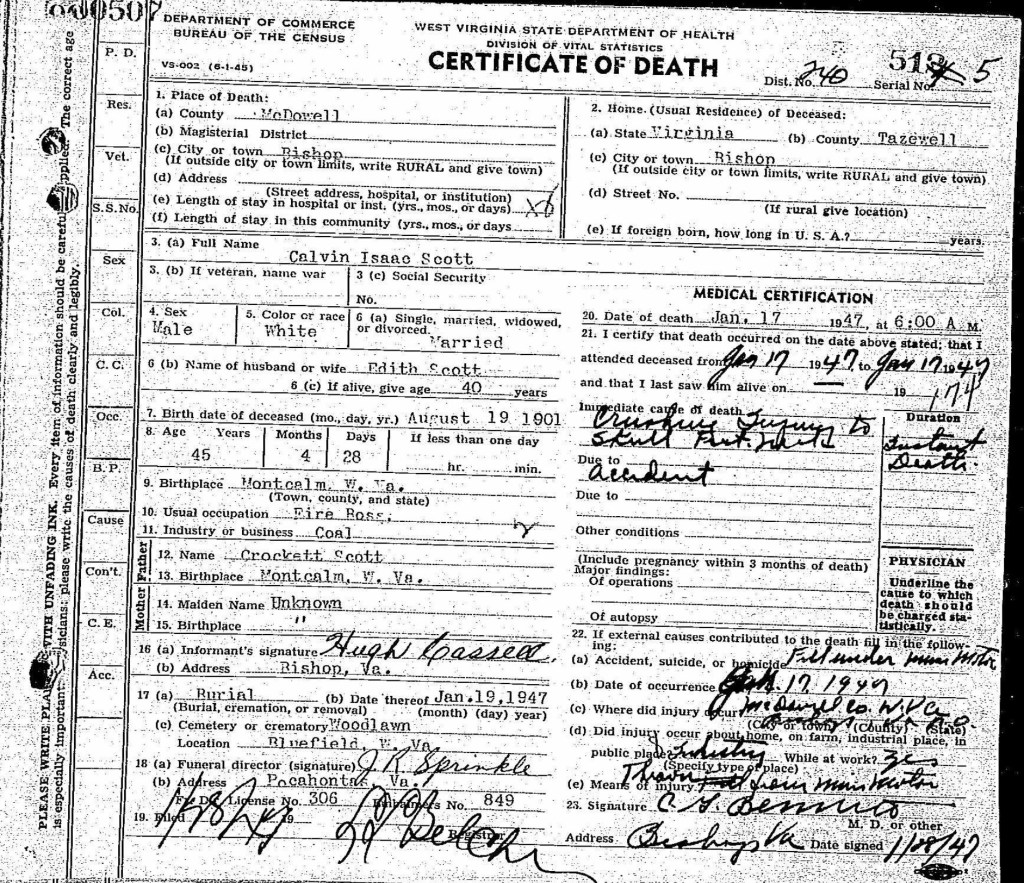
Calvin Isaac Scott, a 45-year-old coal mine fire boss, died on January 17, 1947, following a horrific mining accident. His death certificate records severe crushing injuries to his skull. The following day, January 18, 1947, Union Funeral Home issued this statement to his wife, Edith Scott of Bishop, Virginia.
The total funeral cost was $567, including:
Casket, $475 Embalming, $25 Tie and hose, $1.50 Flowers, $25.50 Equipment and professional service, $40
The Compensation Commission paid $150, leaving Edith Scott and the family with $417 to pay.
In today’s dollars, $417 in 1947 represents roughly $6,245 in purchasing power, while the full $567 would be approximately $8,480. Even a stripped down version of these funeral costs came to $500, equivalent to roughly $7,485 today.
For working families in Central Appalachia, that was a significant financial burden. And this is where the importance of Maggie L. Walker’s St. Luke, the Odd Fellows, and the Household of Ruth becomes even clearer. Mutual aid societies provided a financial safety net when families faced death, illness, and other hardships.
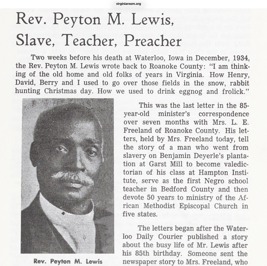
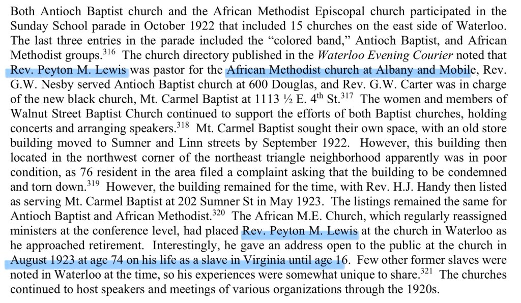
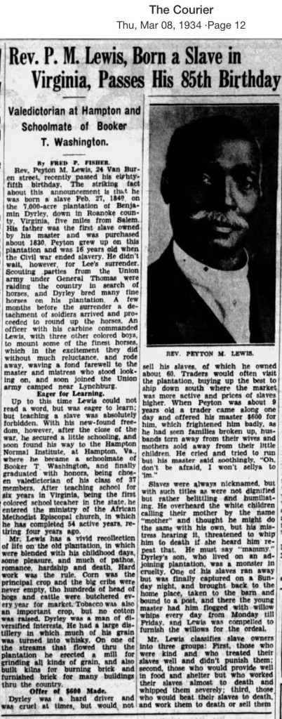
These firsthand recollections provide a rare glimpse into the daily realities of slavery in western Virginia. After emancipation, Lewis became part of the second class to attend Hampton Institute, graduating as valedictorian in 1873. He returned to Bedford County as its first Black public school teacher before dedicating more than 50 years to ministry in the African Methodist Episcopal (AME) Church—a remarkable journey from enslavement to educator and community leader.
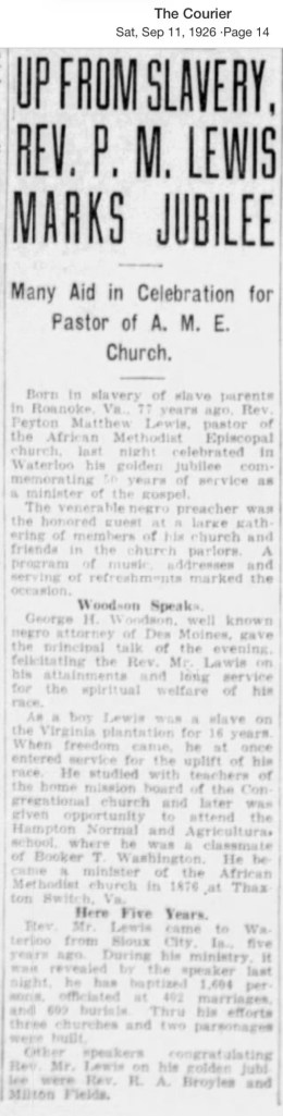
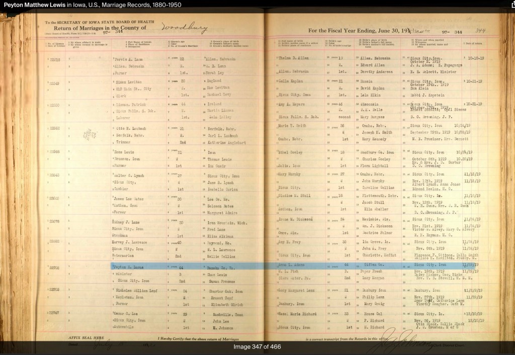
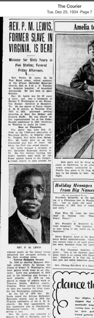
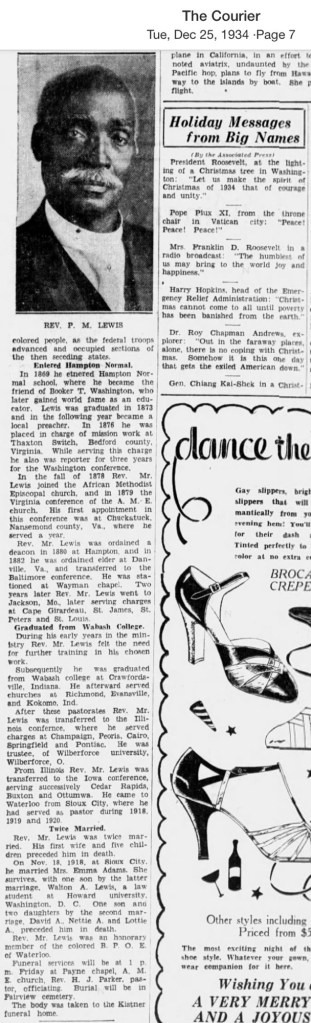
One remarkable story tucked away in the Journal of the Roanoke Historical Society (Vol. 7, p. 50) follows the extraordinary life of Rev. Peyton M. Lewis (1849–1934), whose own recollections of slavery were first published in the Waterloo Daily Courier of Iowa in 1934. His life traces an inspiring journey from enslavement in Bedford County, Virginia, to becoming an educator, minister, and respected leader.
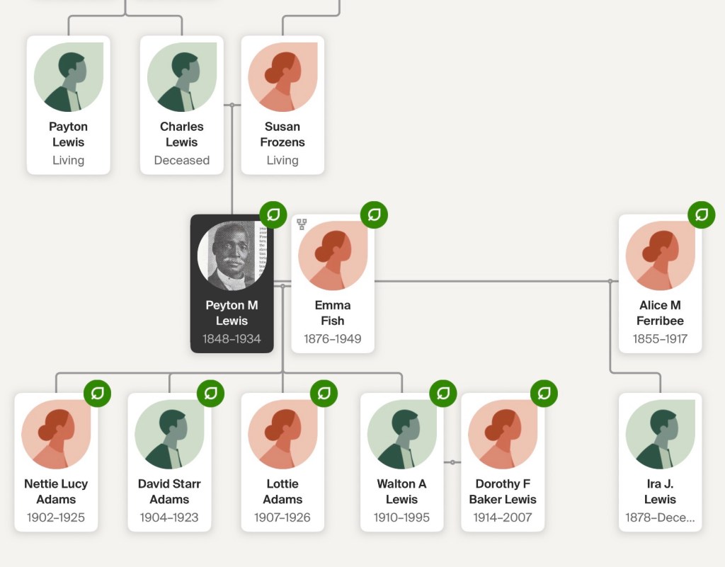
Peyton M. Lewis was born enslaved in 1849 on the plantation of Benjamin and Julia Deyerle near Garst Mill in Bedford County. His father, Charles Lewis, was a highly skilled brick maker and distiller who, along with his brother Peyton, had been purchased by Benjamin Deyerle in Richmond. Benjamin Deyerle was one of western Virginia’s best-known builders, responsible for constructing brick homes, mills, public buildings, and a large whiskey distillery throughout the South West Virginia, including Blacksburg and Christiansburg.
Lewis vividly described the work he performed while enslaved. As a boy he molded bricks, hauled flour and whiskey with a two-team ox wagon, and cleaned and polished the family’s shoes. He also recalled that Uncle Dick and Richard Taylor served as carriage drivers for the Deyerle family. His memories provide a rare first-person account of everyday labor on a western Virginia plantation.
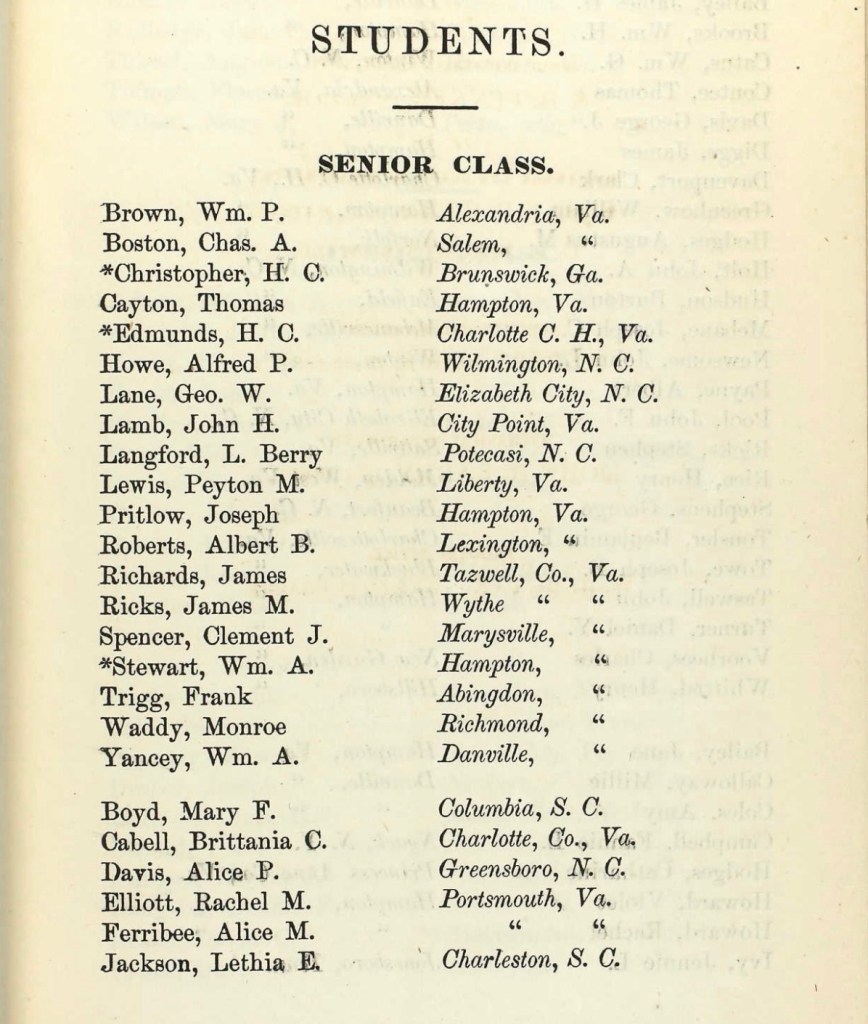
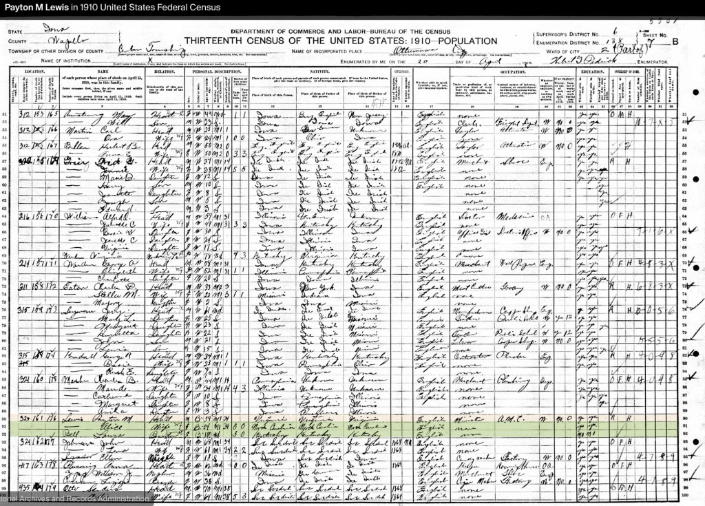
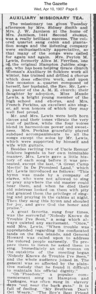
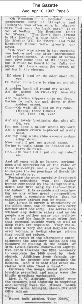
Freedom came in 1865 when Peyton was 16 years old, opening opportunities that had previously been denied him. Lewis participated in mission schooling for formerly enslaved children, where a teacher recognized his abilities and encouraged him to continue his education at the newly founded Hampton Normal and Agricultural Institute. Entering only a year after the school opened, he graduated in 1873 as valedictorian of a class of just seventeen students. There he met fellow student Alice Ferribee (1855-1917) of Elizabeth City, North Carolina, whom he married shortly after graduation.
Returning to Bedford County, Lewis became the county’s first Black public school teacher. He wrote candidly about the challenges of establishing schools during Reconstruction, often teaching in log churches and abandoned cabins because no schoolhouses existed. In an 1893 Hampton alumni publication, he reported having taught more than 600 children, with at least eleven of his former students becoming teachers themselves. His work took him to Liberty (now Bedford), Thaxton Switch, and Bunker Hill, where he helped lay the foundation for public education in Black communities.
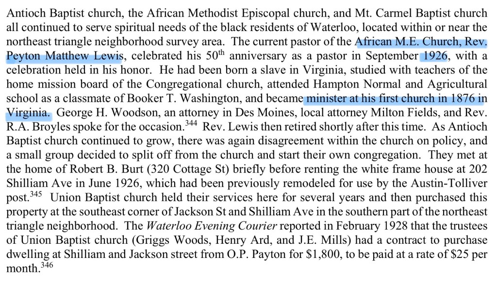
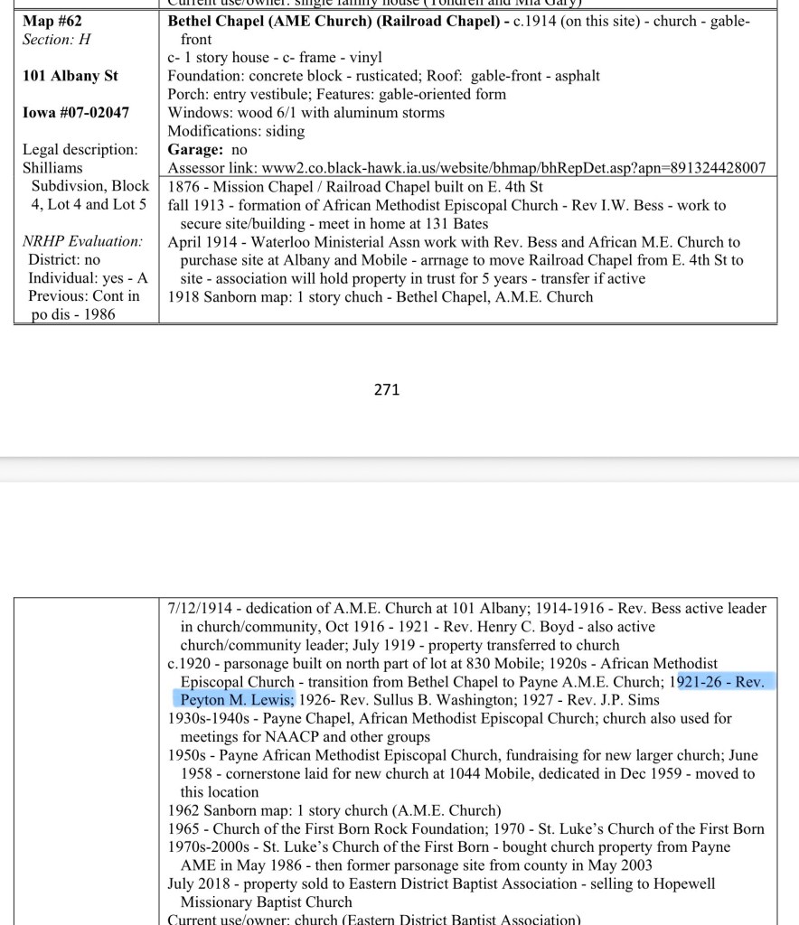
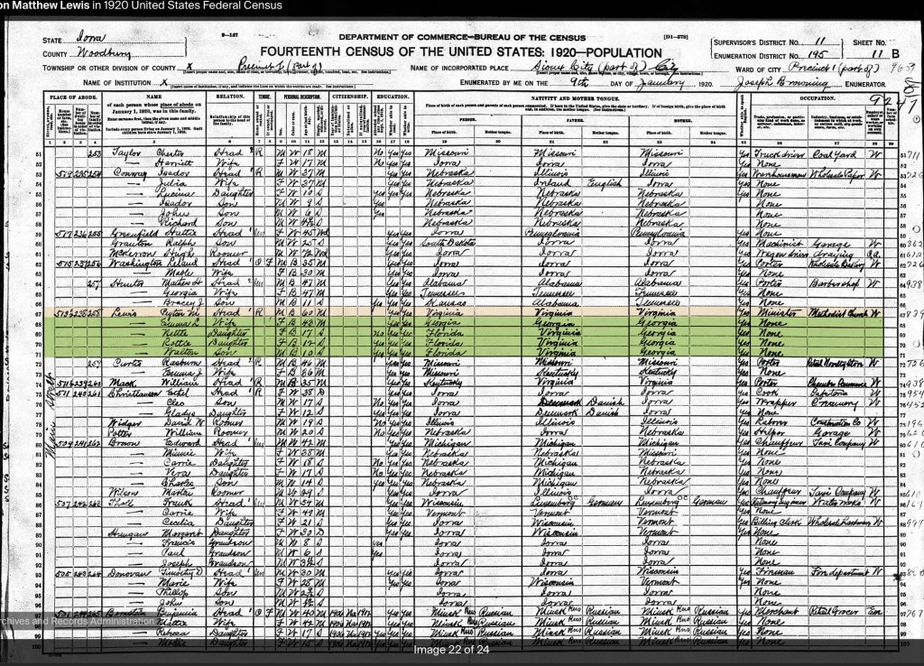
Lewis later attended Wabash College in Indiana and was ordained as a minister in the African Methodist Episcopal (AME) Church. His ministry spanned more than fifty years across several states. By 1926, the citizens of Waterloo, Iowa, celebrated his fiftieth anniversary in the ministry, noting that his first wife, Alice Ferribee for Elizabeth City, NC, had been a year ahead of Booker T. Washington at Hampton and he had devoted his life to education and the church. (cityofwaterlooiowa.com)
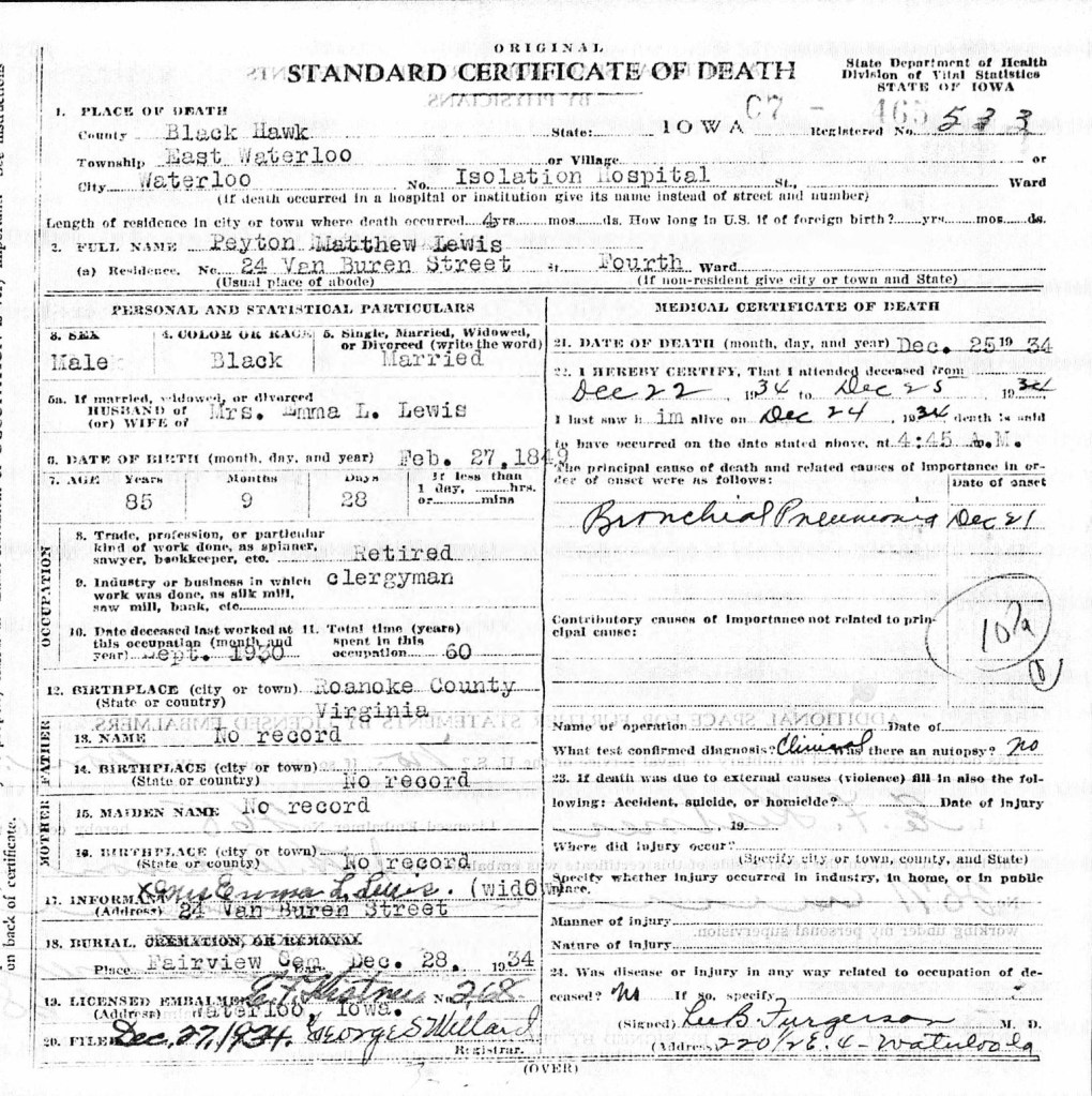
Rev. Peyton M. Lewis died in Waterloo, Iowa, in December 1934. Like many African Americans who left Virginia during the late nineteenth and early twentieth centuries, he settled in Iowa seeking greater economic opportunity and a community less constrained by the racial oppression of the Jim Crow South.
Further Research
Rev. Lewis’s story appears to extend well beyond the published article. Surviving correspondence between Lewis and descendants of the Deyerle family is preserved by the Roanoke Historical Society, Virginia Room. These letters include his reflections on growing up enslaved, his family, and memories of Christmas celebrations and work on the Deyerle plantation. They offer an invaluable first-person record of slavery and Reconstruction in western Virginia and deserve wider study.
Why Rev. Peyton M. Lewis’s Story Matters to Montgomery County
Although Rev. Peyton M. Lewis spent much of his life in neighboring Bedford County, his story has important connections to Montgomery County’s history.
First, the Lewis surname appears in historical records throughout Montgomery County, raising the question of whether there may be family connections worth exploring. Further genealogical research could reveal relationships between the Bedford County Lewis family and other African American families living in Montgomery County after emancipation.
Second, Lewis’s firsthand descriptions of establishing schools for formerly enslaved children closely mirror what was happening in Montgomery County during Reconstruction. He recalled struggling to find suitable places to teach, often relying on log churches and cabins because dedicated school buildings did not yet exist. Similar challenges unfolded here. Blacksburg’s first school for Black children, serving grades one through seven, met in the former Presbyterian Union Church on East Clay Street, on land adjacent to the Edwin Amiss estate (later owned by the Palmer family). In Christiansburg, Freedmen’s Bureau superintendent Capt. Charles Schaefer documented the difficulty of securing a building for a Black school, noting the reluctance of white property owners to rent space for African American education.
Firsthand narratives from formerly enslaved people in Montgomery County are exceedingly rare. Because of this, accounts like Rev. Lewis’s become especially valuable. While his experiences occurred just across the county line, they provide a vivid, personal window into the challenges of emancipation, education, and community building that were shared across southwest Virginia. His recollections help us better understand the historical experiences of people in Montgomery County when local voices from the period have not survived.
Taken together, these regional stories allow us to reconstruct a more complete and truthful history of Reconstruction in the New River and Roanoke valleys—one that recognizes the determination of newly freed African Americans to build schools, educate their children, and create opportunities despite significant resistance.
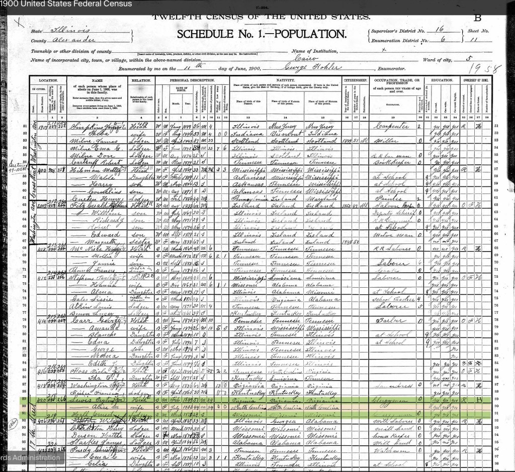
Death CertificateHampton Institute 1900 Census1910 Census1920 Census
Blacksburg’s history reaches far beyond our local newspapers. A search of The Richmond Planet archives reveals decades of letters and news from our community, reminding us that Blacksburg was part of important conversations across Virginia, and that one of America’s most influential Black newspapers preserved those stories for future generations.
Did you know Blacksburg appears in the pages of The Richmond Planet?
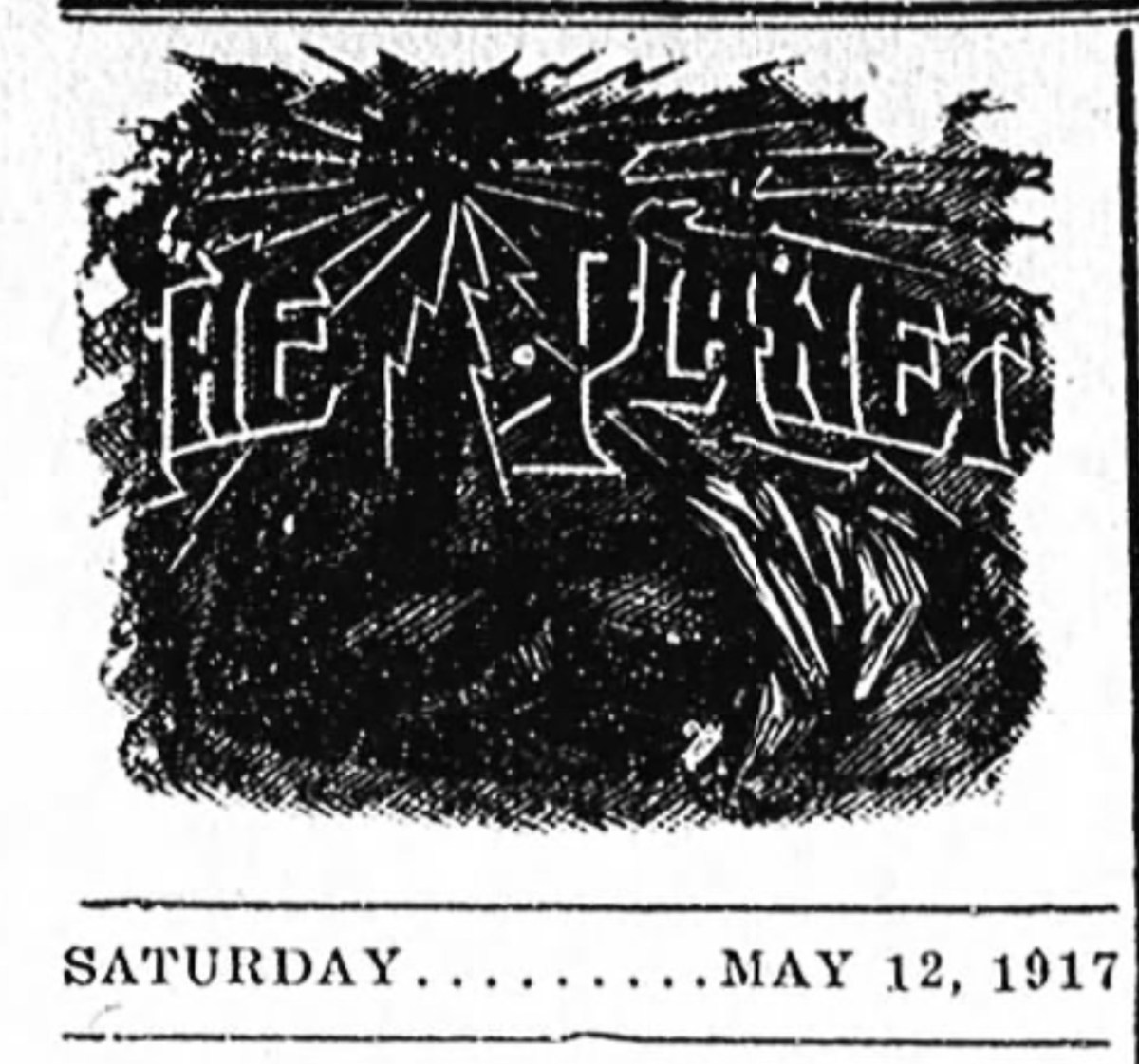
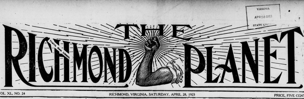
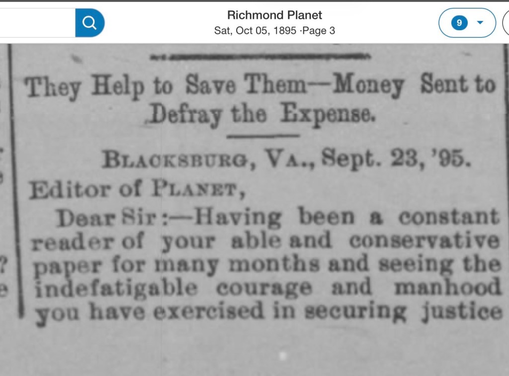
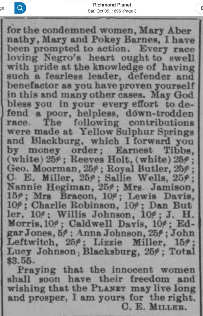
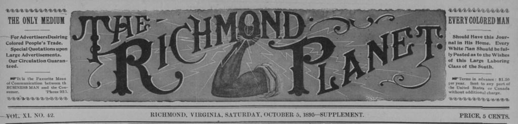
Edited by the legendary John Mitchell, Jr., The Richmond Planet was one of the nation’s most influential Black newspapers. We know people in Blacksburg subscribed to it—in the October 5, 1895, edition, C. A. Miller of Yellow Sulphur Springs wrote to the editor about raising funds here for the defense of two women.
A search of the archives reveals years of letters and news from Blacksburg, including coverage of the 1917 trial of Virginia Tech mathematics professor Charles E. Vawter’s murder of Stockton Heth, Jr.
These stories remind us that Blacksburg was connected to important conversations taking place across Virginia—and The Richmond Planet preserved that history.
5 October 18955 October 1895
Want to read The Richmond Planet? Newspaper.com (paid service) is the easiest to search. Virginia Chronicle, Library of Virginia, is free but not as easy to search.
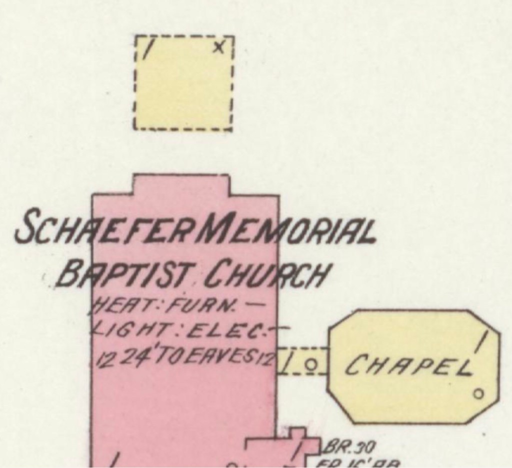
This 1913 Sanborn Fire Map of Christiansburg, Virginia offers a rare glimpse into the heart of the town’s early African American community during segregation. The map identifies key institutions including the Hill School Elementary, the Christiansburg Industrial Institute, and Schaeffer Memorial Baptist Church — places that anchored education, faith, and community life for Black residents in Montgomery County.
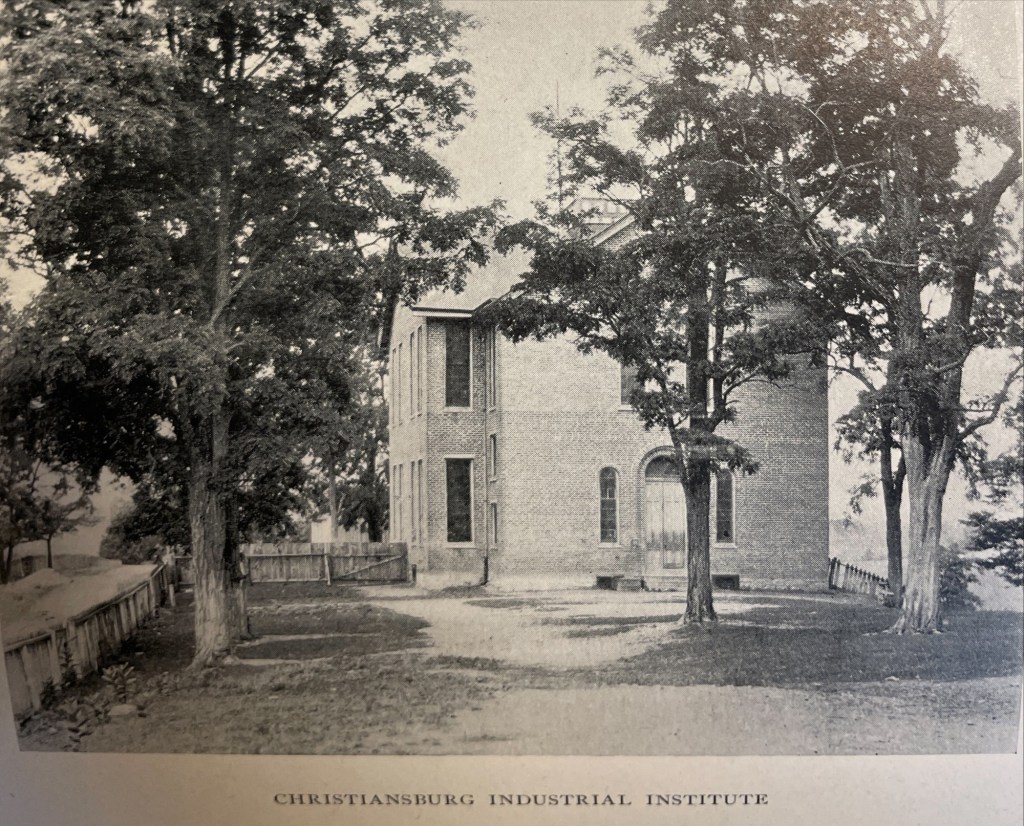
The Sanborn Fire Insurance maps are often the only early glimpse of buildings in rural towns over time. Christiansburg Industrial Institute moved from the Zion Hill location to the Lattimer Plantation site, north west of Christiansburg, at the turn of the 20th Century. This Sanborn Fire Insurance Map from Christiansburg, Montgomery County, Virginia was published by the Sanborn Map Company, dated Sep, 1913. The key to the maps is at the end.
The map is of Christiansburg Industrial Institute, situated north west of Cambria and north of Christiansburg courthouse. Note that frame constructed buildings are coded yellow and red for the solid brick building. The Baily Morris Building which housed the girls dorm, assembly hall, dinning hall and kitchen (close-up below) is heated by steam and lighted by electricity.
“Baily-Morris” Building
The Morris Hall Boys’ Dorm is both red and yellow, denoting built of a combination of building materials. The building is heated by hot water and lighted by electricity. Note that the buildings were supplied with water by 2,500 ft of pipes connected to the 10K gal water tank on the hill. The tank is filled by a Worthington Pump, moving water from a spring.
The girls and boys dorms were named for two Friends’ of the Freedmen of PA, Elliston P. Morris and Joshua L. Baily. They also donated money to construct the water system which was installed in 1907, before either Christiansburg or Blacksburg had a community water system. (A Vision of Education, Selected Writings of Edgar A. Long, Anna Fariello, Ed. Christiansburg Institute, Inc. 2021, pg 86,)
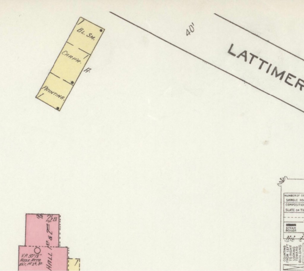
The Lattimer Mansion House, wood framed, was heated by stove and not connected to the water supply. The house was used as classrooms. Note the printing, carpenter and black smith shop close to the entrance road.
1913 Hill School & Schaeffer Memorial Baptist Church
This map is of Zion Hill which is located on the ridge (now High Street) between Cambria and Christiansburg. The brick (red) “Public School” housed the Christiansburg Industrial Institute before that secondary school moved to the Lattimer Plantation property by the turn of 20th century. This brick school, built by 1885, was converted to a primary school for African American children after CII moved. As noted by the Sanborn map, the building was heated by stoves and lighted by electricity.
Image of the Hill School from The Story of a Consecrated Life, Commemorative of Rev. Charles S. Schaeffer by CH Harrison, 1900. High Street is visible.
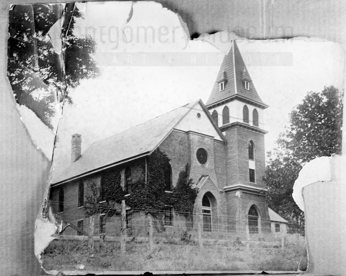
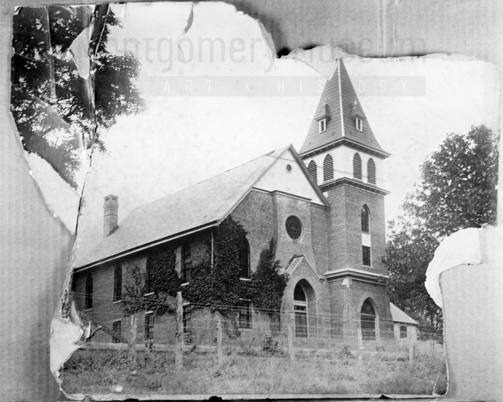
The Schaeffer Memorial Baptist Church is also of brick and built by 1885. Charles S Schaeffer’s memorial brass plaque were unveiled 1 October 1899, after he died in May of that same year. Note the frame chapel to the left (east) of the brick structure.
Image of Schaeffer Memorial Baptist Church from The Story of a Consecrated Life, Commemorative of Rev. Charles S. Schaeffer by CH Harrison, 1900. High Street is visible in the foreground. Later photograph, courtesy of the D.D. Lester Collection, Montgomery Museum of Art & History
On the Sanborn map, note the small frame, 1 story building behind the church? This may be the first school/church building on Zion Hill. The deed (DB S, pg 12, Oct 1868) and Harrison, 1900 * note the existence of this building. The brick school on the 1913 Sanborn map was the third version of this school at this site. The second school on Zion Hill was a 2 story & frame building, used between 1974 and 1885. (The rented Campbell house was the first school but it was not located on Zion Hill.)*
The image of the small school/meeting house shows a one story frame building with hip-roof and double stove-pipes. The dressed limestone block foundation was typical in this area and seen on buildings dating from early 1800s to the turn of the 20th century.
Image of the first school house on Zion Hill from The Story of a Consecrated Life, Commemorative of Rev. Charles S. Schaeffer by CH Harrison, 1900. High Street is visible in the foreground.
Virginia Untold offers a rich online archive of African American history. Search Montgomery and Wythe County records, and use downloadable PDFs for more precise, in-document searching.
Library of Virginia’s Virginia Untold: The African American Narrative provides a comprehensive online archive of African American and related history. These primary sources are invaluable for researchers and genealogists. Search “Montgomery County, VA” to locate local materials, and include “Wythe County, VA,” as some Montgomery County records are held there.
While the site offers search functionality, downloading the PDF transcriptions allows for more targeted searching. For example, a name search will return relevant documents, but locating specific references within them requires opening the PDF and using your browser’s search function. Please note that name spellings may vary.
Don’t forget to scroll down the Virginia Untold Search page for additional online resources. Also, the Library holds a huge collection of other online resources that is growing.
This collection of archival letters and newspaper clippings—many discovered through eBay searches focused on Virginia—is shared in the spirit of public history and community research. By making these materials accessible, we hope they may help individuals uncover, reconnect with, or deepen their understanding of their ancestors and the stories that shape our shared past.
This is a collection of archival letters and newspaper clippings, many of which were discovered through eBay searches focused on Virginia. We’re sharing them in the hope that they may help someone uncover or connect with their ancestors.
Disclaimer: Any text in quotation marks reproduces the seller’s original listing. As with all archival materials, we encourage careful interpretation, as this information has not been independently confirmed.
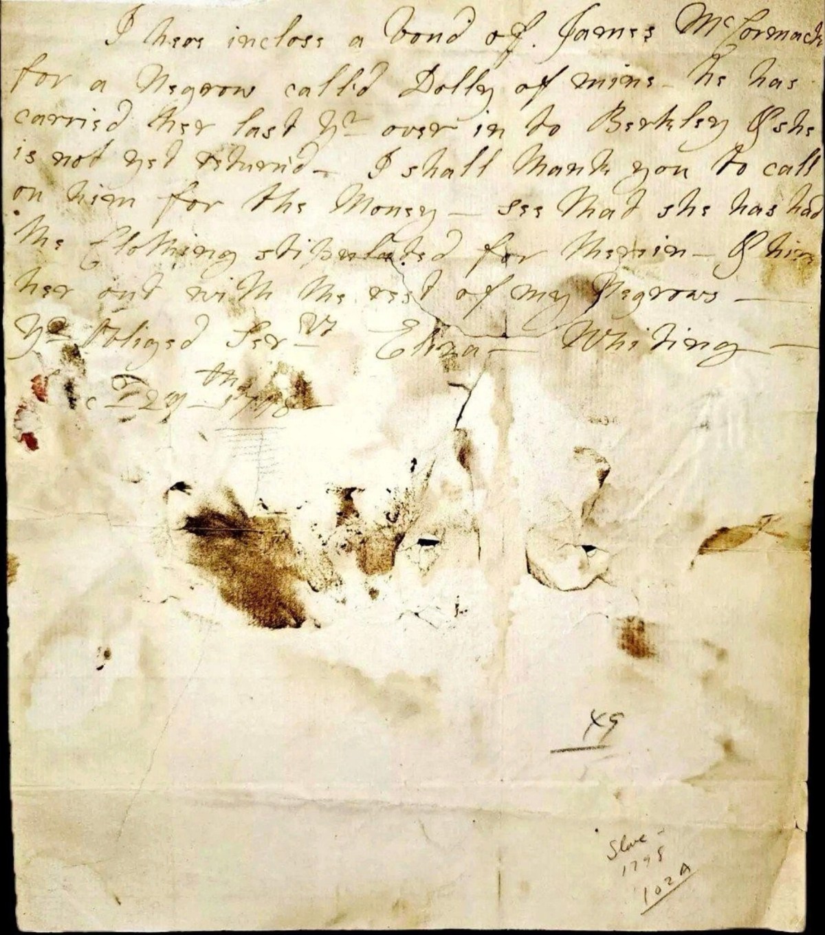
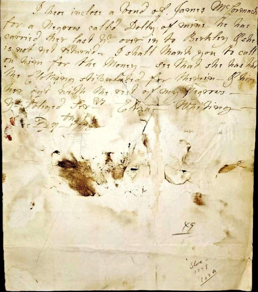
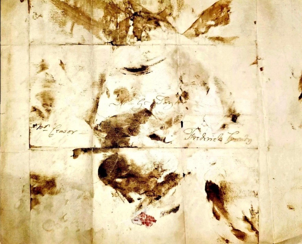
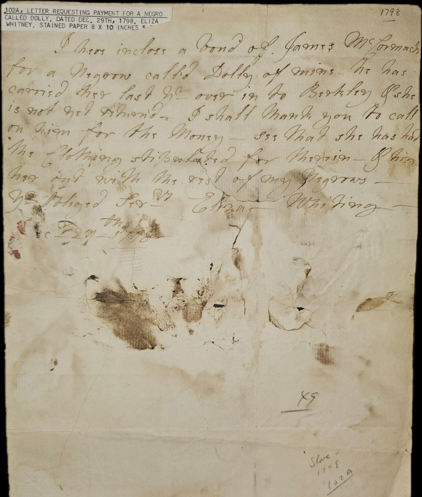
February 27, 1798 – Mention of Dolly
“This rare and historical slave letter from 1798 is Eliza Whiting to James McCormack is a must-have for collectors or slavery historian. The letter, written on old paper and hand-stamped for cancellation, depicts the harsh realities of slavery and commerce in the United States. Specifically relating to the Frederick County Virginia area in 1798.
The letter reads…
“Mr. George Taylor
Frederick County
-for favor
I hereby inclose a bond of James McCormack for a Negrow called Dolly of mine. He has carried her last go-over in to Berkley Pshs (Plantation) is(has) not yet returned – I shall mark you to call on him for this money – see that she has had the clothing stipulated for mention – Of hire her on I with the assist of my negroes.
Your Most Obliged Servant – Feb 27th 1798 – Eliza Whiting”
Elizabeth Burwell Whiting was the daughter of Lewis Burwell (1710–1752) of Carter’s Creek, Gloucester County, Virginia. A graduate of Cambridge who studied at the Inner Temple, Burwell served in the Virginia House of Burgesses and was acting governor of the colony in 1750. Mrs. Whiting’s husband, Beverley Whiting, was probably the son of Peter Beverley Whiting (c.1707–1755) of Gloucester County. Peter Beverley Whiting may have been the son of the Beverley Whiting who was one of George Washington’s godfathers.
James McCormick was born on June 8, 1768, in Frederick, Virginia, United States. His father was also named James McCormick, and his mother was Mercy Lupton. In 1784, James married Elizabeth Hanna in Rockbridge, Virginia. They had at least three sons. James passed away in 1841 in his hometown at the age of 73.
The letter’s aspects include a Stampless Courier denomination, a year of issue 1798, and a place of origin in the United States. It is a valuable addition to any collection and a testament to the rich history of Maryland. Don’t miss out on the opportunity to own a piece of history.
The piece has significant staining, probably dating to the time of creation, as it could be ink, or mud, or caused from water during delivery to its recipient.
Upon further research the name appears to be Eliza “Burwell” Whiting who was from a prominent family out of Prince William County.”
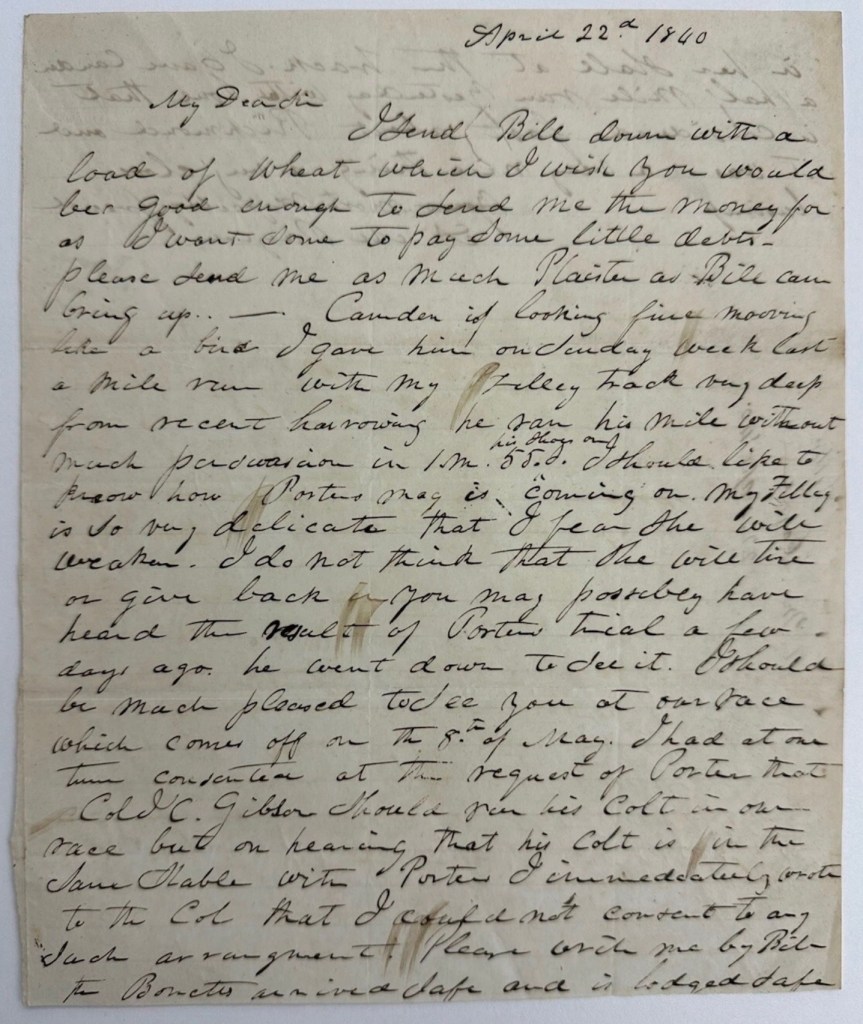
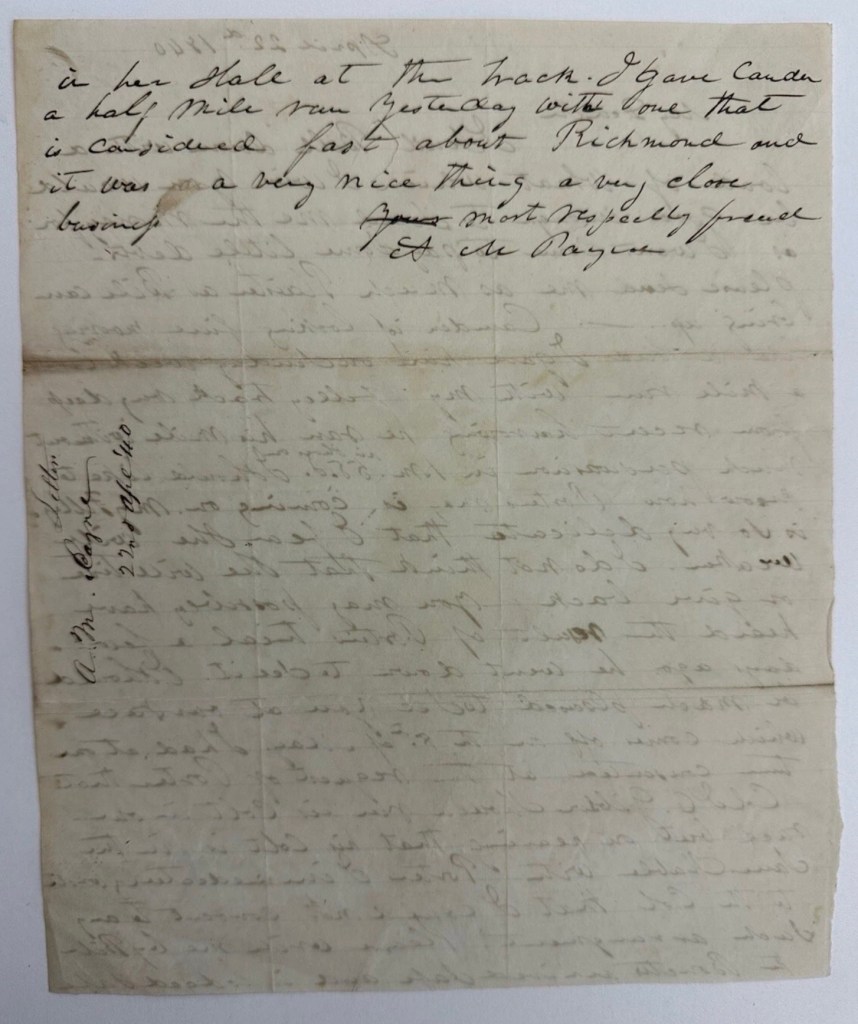
April 22, 1840 – Mention of Bill
“April 22d 1840 [-] My Dear Sir [-] I send Bill down with a load of wheat which I wish you would be good enough to send me the money for as I want some to pay some little debts – Please send me as much plaister as Bill can bring up. – Camden is looking fine mooving [sic] like a bird. I gave him on Sunday week last a mile run with my [filley?] track very deep from recent harrowing [-] he ran his mile without much persuasion in 1 m[inute] 55 [seconds] his shoes on. I should like to know how Porter’s nag is coming on. My filler is so very delicate that I fear she will weaken. I do not think that she will tire or give back in. You may possibly have heard the result of Porter’s trial a few days ago. he went down to see it. I should be much pleased to see you at our race which comes off on the 8th of May. I had at one time consented at the request of Porter that Col. J.C. Gibson should run his colt in our race but on hearing that his colt is in the same stable with Porter’s I could not consent to any such arrangement. Please write me by Bill [illegible] Bonetis arrived safe and is lodged safe in her stall at the track. I gave Camden a half mile yesterday with one that is considered fast about Richmond and it was a very nice thing a very close business. Most respectably friend. A. M. Payne.”
“The author of this letter, Arthur A.M. Payne (1804-1868), was a member of the longstanding family associated with Fauquier County, and the last familial owner of the Clifton estate in that county, which he sold in 1854 on moving to Missouri, where he passed away in 1868. His father was Captain William Payne (1755-1833) who served in the Virginia Militia under General Richard Henry Lee during the American Revolution. A.M. Payne was in turn the father of Confederate States Army Brigadier General William Henry Fitzhugh Payne (1830-1904). The man mentioned in the letter, Colonel Jonathan Catlett Gibson (1793-1849), was a notable landholder in both Culpeper and Rappahannock County, Virginia.
Colonel Gibson served in the Virginia militia during the War of 1812 and rose to command rank in later years. He was elected to the Virginia House of Delegates in 1830. Originally married to a niece of George Washington, he remarried after her death, raising five sons, all of whom served in the Confederate Army. “
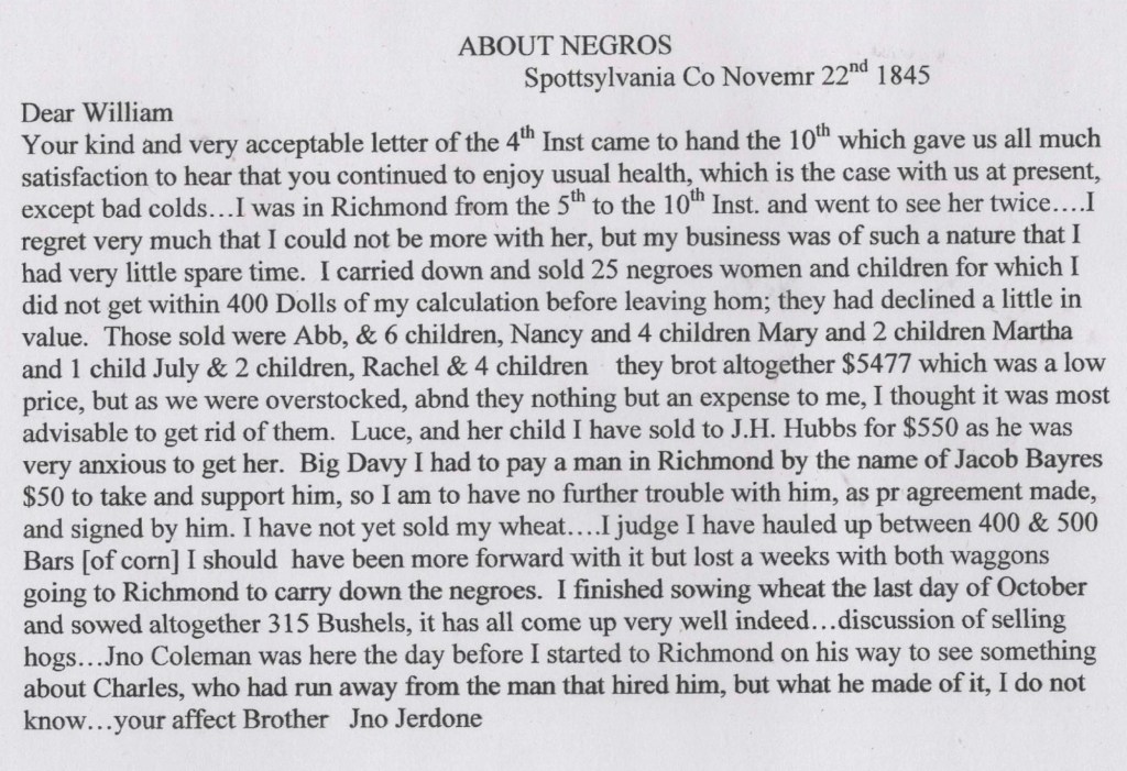
November 22, 1845 – Mention of Abb, Nancy, Mary, Martha, Rachel, Luce, Big Davy
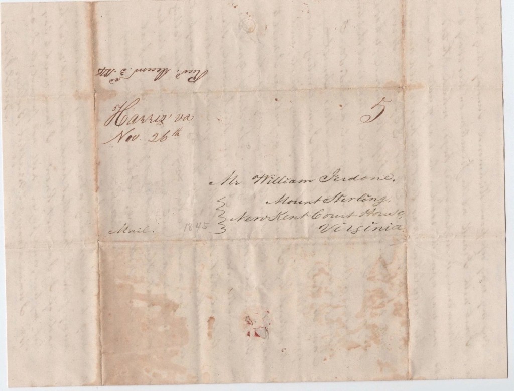
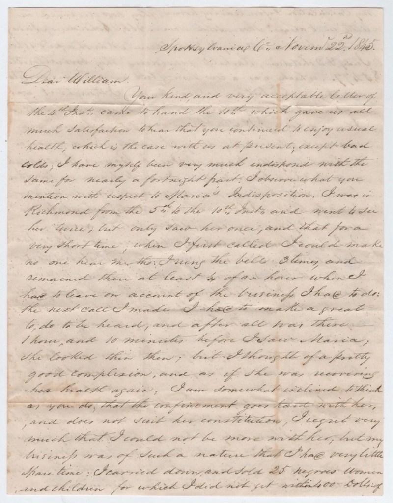
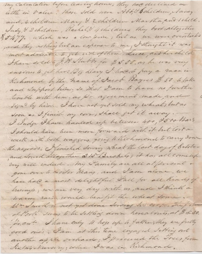
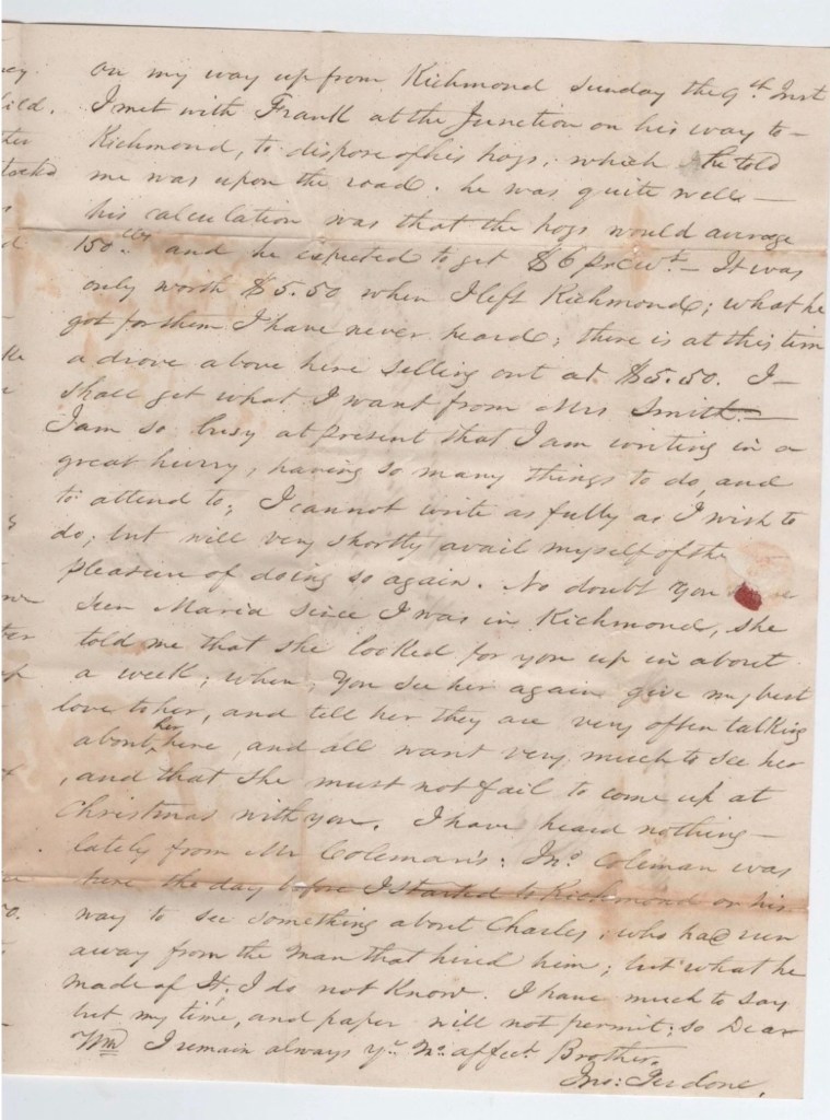
“Remarkable Stampless folded letter written November 22, 1845 by John Jerdone, a prominent plantation owner in Spottsylvania, Virginia and sent to a relative, William Jerdone in Mount Sterling, New Kent Court House, VA.
Content is about the sale 25 enslaved negro women and children, the prices obtained. Rest of content is farming news, selling hogs in Richmond etc.”
As noted by Dan Thorp in Seeking Justice: The Extraordinary Freedom Suits of an Enslaved Virginia Family, fluctuations in the enslaved labor market in eastern Virginia reflected broader economic shifts in the decades before the Civil War. Periods of declining prices—such as those described in this letter, where individuals were said to be “overstocked”—often prompted enslavers to sell people out of the region, feeding the domestic slave trade to the Deep South. This language of “overstock” underscores the brutal commodification of human lives, where people were treated as surplus property in a market economy, and their forced movement reshaped families and communities across the South.
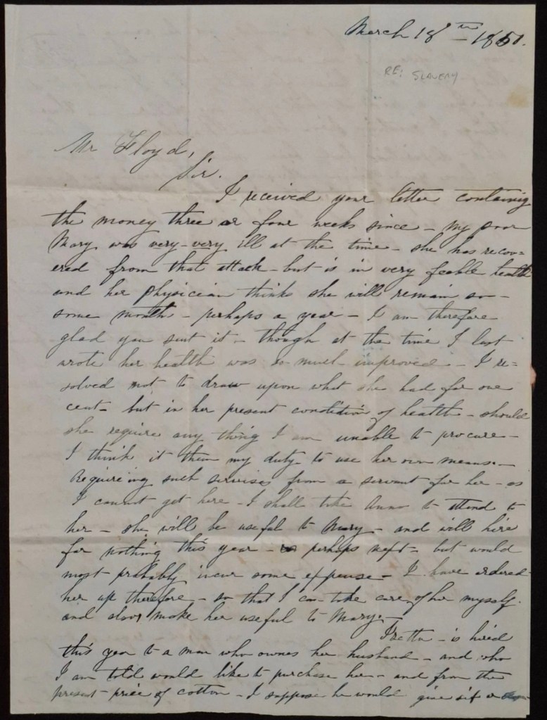
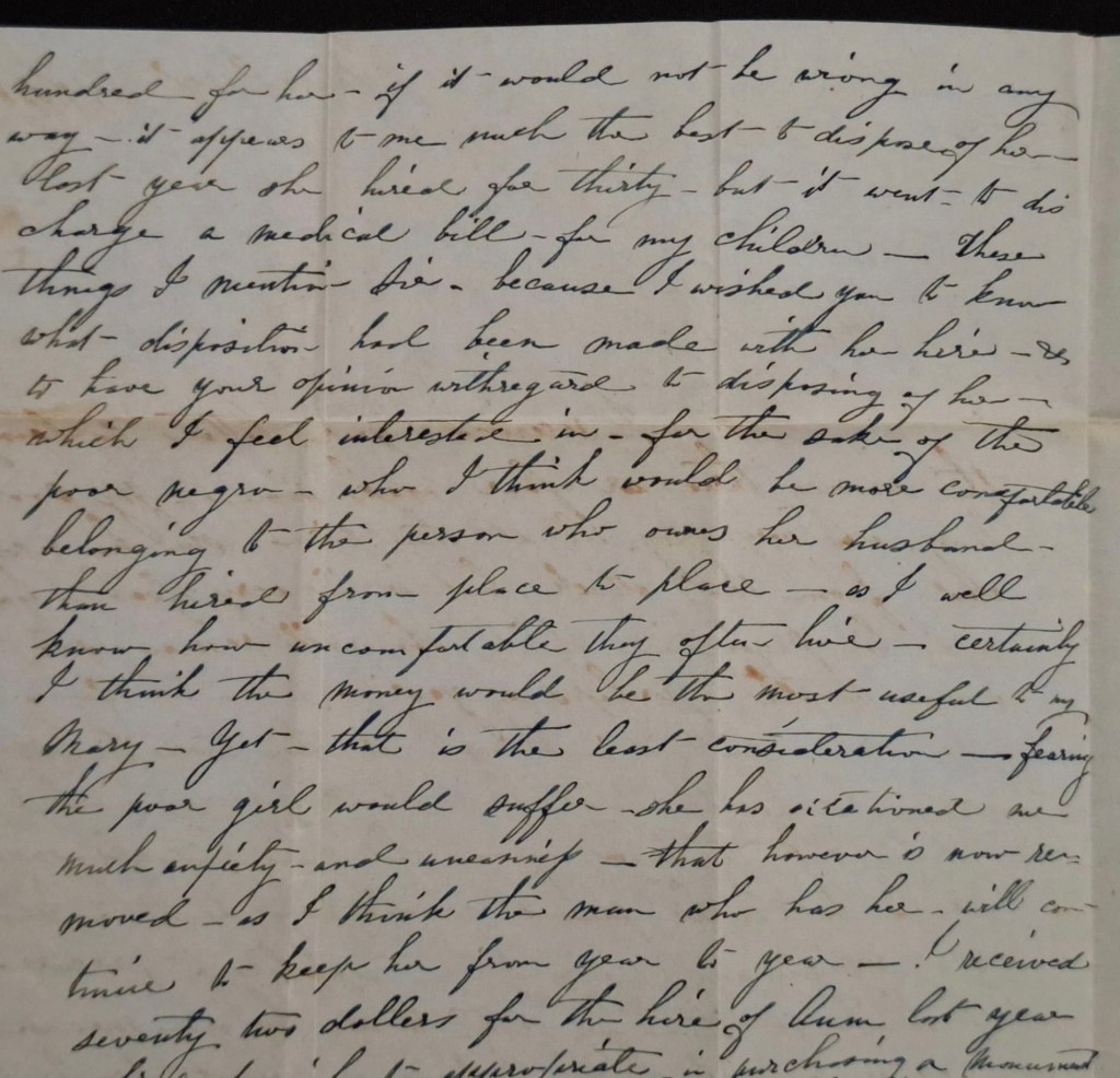
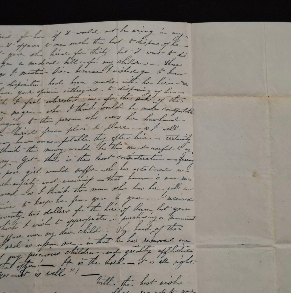
1851 March – Mention of Isetta
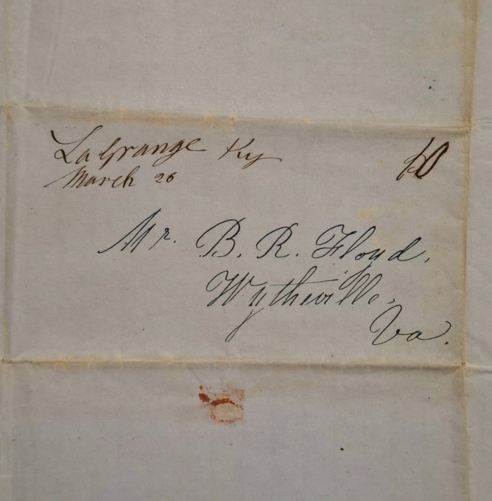
“An autograph letter signed S.W. Leigh to Benjamin Rush Floyd, discussing personal matters and asking for advice on the sale of a slave woman named Isetta.
Excerpt:
“[….] Isetta is hired this year to a man who owns her husband and who I am told would like to purchase her and from the present-price of cotton – I suppose he would give six hundred for her….”
2 pp. , 25 x 18,5 cm, leaf address “Mr. B.R. Floyd, Wythe, Virginia” sent from La Grange, Kentucky, March 1851.
Note: The recipient of the letter, Benjamin Rush Floyd (1811-1860), American lawyer and politician was a member of the Virginia House of Delegates from 1847-1848, and state senator from 1857-1858.”
1854 – Roanoke
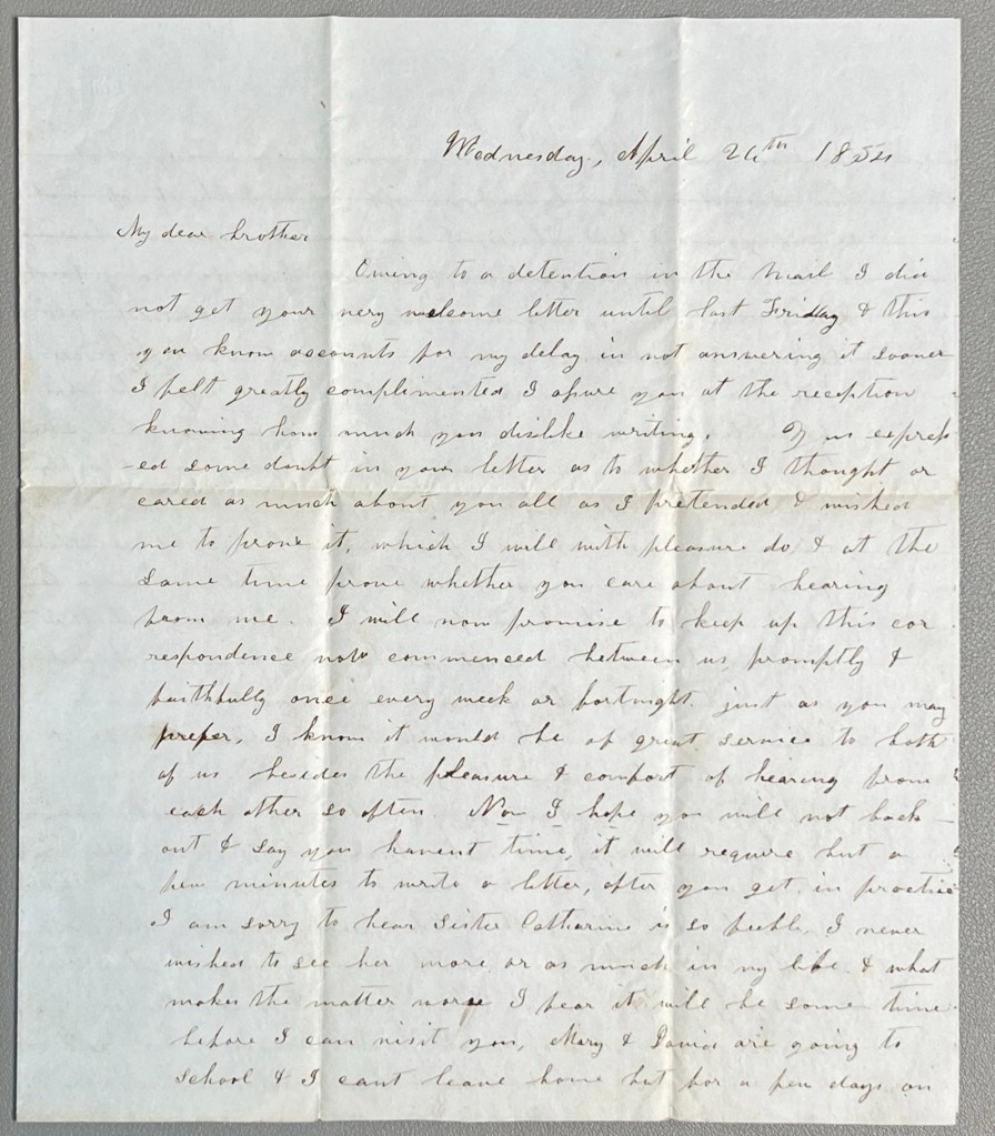
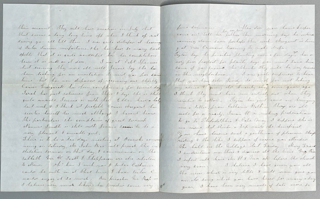
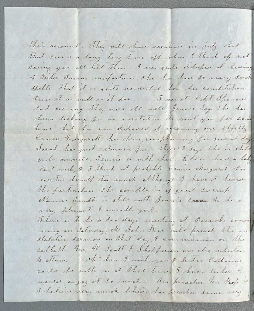
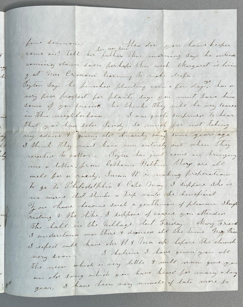
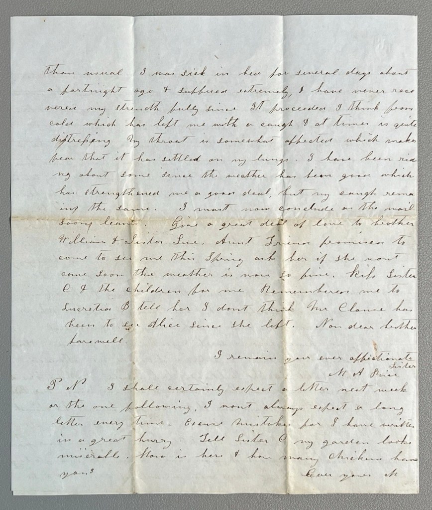
Primary Historical Hook: The defining value of this manuscript rests on the explicit mention of the sale and transfer of enslaved individuals. Within the text, the author expresses surprise at the recipient’s actions:
“I was quite surprised to hear that you had sold Sindy. So much for not taking my advice & giving old Anarchy away some years ago.”
Antebellum correspondence that names specific enslaved persons is highly sought after by academic archives, museums, and private historical collectors for its rarity and research potential.
Date & Origin: The letter is dated Wednesday, April 26th, 1854.
Local Interest: Refers to a “Two days meeting at Roanoke” with sermons delivered by “Mr. John Rice” and “Mr. Proffit.”
Identified Individuals: The text is rich with genealogical data, mentioning “Sister Catharine,” “Sister Susan,” “Sister Sue,” “Brother William,” “Capt. Spencer,” “Cousin Margaret,” “Nannie Smith,” “Peyton,” and “Aunt Irene.”
Health & Daily Life: Details the “feeble” state of Sister Catharine, agricultural concerns regarding a “poor prospect for plants,” and general family news regarding school and recent births.
Date: April 26, 1854
Location: Roanoke, Virginia
Author: M. A. Price
Key Themes: Slavery/Enslavement history, Southern Social History, Genealogy, 19th-Century Religion
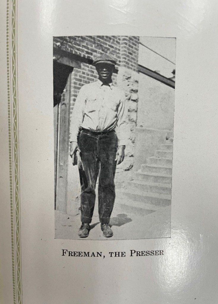
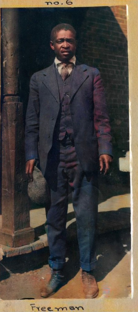
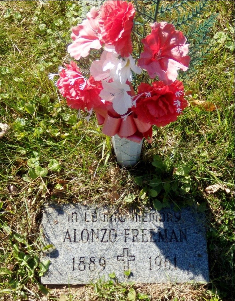
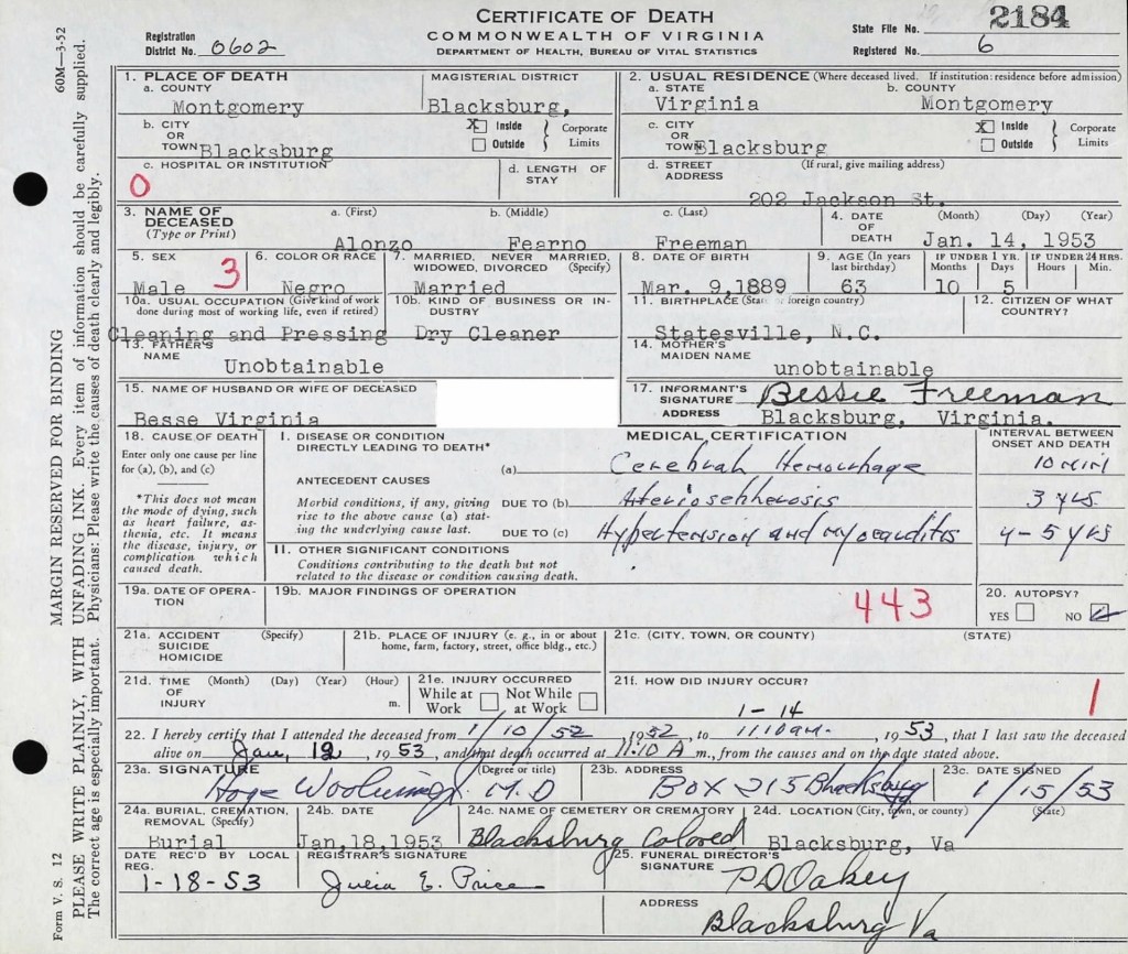
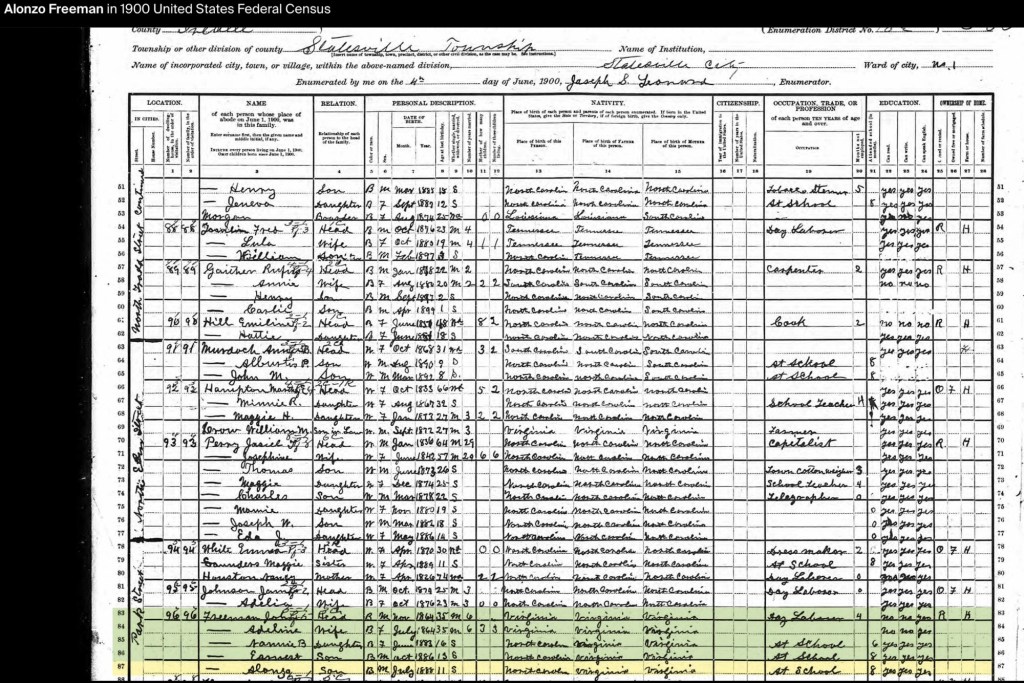
Alonzo Feadore (Fearno) Freeman, Sr. was born on March 10, 1889, in Statesville, North Carolina, to John (b. circa 1864) and Adeline Freeman (b. circa 1864). By the 1900 U.S. Census, John, a day laborer, and Adeline were living with their three children: Nannie B. (b. June 1883), Earnest (b. October 1886), and Alonzo Sr. (b. July 1888, student).
Alonzo F. Freeman (1889-1953)
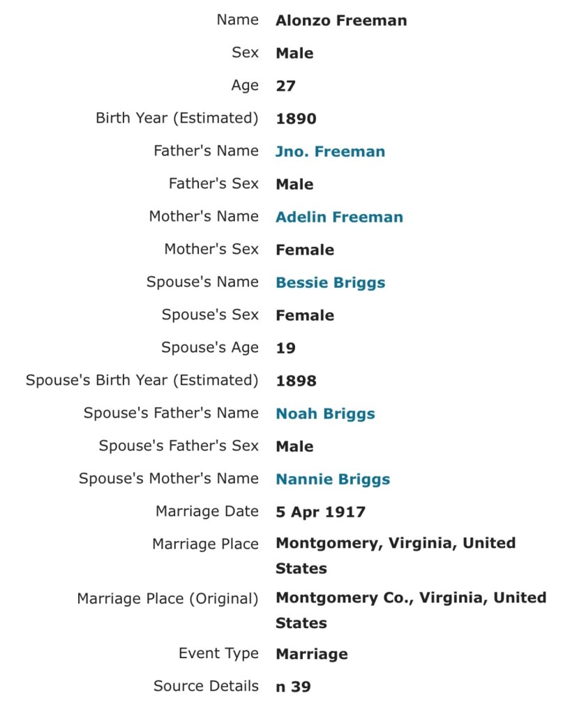
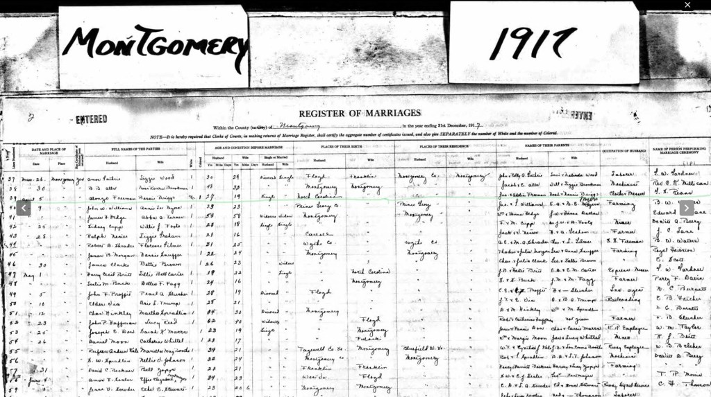
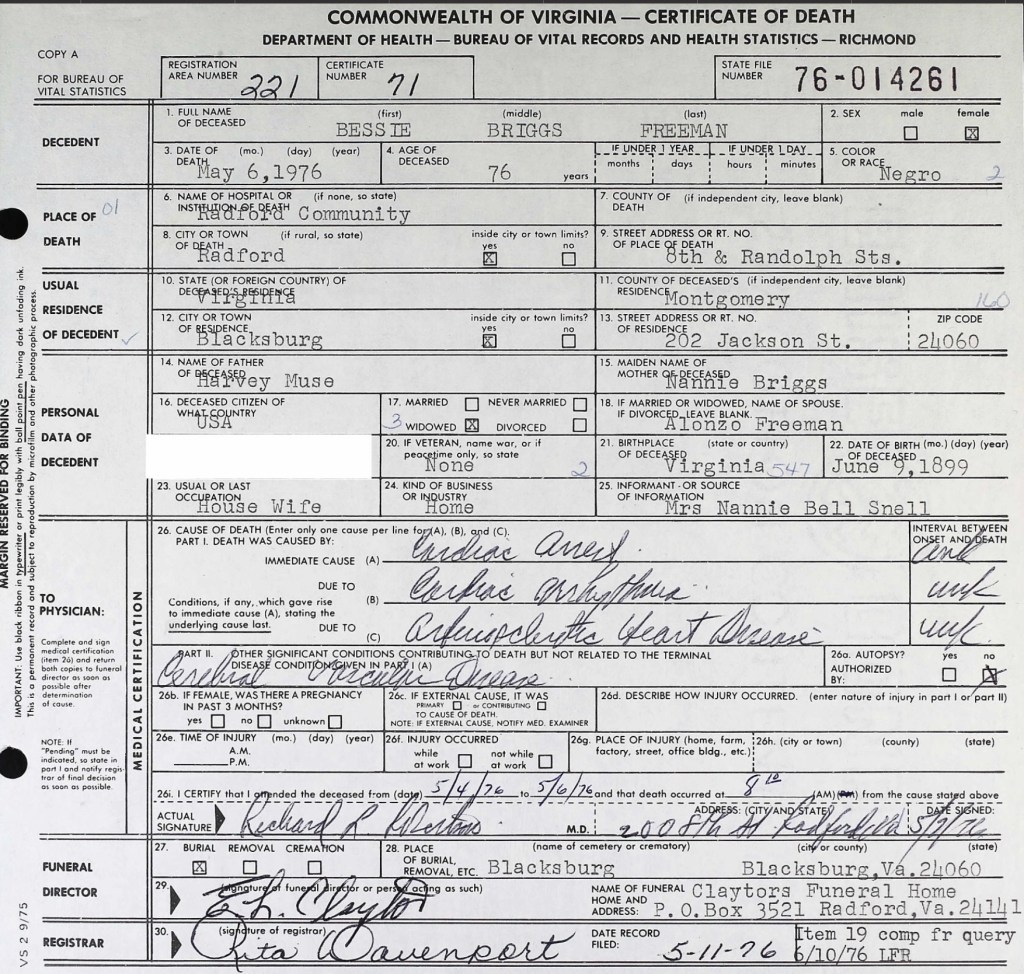
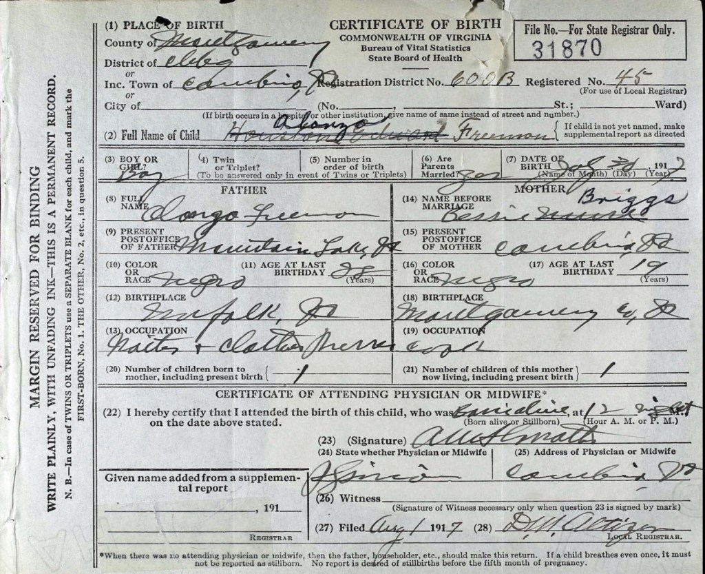
On April 5, 1917, Alonzo married Bessie Virginia Briggs (1899–1976) in Cambria, Virginia. Just a few months later, on July 31, 1917, their first son, Alonzo Freeman Jr., was born in Cambria, Virginia. According to his birth certificate, Alonzo Sr. worked as a waiter and clothes presser at Mountain Lake Resort, Virginia, while Bessie was a cook. During this time, they may have been living with Bessie’s mother and stepfather, who resided near the railroad tracks in Cambria.
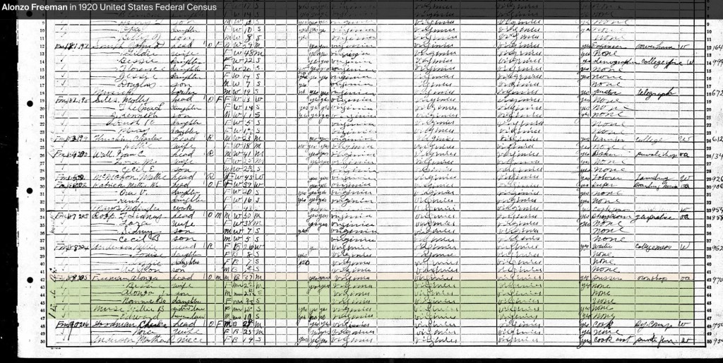
By the 1920 U.S. Census, the Freeman family had settled in Blacksburg, Virginia, on Jackson Street (originally Smithfield Road). Alonzo and Bessie were raising their two children, Alonzo Jr. and Nannie Bell (1919–1987). Also living in the household were Bessie’s siblings, Willie B. Muse and Edward Muse. At this point, Alonzo Sr. owned his home and operated his own pressing and cleaning shop. Their next-door neighbor was Nellie Anderson.
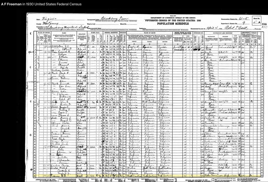
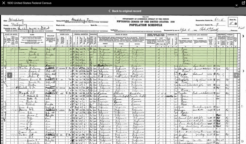
In the 1930s, the Freeman family were living in the same home, now valued at $1,600. They were part of a growing Black community on Jackson and Bennett Streets, surrounded by neighbors such as Wade Sears, Charles Saunders, Lev Collins, John Stolt, Yola Young, Emmett Meade, William Turner, Floyd Meade, Louise Anderson, and Leonard Price. The 1932 Blacksburg City Directory lists Alonzo Sr. as the proprietor of the Blacksburg Press Shop at 302 E. Jackson Street.
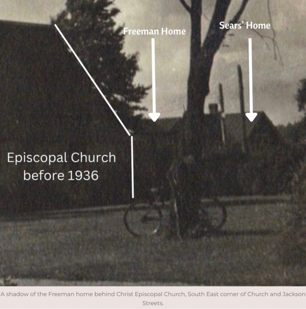
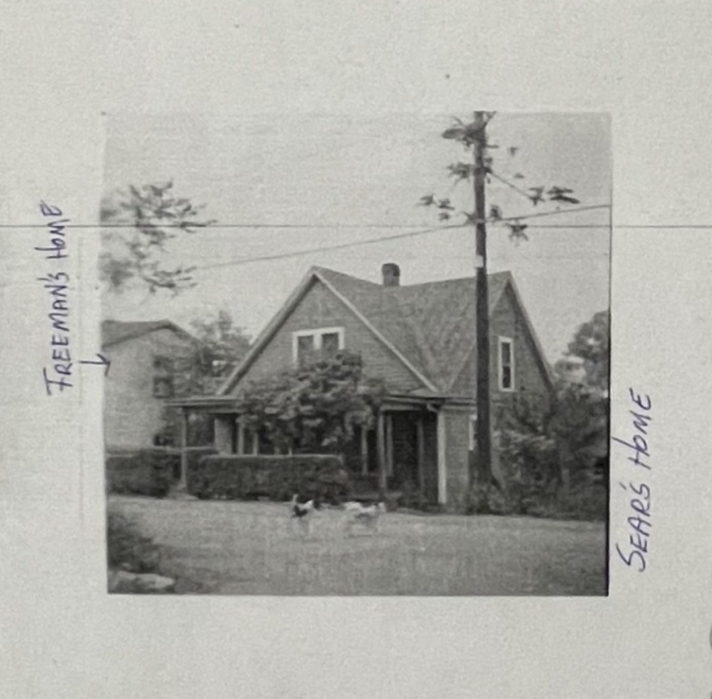
Freeman house is to the left of Christ Episcopal Church, Church and Jackson Streets, prior to 1930s.
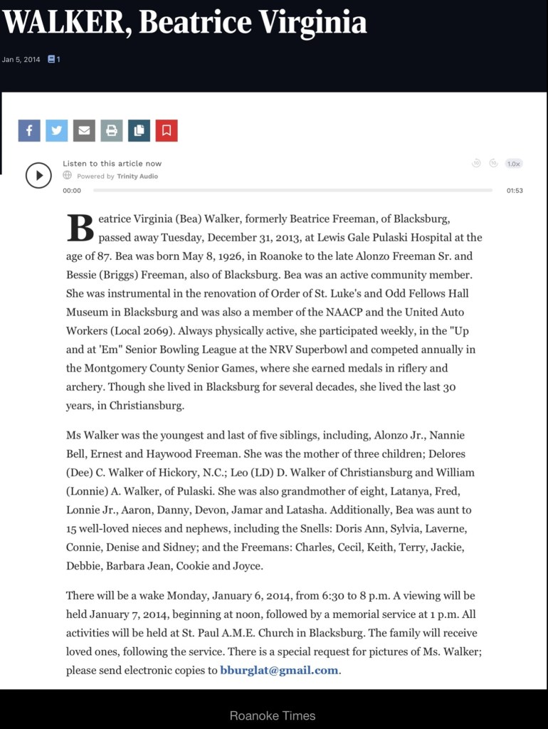
By this decade, the Freemans had expanded their family with three more children: Ernest Linwood (b. 1922), Haywood (1924–1984), and Beatrice (1926–2013). Alonzo Sr. continued to run his cleaning business—the first of its kind in Blacksburg—while Bessie worked for the Episcopal priest, Rev. Richard Martin, and his wife, Jean in the church’s office.
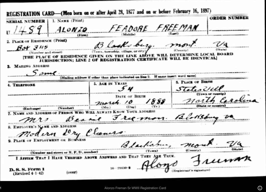
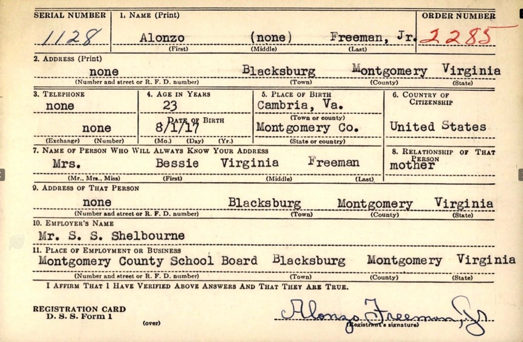
The 1940s marked a pivotal time for the Freeman family, as all the male members registered for the 1942 World War II Draft. These records provided Alonzo Sr.’s full name, Feadore, and documented his business, Modern Dry Cleaners (featured on an early 1950s map of Blacksburg). During this time, Alonzo Jr. served as the principal of the Clay Street Graded School, Linwood worked at the Radford Ordnance Works, and Haywood was employed by Ray Taylor.
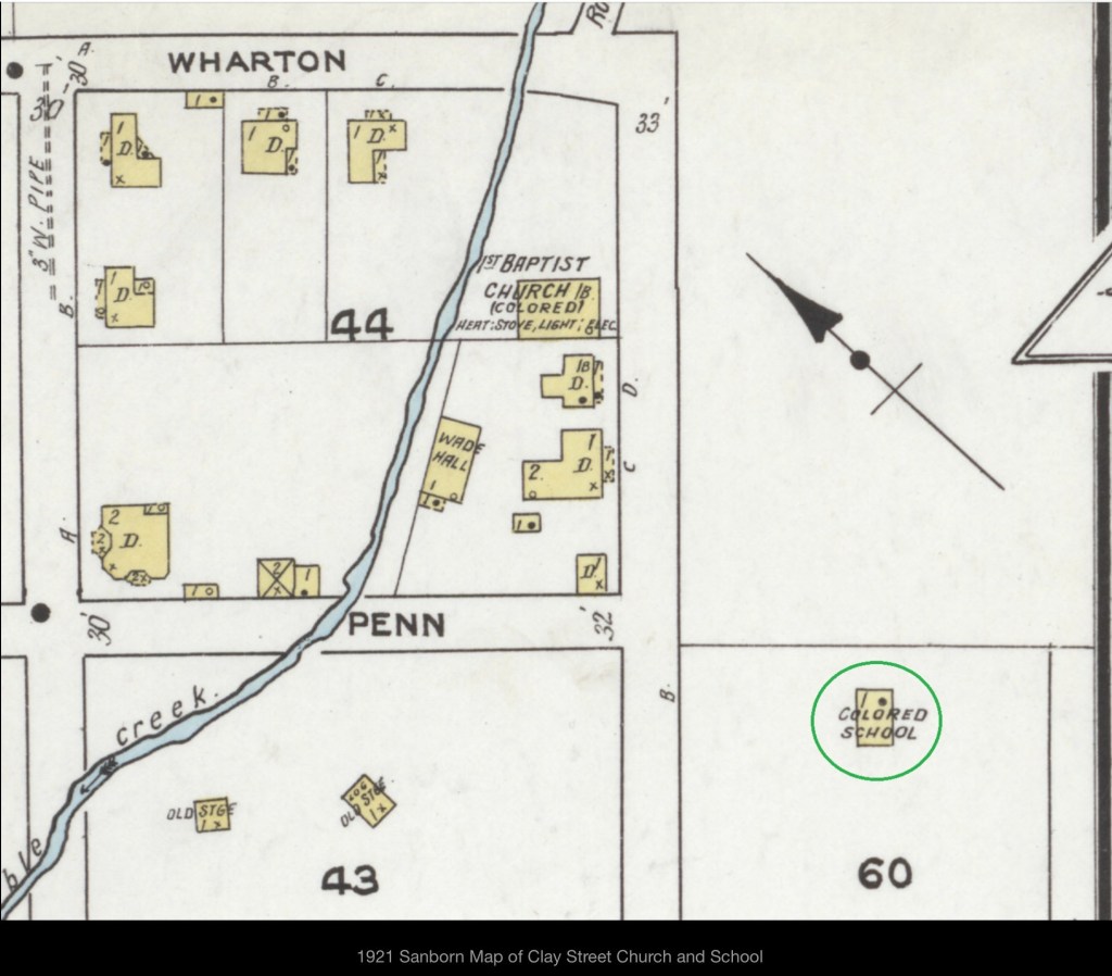
1921 Sanborn Fire Map
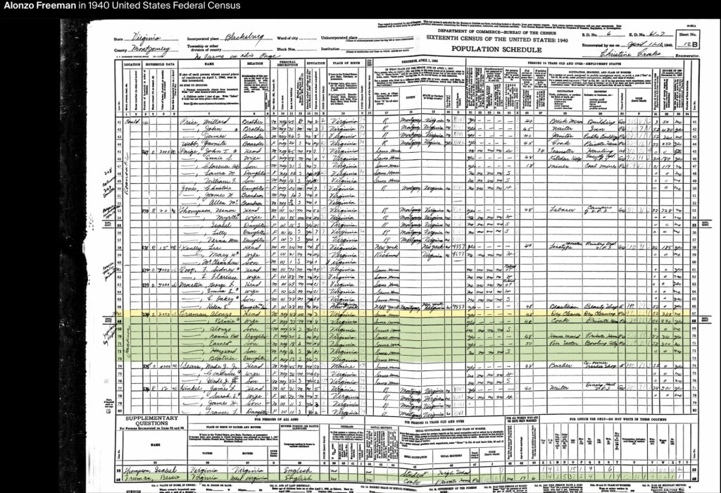
According to the 1940 U.S. Census, all of Alonzo and Bessie Freeman’s children were still living at home. Nannie Bell worked as a private housemaid, while Linwood was employed as a pin setter at the college bowling alley. Alonzo Sr. continued running his cleaning business, and Bessie worked as a private cook.
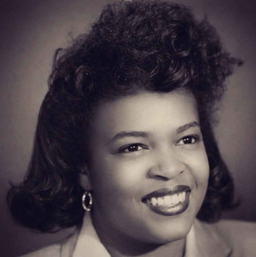
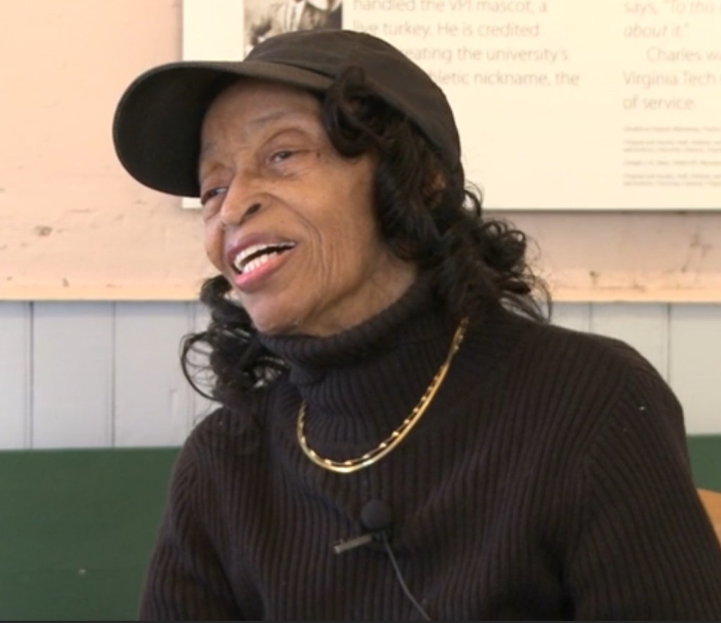
Nannie Bell Freeman Snell (Courtesy of Montgomery Museum of Art & History, repaired image)
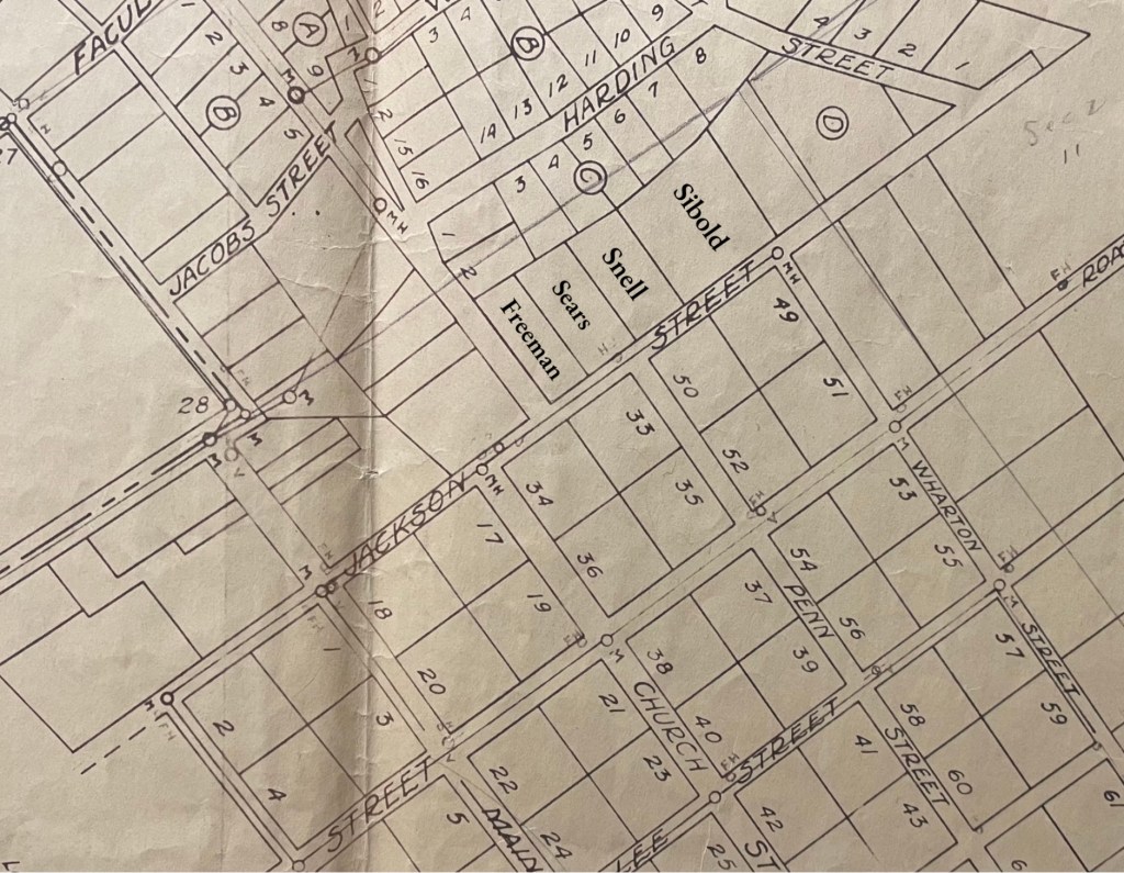
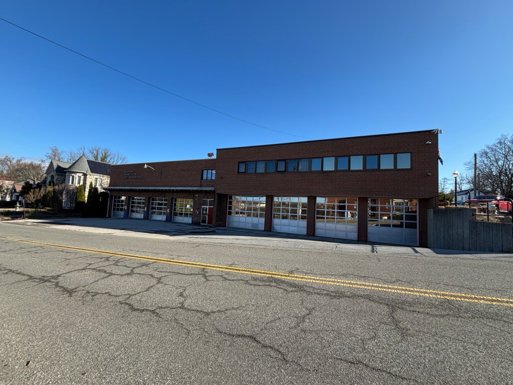
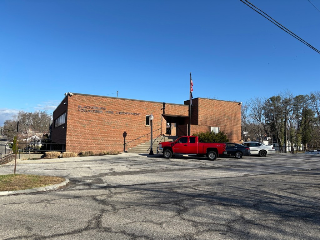
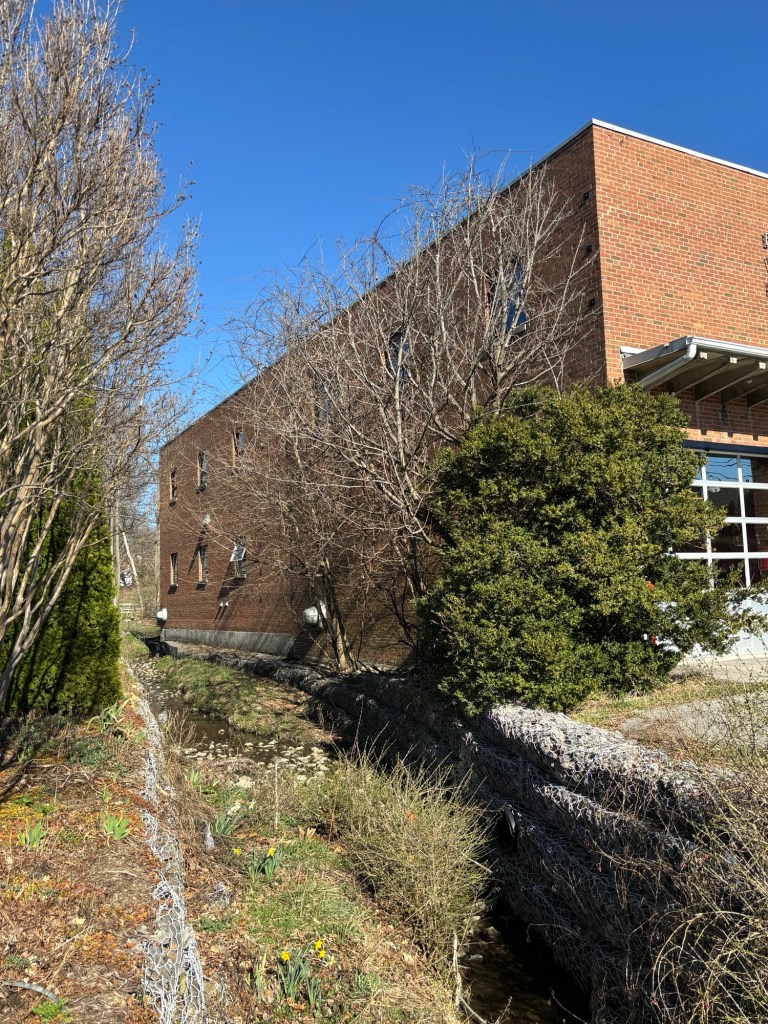
On November 19, 1947, Nannie Bell, now a beautician, married Sidney Grant Snell (1921–1975), a mechanic from Radford. The Snells raised six children and lived at 404 Jackson Street, just down the street from Nannie Bell’s parents, Alonzo and Bessie, who resided at 202 Jackson Street. Only the Snell’s home remains standing today, but the Freeman residence was located at the same corner of Jackson and Progress Streets where the town’s 1958 firehouse now stands. Blacksburg named a frog to honor Nannie Bell.
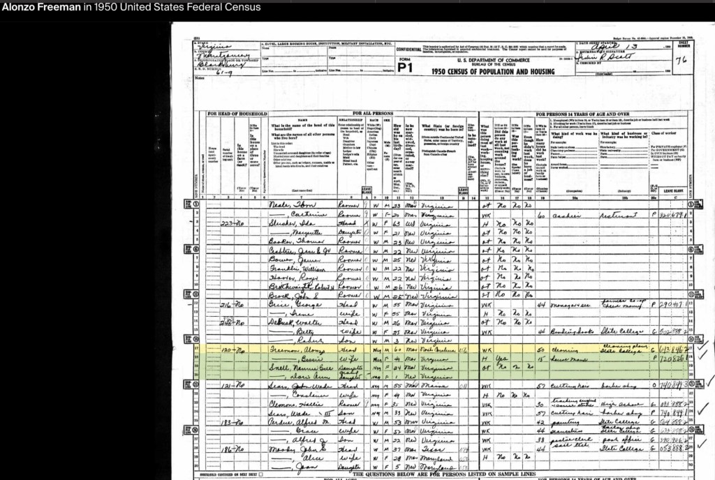
By the 1950 U.S. Census, Alonzo Sr., now in his 60s, was working at Virginia Polytechnic Institute’s Cleaning Plant. Nannie Bell and her daughter, Doris Ann, were living with her parents at the family home. By this time, all three Freeman sons had moved to Washington, D.C., with Linwood living alongside Haywood. Alonzo Jr. had married and was serving as the principal of the Clay Street segregated school before becoming the principal of an elementary school in Baltimore.
Bessie Virginia Briggs Freeman (1899 to 1976)
Bessie’s mother, Nancy Sweeney, was born in 1872 in Christiansburg, Virginia. Her father, Noah Briggs, was the son of George and Jane Briggs. Nancy and Noah were married on February 14, 1894. By the 1900 Census, the Briggs, Green, and Sweeney families—several generations of the same extended family—were living as neighbors in Cambria.
By the 1910 Census, Nancy Sweeney Briggs had married Harvey (Harry) Muse of Cambria, a laborer at the lime kiln. Together, they had four children: Willie B. (b. 1902), Grace (b. 1904), Connie (b. 1906), and Edward (1909–1950). Edward Muse later married Bessie Lynch (b. 1911), and they settled in New Town, where they raised five children: Jean (b. 1932), Constance (b. 1934), Shirley Ann (b. 1936), Edward Jr. (b. 1938), and Harold A. (b. circa 1940). By 1940, Edward Muse was working at the Virginia Polytechnic Institute Monogram Presser Plant alongside his neighbor, John Green, and Alonzo Freeman Sr.
In 2013, Beatrice Freeman Walker, the youngest daughter of Bessie and Alonzo Freeman, participated in an oral history interview now archived at Virginia Tech University Libraries. In this interview, she shared valuable insights into her mother’s work in the homes of prominent community members and her leadership in the Independent Order of St. Luke’s (St. Frances Council #235), which operated out of the shared building in New Town alongside the Odd Fellows and the Household of Ruth. Beatrice also highlighted her mother’s important role in coordinating the return of soldiers for family funerals through the Red Cross.
Beatrice Freeman Walker (courtesy of Virginia Tech University Libraries)
Additionally, the interview sheds light on her father, Alonzo Freeman Sr., and his contributions to the Black community in Blacksburg. Among these was his creation of a weekend retreat for African Americans, called Paradise View, located on land he owned off Grissom Lane—now known as Nellie’s Cave. Beatrice’s recollections provide a crucial window into the history of Black life in Blacksburg and the legacy of her parents.
Notes to Further Explore – Mountain Lake Connection
In her book Kentland at Whitethorne (Walpa Publishing, Blacksburg, VA, 1995), historian Patricia Givens Johnson mentions a “Mrs. Freeman,” who worked as a chambermaid at Mountain Lake Hotel shortly after emancipation. According to Johnson (p. 53), Mrs. Freeman married Bob Jackson, who had been enslaved by James Randal Kent (1792–1867), the owner of Kentland Plantation. Some of their children took the Jackson surname, while others retained the Freeman name. Johnson identifies their children as Flemish Jackson, Bessie, Bob, Qu, and Irene Freeman, noting that they were employed by the hotel well into the 1900s.
This connection warrants further research, but it raises an interesting possibility—when Alonzo Freeman married Bessie Briggs in 1917, he was working at Mountain Lake Hotel as a waiter and clothes presser. Could this employment have been influenced by family ties to the hotel? Further exploration may help clarify the Freeman family’s long-standing connection to Mountain Lake.
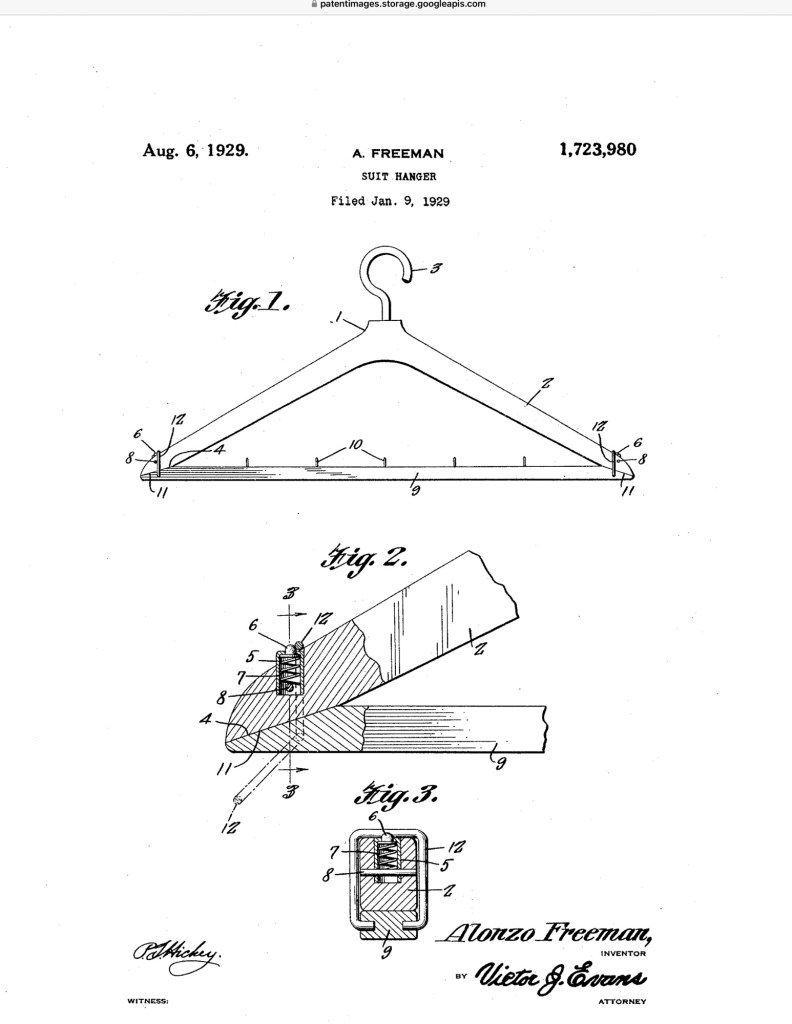
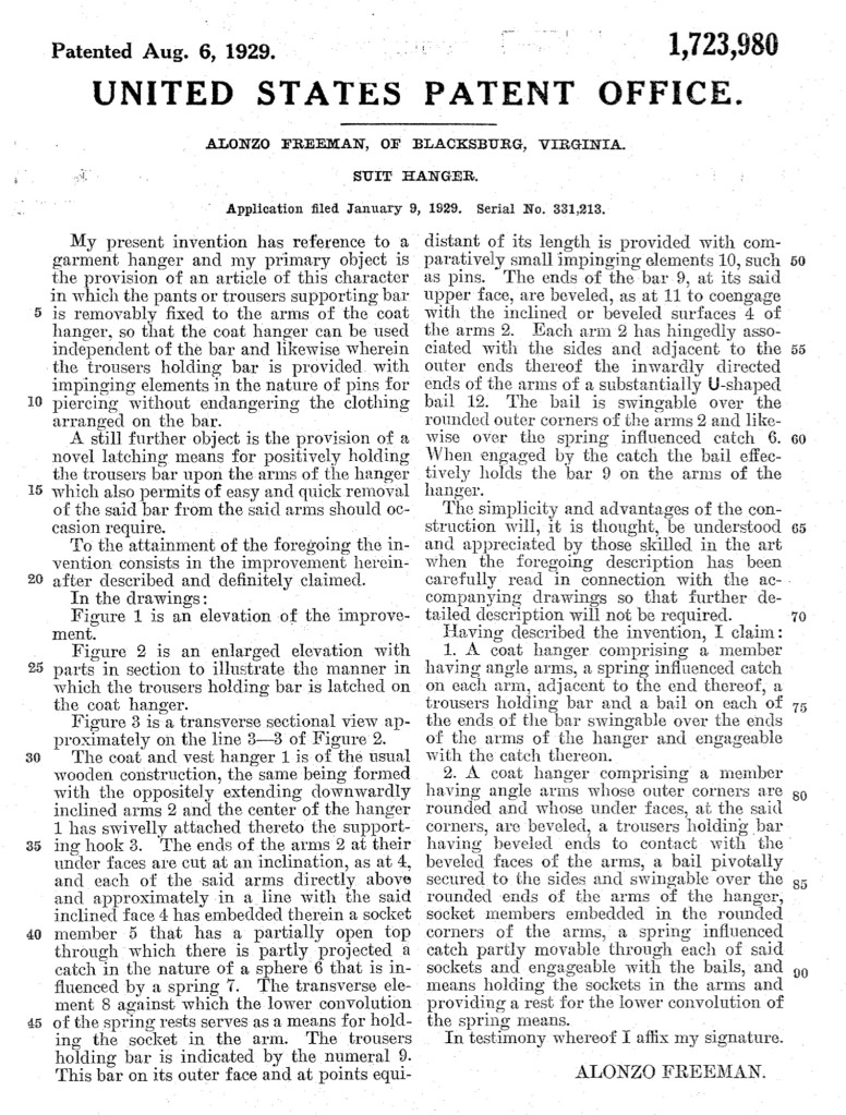
In the winter of 1929, in Blacksburg, Virginia, Alonzo Freeman did something remarkable. While running his clothes-cleaning business during the era of government sanctioned segregation, he took time to solve a practical problem he faced every day.
Working with coats, suits, and trousers, Freeman designed a better garment hanger. His invention included a removable bar for trousers and a simple latching mechanism that held the bar securely in place while still allowing it to be quickly removed.
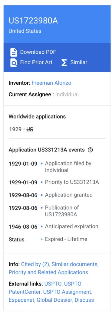
On January 9, 1929, Freeman filed for a patent with the United States Patent and Trademark Office. Later that year, on August 6, he was granted U.S. Patent 1,723,980.
Freeman’s hanger is a reminder that innovation often grows out of everyday work. Even in the face of segregation, Black entrepreneurs and tradesmen were imagining new ideas, improving tools, and shaping their communities.
Gallery
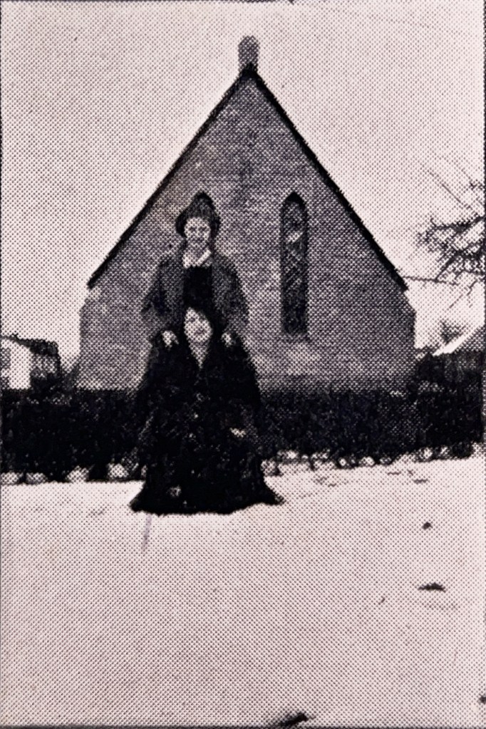
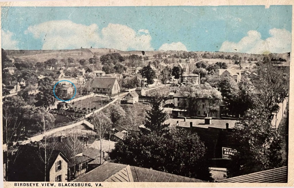
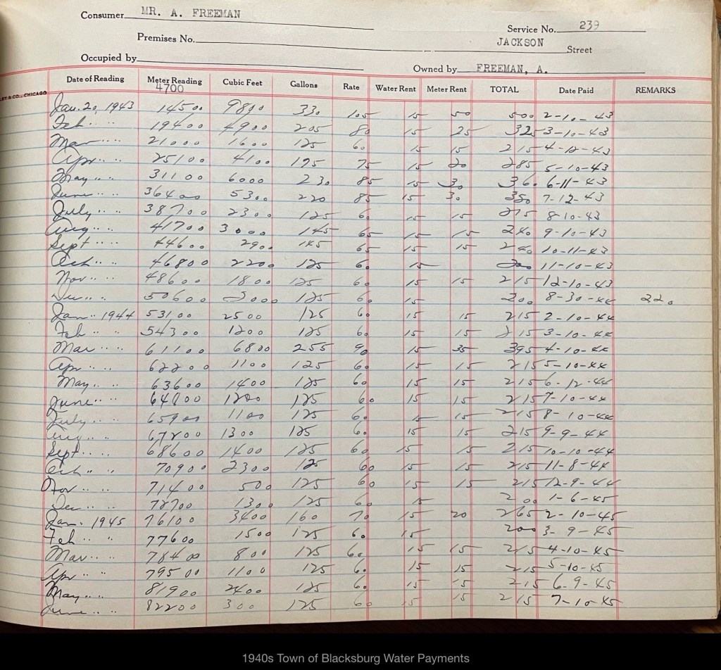
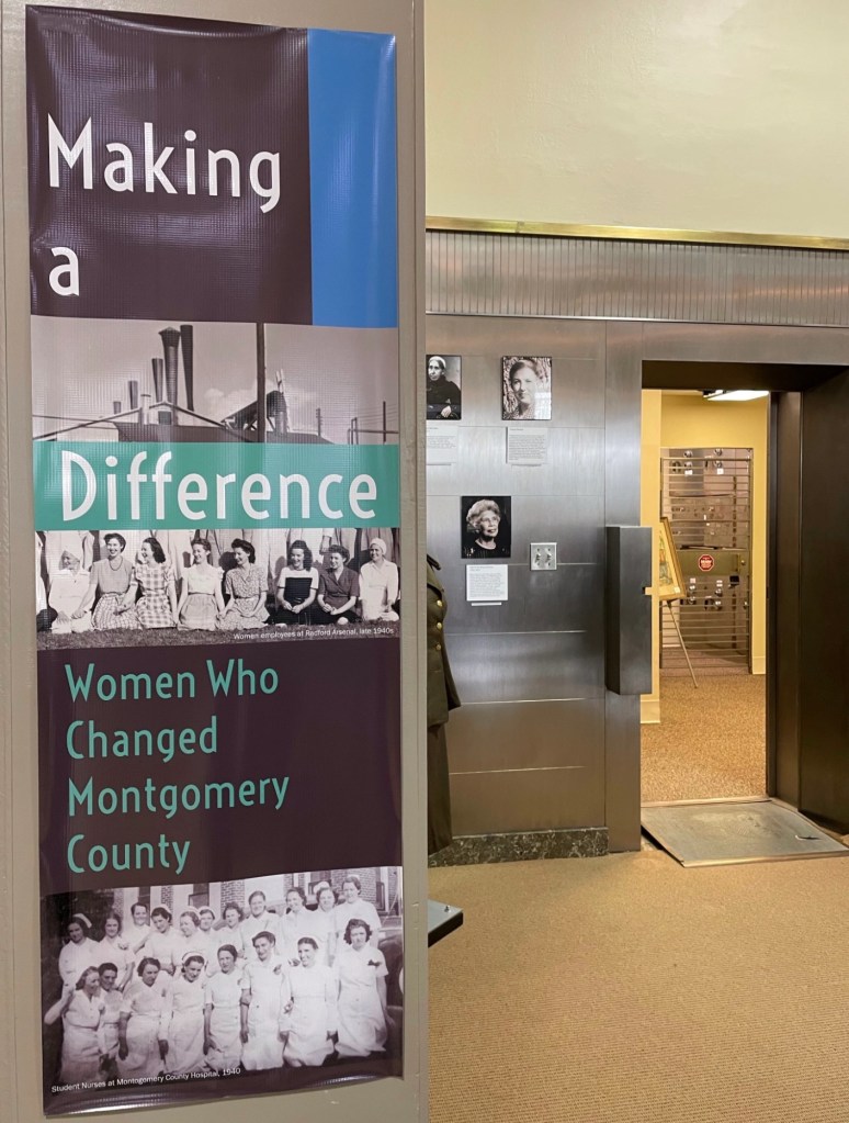
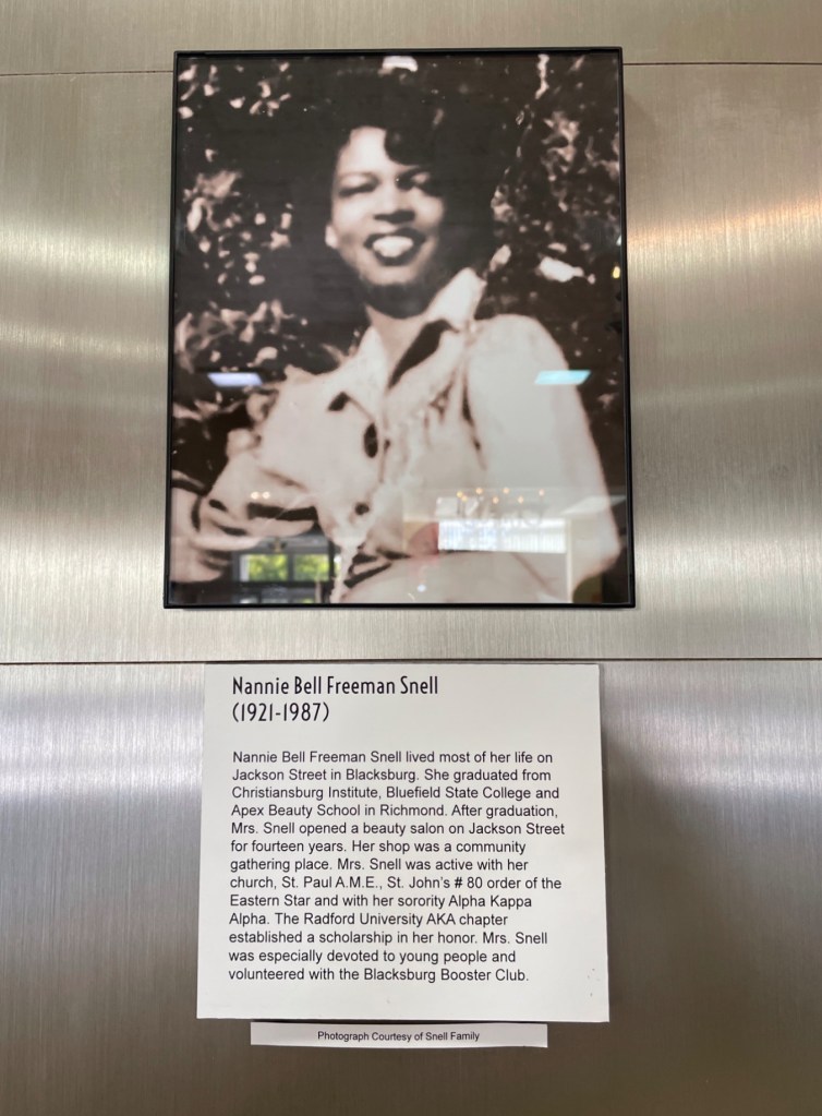
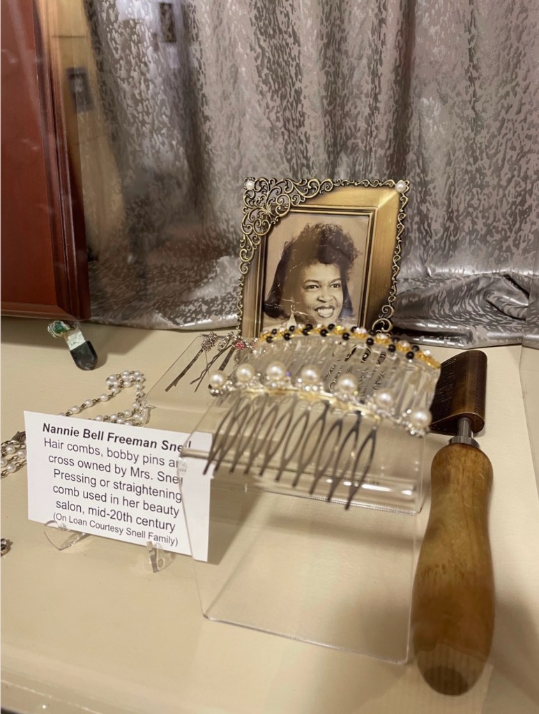
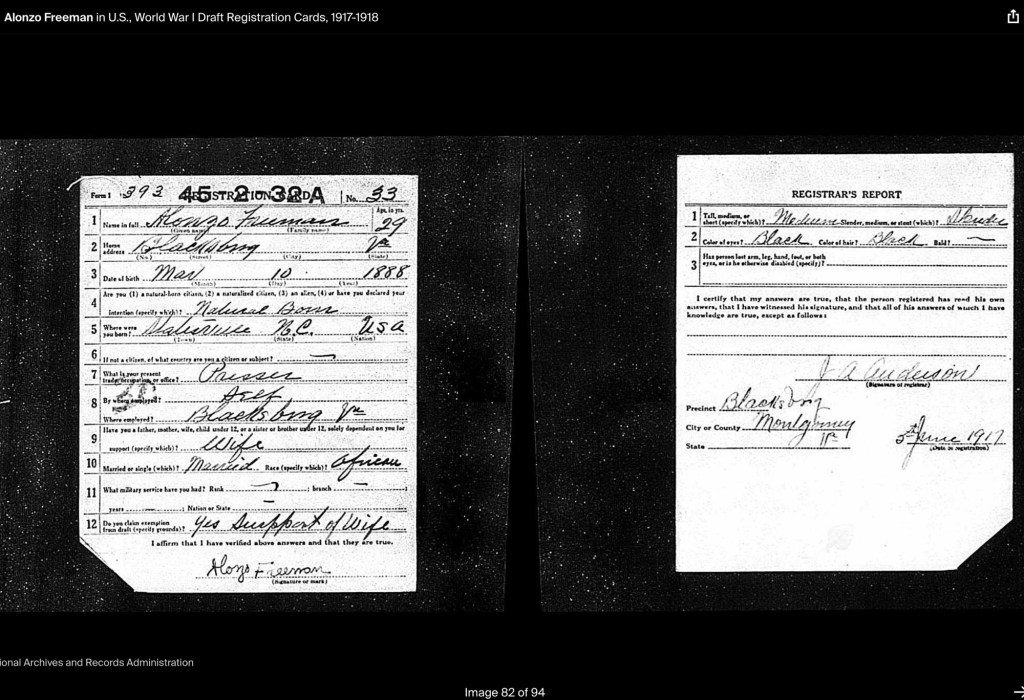
Location of the Freeman’s Home (postcard of Blacksburg prior to 1913, courtesy of Jody Booze-Daniels)Map of Blacksburg prior to 1957 with the families noted. Freeman’s home located west of Wade Sears’ Home prior to 1957, date the firehouse was built. (Martha Shupp Phillips masters thesis, 1948, VPI)The two houses in the background.The Freeman’s home is behind the church (people unknown) to the left of the image. The 1940s town water payment ledger (courtesy of BMCF)West-facing façade of Blacksburg Fire Station #1. The original 1957–58 building appears on the left side of the image, marked by the smaller doors. The Freeman family home once stood on the site where the newer vehicle bays are now located.South-facing façade of Blacksburg Fire Station #1, on the site where the Freeman family’s home once stood.North-facing façade of Blacksburg Fire Station #1. The original 1957–58 building extended about halfway along the brick wall that runs parallel to Stroubles Creek, near the location of Nannie Bell’s frog.Alonzo Freeman, Sr from 1922 Bugle Yearbook. Alonzo Freeman, Sr (source unknown) Freeman family Lee Street Cemetery (now called Southview Memorial Gardens)Alonzo Feadore Freeman WWI registration card. Alonzo Freeman Death CertificateAlonzo and Bessie Marriage Record information.Alonzo and Bessie Marriage Record 1917Alonzo Freeman in Statesville, NC in US Census 1900.Freeman family in Blacksburg, Va on Jackson St (1st St) in US Census 1920Freeman family in Blacksburg, Va on Jackson St (1st St) in US Census 1930Freeman family in Blacksburg, Va on Jackson St (1st St) in US Census 1930. Willie Thomas included, boarder. Freeman family in Blacksburg, Va on Jackson St (1st St) in US Census 1940. Freeman family in Blacksburg, Va on Jackson St (1st St) in US Census 1950Bessie Briggs Freeman obituaryBeatrice Freeman Walker obituaryAlonzo Freeman, Jr WWII registration cardAlonzo Freeman, Jr birth certificateNannie Bell Freeman Snell was featured in a 2022 exhibit at the Montgomery Museum of Art & History titled “Making a Difference: Women Who Changed Montgomery County.” The exhibit recognized women whose leadership, work, and community impact helped shape the history of Montgomery County.Nannie Bell Freeman Snell was featured in a 2022 exhibit at the Montgomery Museum of Art & History titled “Making a Difference: Women Who Changed Montgomery County.”Nannie Bell Freeman Snell was featured in a 2022 exhibit at the Montgomery Museum of Art & History titled “Making a Difference: Women Who Changed Montgomery County.”Alonzo Freeman, Sr WWI registration Card
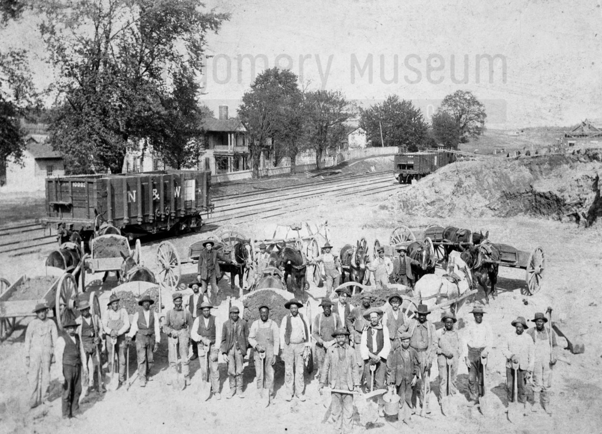
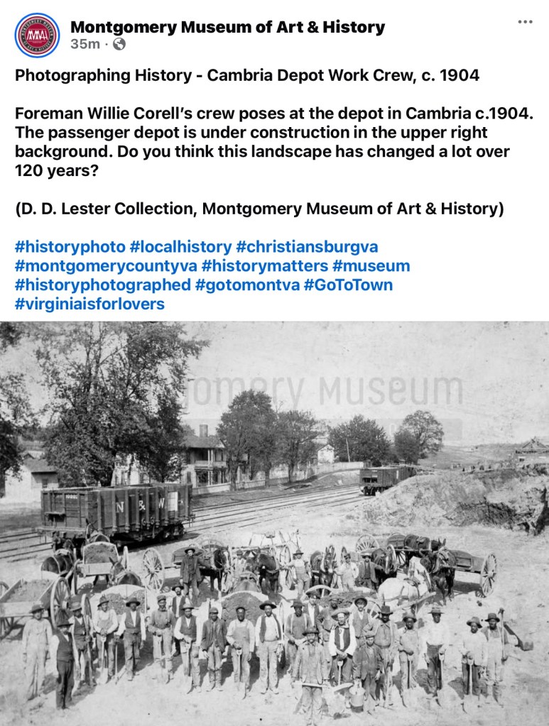
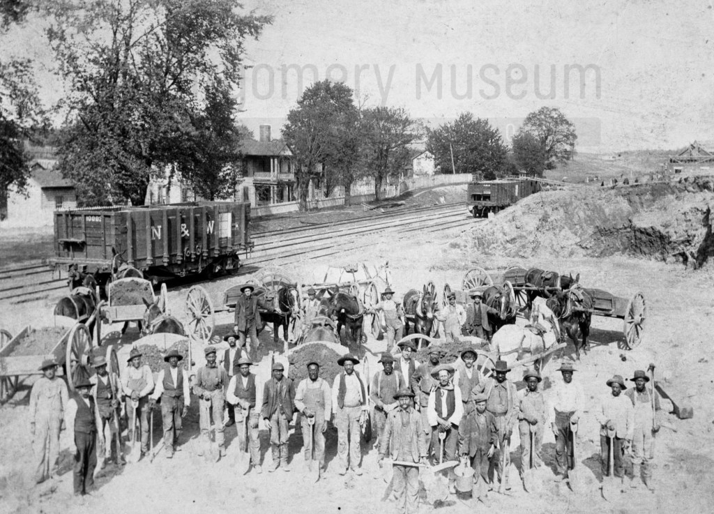
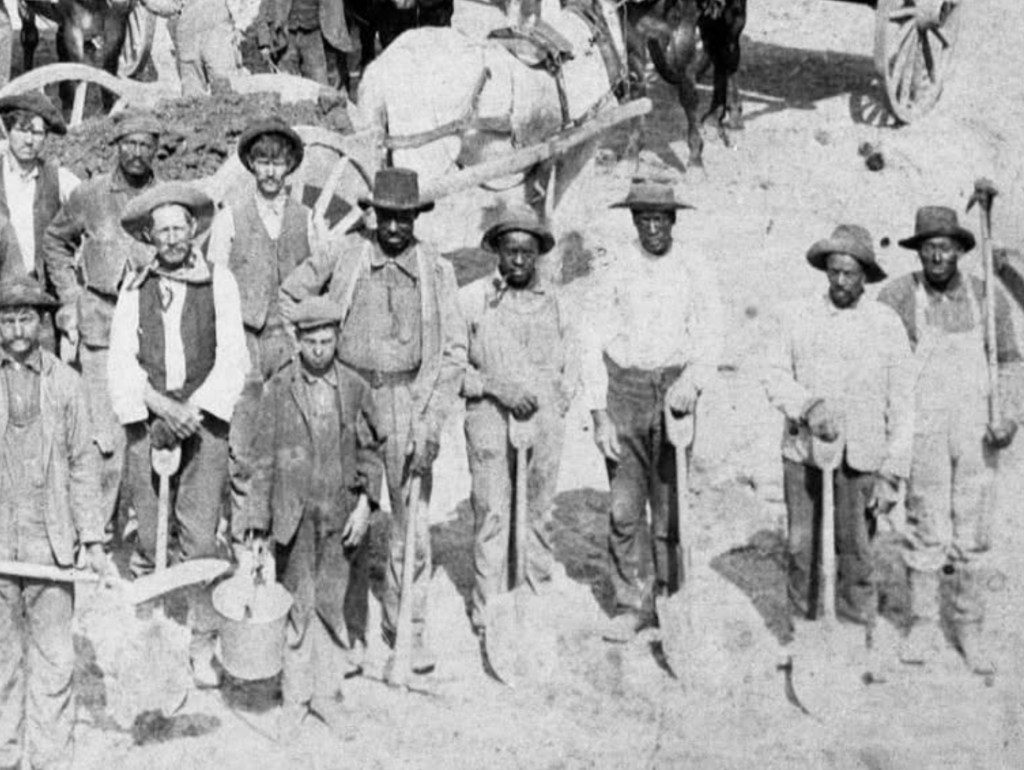
In 1904, a mixed-race crew built the new Cambria, Virginia Depot passenger station. Their faces were captured, but their names were not. As we search census records and explore new tools like AI facial recognition, we hope to uncover who they were — the hands and lives behind this piece of our shared history.
Facebook PostCambria Depot Work Crew, about 1904 (DD Lester Collection, Montgomery Museum of Art & History)Close-up of Cambria Depot Work Crew, about 1904 (DD Lester Collection, Montgomery Museum of Art & History)Close-up of Cambria Depot Work Crew, about 1904 (DD Lester Collection, Montgomery Museum of Art & History)Close-up of Cambria Depot Work Crew, about 1904 (DD Lester Collection, Montgomery Museum of Art & History)
This 1904 photograph captures a work crew—Black and white men together—building the new passenger station for the Cambria, Virginia Depot. It’s a remarkable image of shared labor and community effort during a time of deep segregation.
Yet, like so many images from the early 20th century, the men remain unnamed, except for the foreman, Willie Corell. Their faces look back at us across more than a century, but their identities have been lost to time. Who were they? What were their lives like?
With advancing technology, tools like AI facial recognition may one day help uncover their names and family connections. Until then, our research turns to the 1900 and 1910 census records, where we hope to find traces of the African American laborers who helped shape the Cambria community and build this station that still stands as part of our shared history.
If you have family stories, photographs, or names that might help identify these men, we would love to hear from you. Each clue brings us closer to giving them the recognition they deserve.
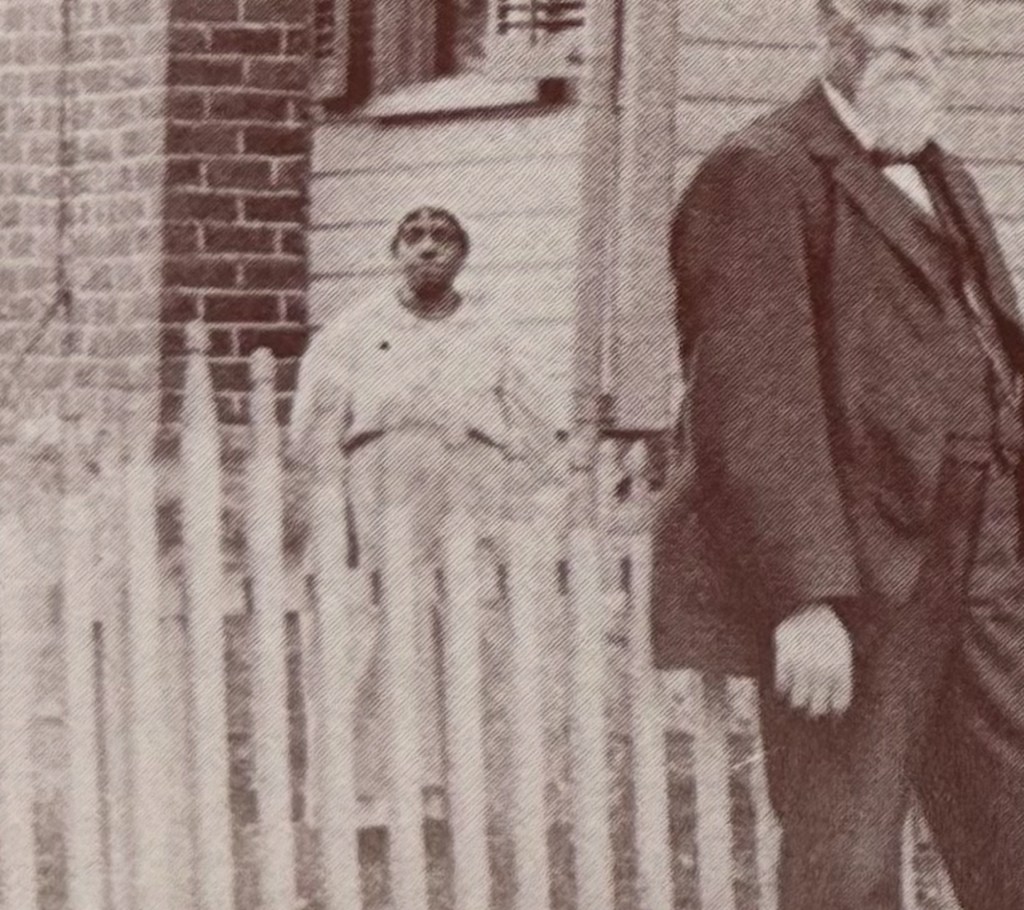
Behind the Lawrence family’s fence on Five Points Road in Riner stands an unidentified African American woman—her name unrecorded, her story unknown. She appears behind Canaan and Mollie Weaver Lawrence, whose wealth came from farming, commerce, and the post office in the late 1800s.
Searching for Her Name
In this photograph, taken in Riner, Virginia, a white family stands proudly in front of their home on Five Points Road, Riner, Virginia. Behind the fence, partially obscured, stands an unidentified African American woman—someone whose name and story have not yet been recorded.
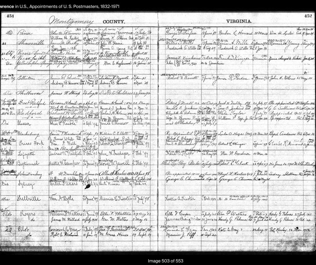
She is pictured behind Canaan (1840–1905) and Mollie E. Weaver Lawrence (1838–1931), whose home and farm once stood at this site. Canaan, a Confederate veteran, was listed as a farmer, D.G. merchant, and postmaster in 1893—the sources of the family’s prosperity. Born in Floyd County, he moved to Auburn by the 1870 census. Mollie, born in Auburn, remained there her entire life.
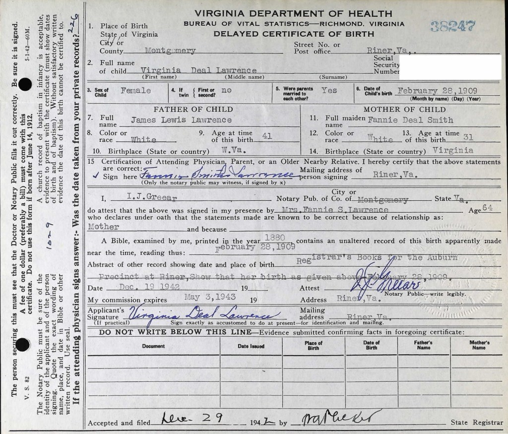
This photograph was shared by their granddaughter, Virginia Deal Lawrence, a longtime teacher at Auburn Elementary School, who preserved many family images and documents. Despite a search through census and local records, the woman’s name remains unknown.
We will continue to look through Virginia Deal’s papers and scrapbooks in hopes of finding a clue.
If you recognize this woman or know anything about the African American community connected to the Lawrence family, please contact us—we would be honored to record her name and story.
Please let us know if you can identify this woman behind the fence.Lawrence Family PhotoCanaan Lawrence1893 Canaan Lawrence was Postmaster of Riner, Va1895 Canaan Lawrence was the Postmaster in Riner, VaMollie Elizabeth Weaver Lawrence Virginia Deal Lawrence, granddaughter of Canaan and Mollie LawrenceThe Riner 1995 Calendar filled with Virginia Deal Lawrence’s photos
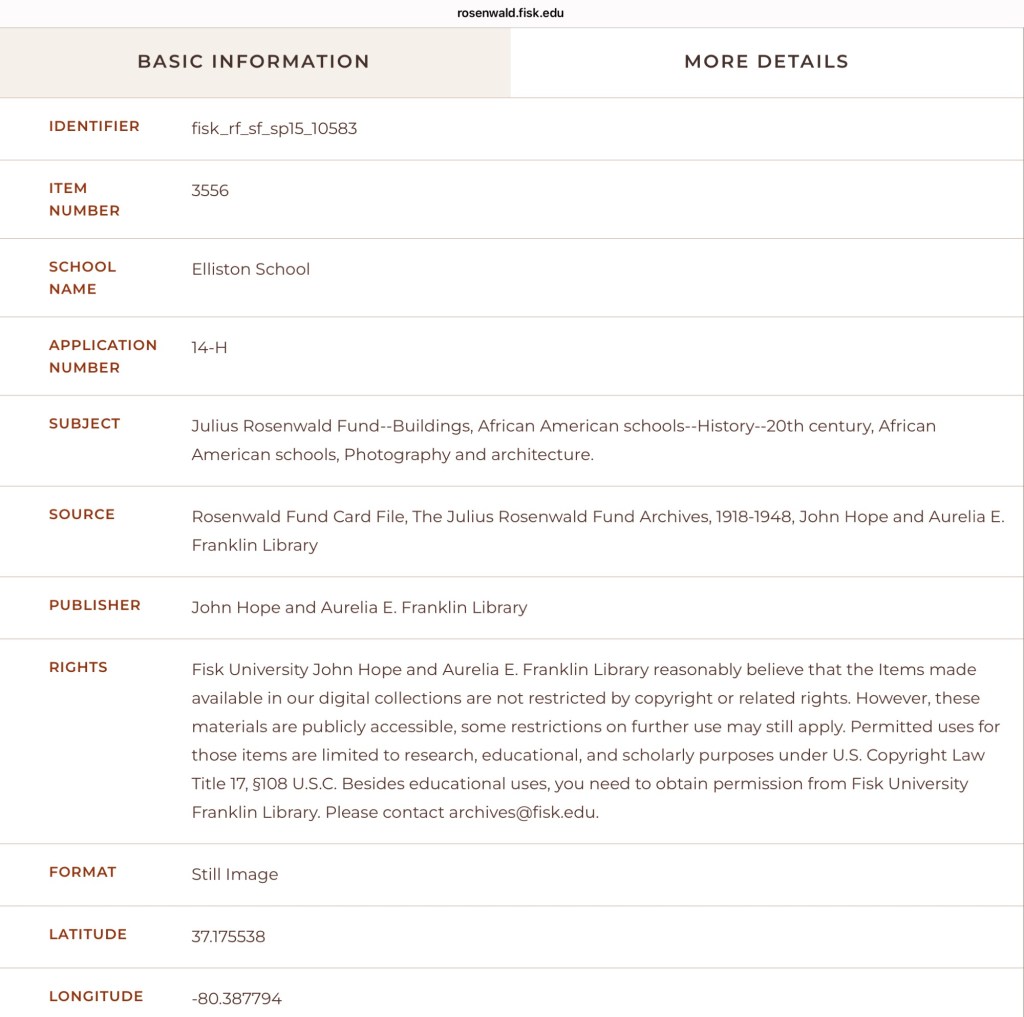
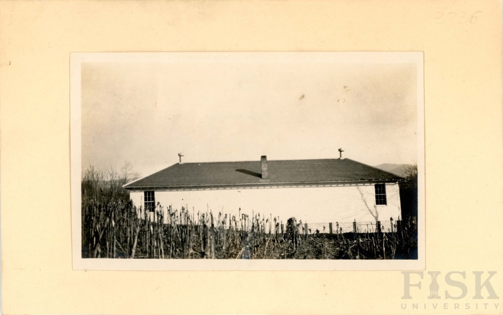
Fisk University has released its Rosenwald School Digital Collection, preserving and sharing the history of these vital institutions. In Montgomery County, the collection highlights schools built through the determination of African American communities in Elliston, Pine Woods, Shawsville, and Wake Forest.
Fisk University has made its Rosenwald School Digital Collection publicly accessible, a significant step in preserving and sharing the history of these important institutions. For Montgomery County, the collection documents the Rosenwald Schools established through the determination and vision of African American communities in Elliston, Pine (Piney) Woods near Riner, Shawsville, and Wake Forest.
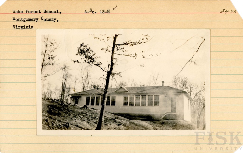
Although only the Wake Forest school remains today—adapted for use as a private residence—the collection ensures that the legacy of all three schools endures. These schools stand as a testament to community leadership, resilience, and the transformative power of education during the early twentieth century.
The Story of Rosenwald Schools
The website (scroll down) offers a wealth of information: the story of Julius Rosenwald and his vision, the purpose of the school fund, the significance of the school designs, and the requirement that African American communities contribute a share of the cost. Visitors will also find maps, photographs, and documentation of schools across the region and beyond.
Elliston School Info1940 School Census Map2002 Image (Courtesy of Meadowbrook Museum, Shawsville)Image of the list of students in 1935 (Courtesy of Meadowbrook Museum, Shawsville, James Earnest Dow document)
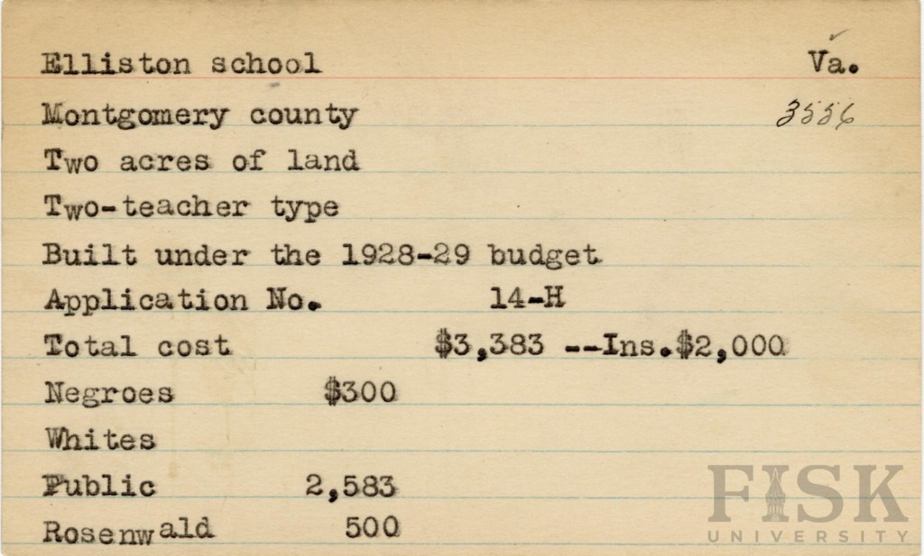
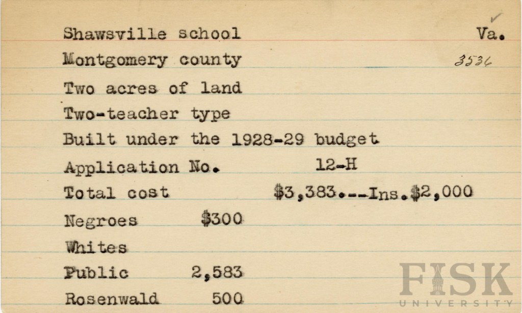
Built in 1928–1929, the Elliston Rosenwald School reflects the determination of the local African American community to provide better educational opportunities for their children. Families in Elliston raised $300 toward the project, which was matched by $500 from the Rosenwald Fund and $2,583 from the Montgomery County School Board.
The school stood on two acres of land and housed two classrooms, each with its own teacher. The school was located on Brake Road, in the Allegheny School District. The legacy: the Elliston Rosenwald School was a center of learning, community, and pride during an era when access to education was hard-won.
The Pine Woods Rosenwald School (Piney Woods) was built in a two-teacher design under the supervision of Tuskegee University. The school was sited on Piney Woods Road, in the Auburn School District. While the exact construction date is unknown, records indicate the total cost was $1,075. Of that amount, the Rosenwald Fund contributed $300, the African American community raised $275, and the Montgomery County School Board provided $500.
Unlike white schools of the period, which were fully funded by the School Board, African American families were required to make direct financial contributions toward the construction of their schools. This inequity underscores both the systemic barriers they faced and the extraordinary commitment of the Pine Woods community to ensuring education for their children.
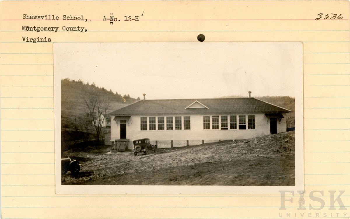
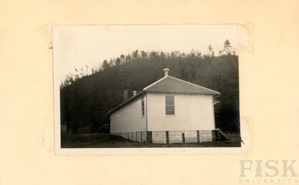
Constructed between 1928 and 1929, the Shawsville Rosenwald School followed a two-teacher design overseen by the Montgomery County School Board. The total cost of $3,383 was shared among the Rosenwald Fund ($500), the African American community ($300), and the Montgomery County School Board ($2,583).
At the time, Shawsville, of the Allegheny School District, was a thriving hub, energized by railroad service and new road (US Route 11) construction projects. These opportunities drew African American laborers and rail workers to the area, many of whom invested their limited resources into building a school for their children. Their contributions—financial and communal—stand as a testament to the determination of Shawsville’s African American families to secure education despite inequities in public funding.
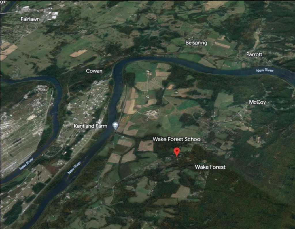
Constructed between 1928 and 1929, the Wake Forest Rosenwald School followed a two-teacher design on a two-acre site, in the Blacksburg School District, overseen by the Montgomery County School Board. The project cost $3,383, with funding shared by the Rosenwald Fund ($500), the African American community ($426 in 1928, about $7,500 in today’s value), and the Montgomery County School Board ($2,457). This school is now a private residence.
The Wake Forest community at this time was made up of independent farmers, farm laborers, boatmen, railroad workers, teamsters, and domestic workers. As coal extraction began to rise and reshape the region’s economy, African American families recognized that education would be essential for their children’s future. By pooling their resources—despite economic hardship—they ensured access to schooling that could open paths beyond the limits of labor and provide new opportunities for the next generation.