Rev. Peyton Matthew Lewis: From Enslavement in Virginia to Teacher, Minister, and Community Leader

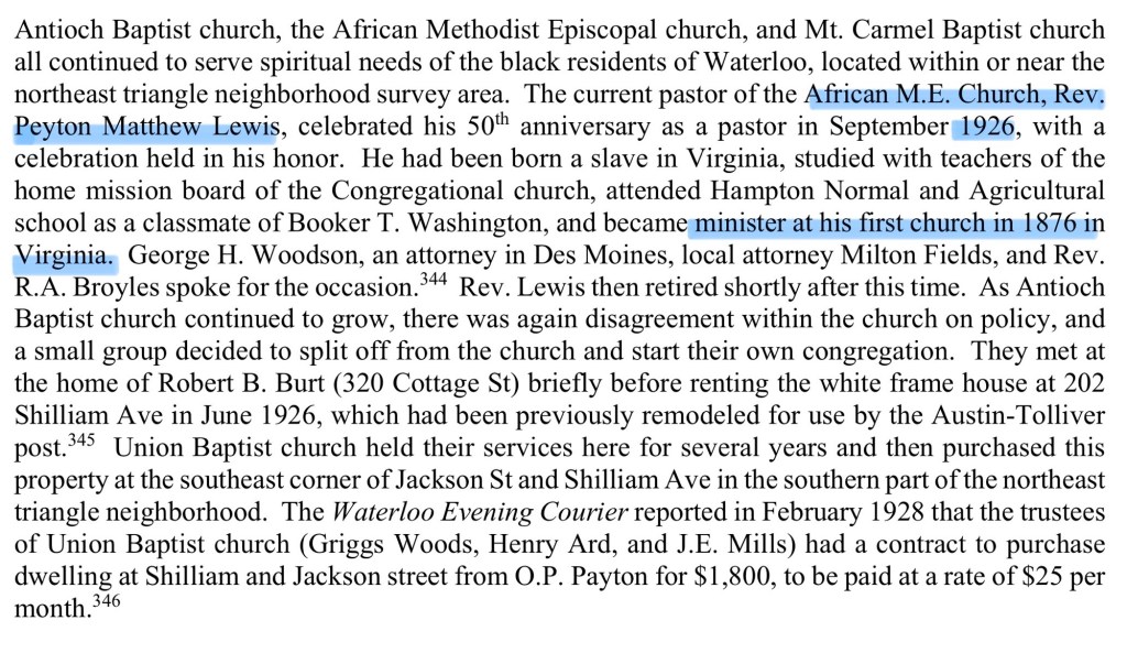
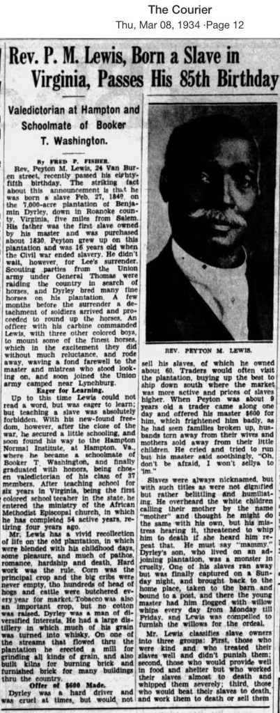
These firsthand recollections provide a rare glimpse into the daily realities of slavery in western Virginia. After emancipation, Lewis became part of the second class to attend Hampton Institute, graduating as valedictorian in 1873. He returned to Bedford County as its first Black public school teacher before dedicating more than 50 years to ministry in the African Methodist Episcopal (AME) Church—a remarkable journey from enslavement to educator and community leader.

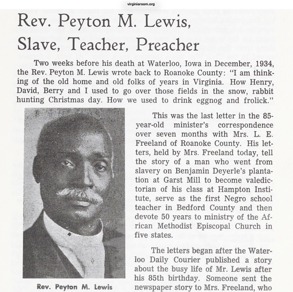
Journal of the Roanoke Historical Society, Vol 7/#2, page 50-52

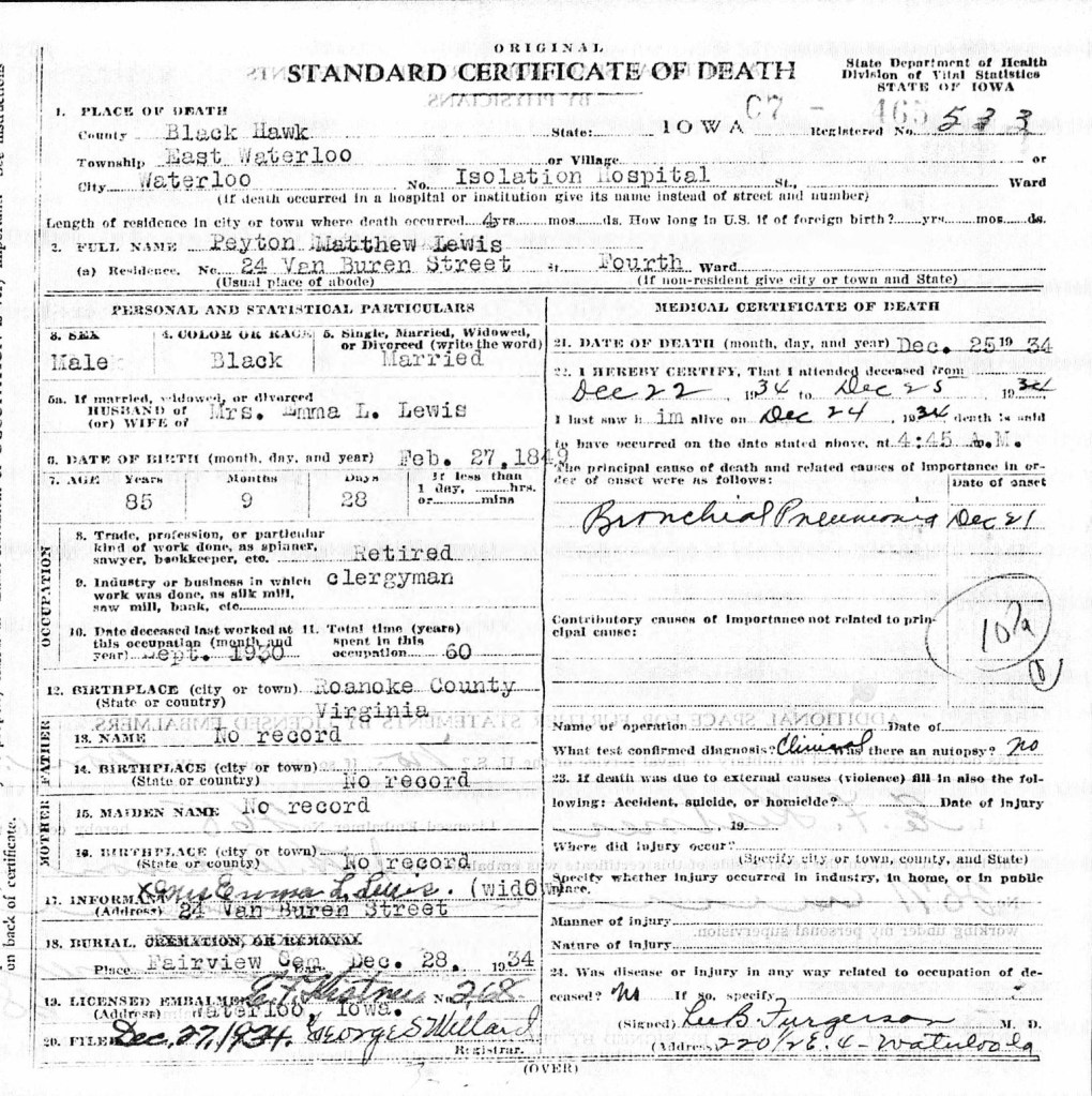
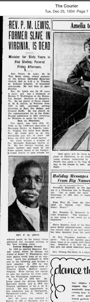
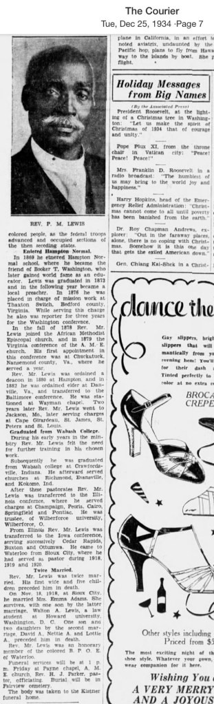
One remarkable story tucked away in the Journal of the Roanoke Historical Society (Vol. 7, p. 50) follows the extraordinary life of Rev. Peyton M. Lewis (1849–1934), whose own recollections of slavery were first published in the Waterloo Daily Courier of Iowa in 1934. His life traces an inspiring journey from enslavement in Bedford County, Virginia, to becoming an educator, minister, and respected leader.

Peyton M. Lewis was born enslaved in 1849 on the plantation of Benjamin and Julia Deyerle near Garst Mill in Bedford County. His father, Charles Lewis, was a highly skilled brick maker and distiller who, along with his brother Peyton, had been purchased by Benjamin Deyerle in Richmond. Benjamin Deyerle was one of western Virginia’s best-known builders, responsible for constructing brick homes, mills, public buildings, and a large whiskey distillery throughout the South West Virginia, including Blacksburg and Christiansburg.

Lewis vividly described the work he performed while enslaved. As a boy he molded bricks, hauled flour and whiskey with a two-team ox wagon, and cleaned and polished the family’s shoes. He also recalled that Uncle Dick and Richard Taylor served as carriage drivers for the Deyerle family. His memories provide a rare first-person account of everyday labor on a western Virginia plantation.

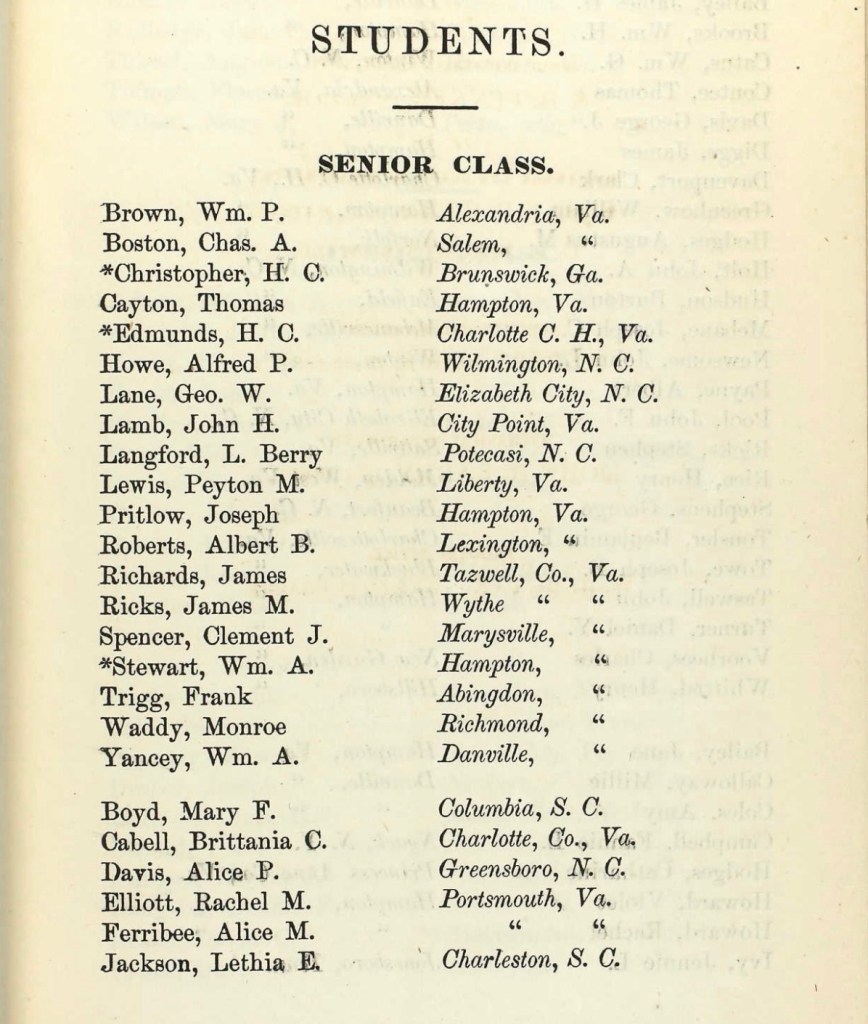
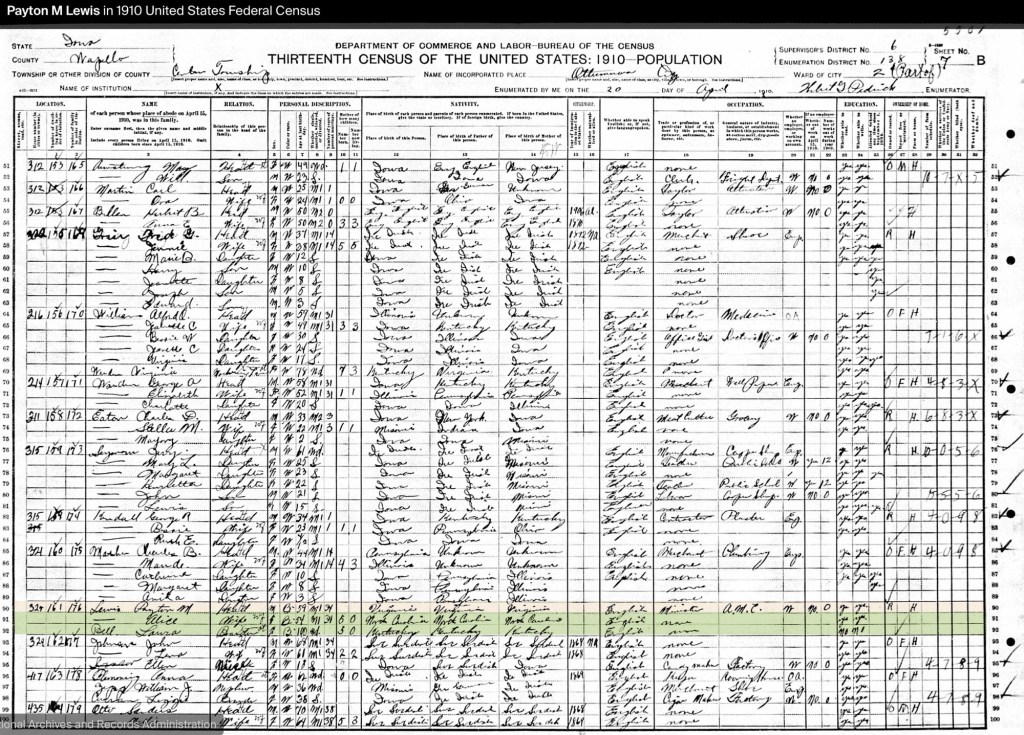
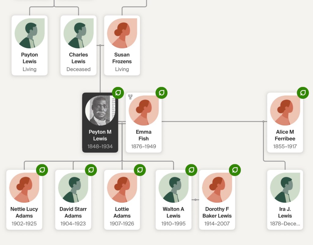
Freedom came in 1865 when Peyton was 16 years old, opening opportunities that had previously been denied him. Lewis participated in mission schooling for formerly enslaved children, where a teacher recognized his abilities and encouraged him to continue his education at the newly founded Hampton Normal and Agricultural Institute. Entering only a year after the school opened, he graduated in 1873 as valedictorian of a class of just seventeen students. There he met fellow student Alice Ferribee (1855-1917) of Elizabeth City, North Carolina, whom he married shortly after graduation.

Returning to Bedford County, Lewis became the county’s first Black public school teacher. He wrote candidly about the challenges of establishing schools during Reconstruction, often teaching in log churches and abandoned cabins because no schoolhouses existed. In an 1893 Hampton alumni publication, he reported having taught more than 600 children, with at least eleven of his former students becoming teachers themselves. His work took him to Liberty (now Bedford), Thaxton Switch, and Bunker Hill, where he helped lay the foundation for public education in Black communities.

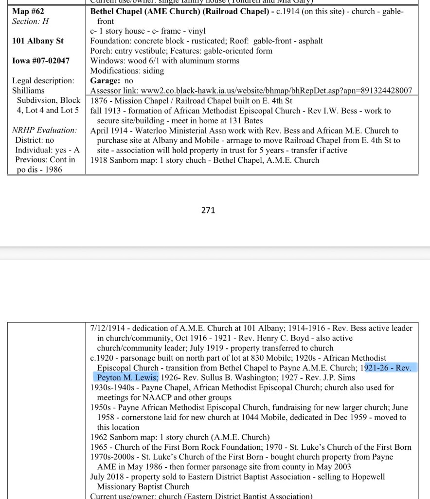
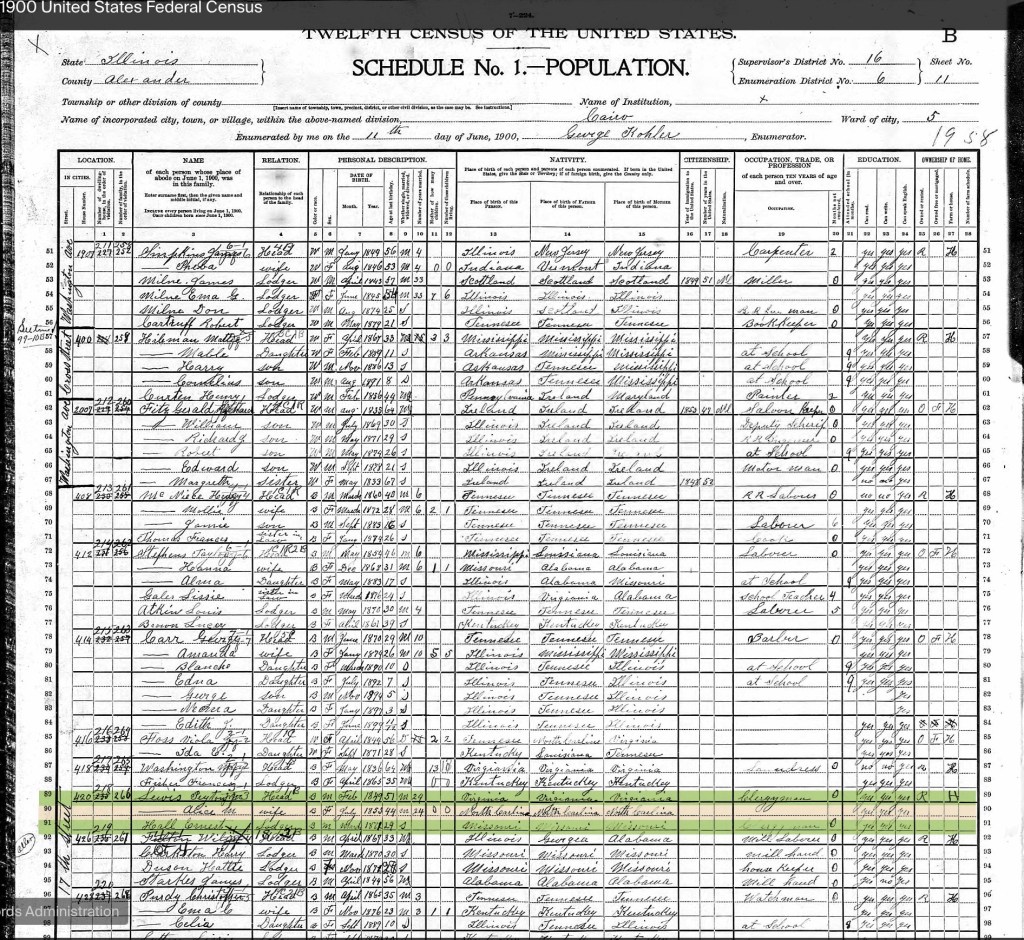
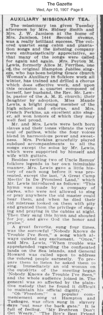
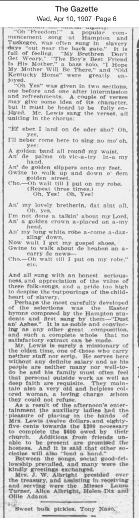
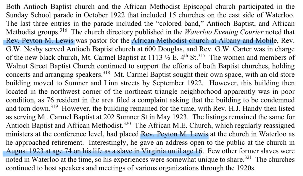
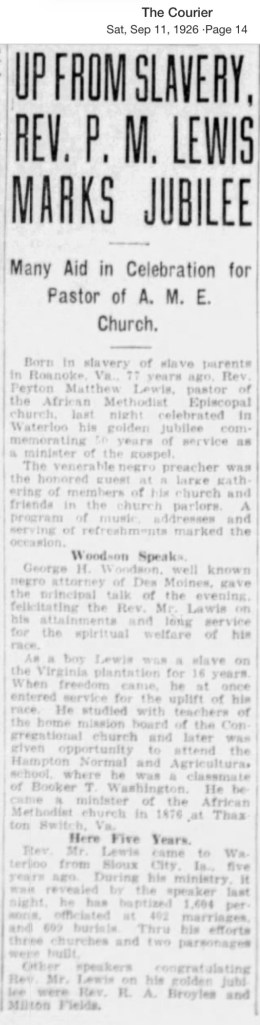
Lewis later attended Wabash College in Indiana and was ordained as a minister in the African Methodist Episcopal (AME) Church. His ministry spanned more than fifty years across several states. By 1926, the citizens of Waterloo, Iowa, celebrated his fiftieth anniversary in the ministry, noting that his first wife, Alice Ferribee for Elizabeth City, NC, had been a year ahead of Booker T. Washington at Hampton and he had devoted his life to education and the church. (⁠cityofwaterlooiowa.com)

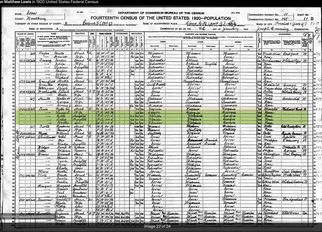
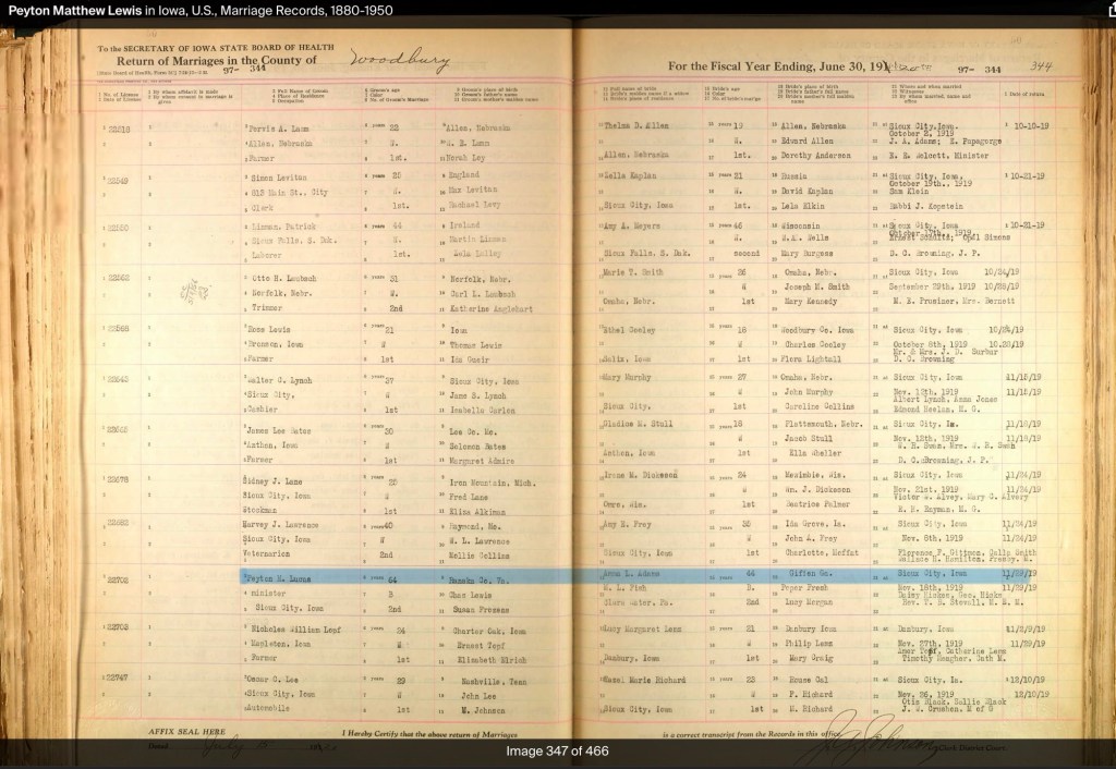
Rev. Peyton M. Lewis died in Waterloo, Iowa, in December 1934. Like many African Americans who left Virginia during the late nineteenth and early twentieth centuries, he settled in Iowa seeking greater economic opportunity and a community less constrained by the racial oppression of the Jim Crow South.
Further Research

Rev. Lewis’s story appears to extend well beyond the published article. Surviving correspondence between Lewis and descendants of the Deyerle family is preserved by the Roanoke Historical Society, Virginia Room. These letters include his reflections on growing up enslaved, his family, and memories of Christmas celebrations and work on the Deyerle plantation. They offer an invaluable first-person record of slavery and Reconstruction in western Virginia and deserve wider study.

Why Rev. Peyton M. Lewis’s Story Matters to Montgomery County

Although Rev. Peyton M. Lewis spent much of his life in neighboring Bedford County, his story has important connections to Montgomery County’s history.

First, the Lewis surname appears in historical records throughout Montgomery County, raising the question of whether there may be family connections worth exploring. Further genealogical research could reveal relationships between the Bedford County Lewis family and other African American families living in Montgomery County after emancipation.

Second, Lewis’s firsthand descriptions of establishing schools for formerly enslaved children closely mirror what was happening in Montgomery County during Reconstruction. He recalled struggling to find suitable places to teach, often relying on log churches and cabins because dedicated school buildings did not yet exist. Similar challenges unfolded here. Blacksburg’s first school for Black children, serving grades one through seven, met in the former Presbyterian Union Church on East Clay Street, on land adjacent to the Edwin Amiss estate (later owned by the Palmer family). In Christiansburg, Freedmen’s Bureau superintendent Capt. Charles Schaefer documented the difficulty of securing a building for a Black school, noting the reluctance of white property owners to rent space for African American education.

Firsthand narratives from formerly enslaved people in Montgomery County are exceedingly rare. Because of this, accounts like Rev. Lewis’s become especially valuable. While his experiences occurred just across the county line, they provide a vivid, personal window into the challenges of emancipation, education, and community building that were shared across southwest Virginia. His recollections help us better understand the historical experiences of people in Montgomery County when local voices from the period have not survived.

Taken together, these regional stories allow us to reconstruct a more complete and truthful history of Reconstruction in the New River and Roanoke valleys—one that recognizes the determination of newly freed African Americans to build schools, educate their children, and create opportunities despite significant resistance.
North Fork River Rural Historic District

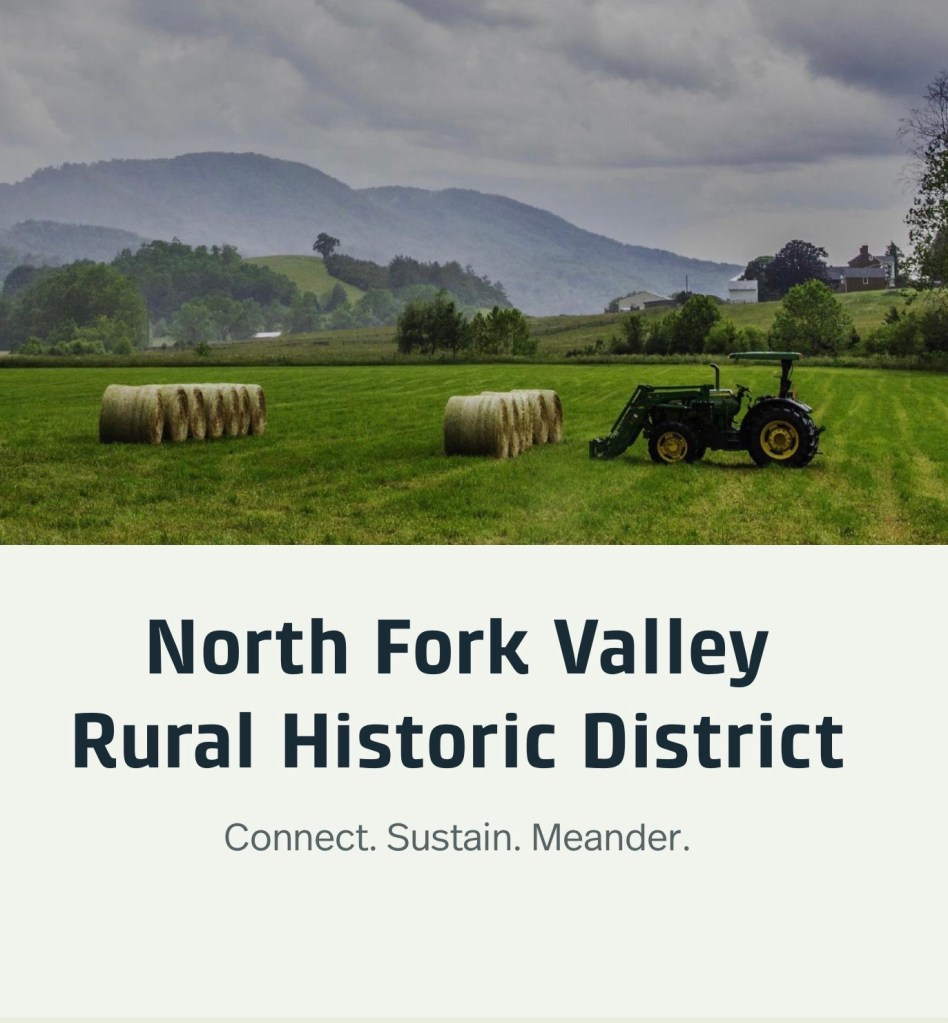
The North Fork Valley Rural Historic District spans nine miles and 10,200 acres in Montgomery County, Virginia. Along scenic Route 785, this ArcGIS tour explores geology, farming, social and architectural history—plus schools and churches—across a multi-generational rural landscape.

Image courtesy of the North Fork Valley Rural Historic District website, accessed May 4, 2026.

The North Fork Valley Rural Historic District spans nine miles and 10,200 acres in Montgomery County, Virginia. Along scenic Route 785, this ArcGIS tour explores geology, farming, social and architectural history—plus schools and churches—across a multi-generational rural landscape.

Search the terms “African American” or “enslaved” to uncover information connected to the enslavement of men, women, and children.

Church: Rough and Ready in Childress, Virginia

The exact location of this church in the Childress area remains unknown. A 1940 school map shows nearby schools but lists only Pine Woods, a Rosenwald-funded African American school. Because schools were often built near churches, the map—and the noted Shelburne home—may offer clues to where the congregation once gathered.

Rough & Ready Church in Childress, Va – Roanoke Times, 05 August 1923, page 20

The exact location of this church in the Childress area is unknown. A 1940 school map identifies local schools but does not mark any African American schools, except Pine Woods School, which was built with Rosenwald funds. In many communities, schools were often situated near churches, so their locations can offer valuable clues. A Shelburne home also appears on this map, suggesting possible connections within the neighborhood.

The Roanoke Times, 05 August 1923, page 20

During a violent electrical storm Monday, lightning struck a son of Authur Shelburne near the colored church “Rough & Ready.”

Pulaski County Resource

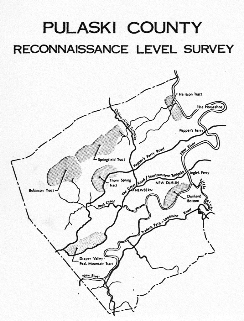
Pulaski County Reconnaissance Survey, created by Gibson Worsham, Dan Pezzoni, and many others, is such a valuable resource. It provides vital insights into African American history in Southwest Virginia and the greater Central Appalachian region, helping us better understand the interconnected stories that shaped our communities.
Montgomery County, Virginia, has never existed in isolation.

The people who have lived here—whether by choice, through enslavement or servitude, or as Indigenous communities who established towns long before European arrival—moved across boundaries freely. They traveled, traded, fought, buried their dead, and carried out the everyday work of survival across what later became county lines.

This is why the Pulaski County Reconnaissance Survey, created by Gibson Worsham, Dan Pezzoni, and many others, is such a valuable resource. It provides vital insights into African American history in Southwest Virginia and the greater Central Appalachian region, helping us better understand the interconnected stories that shaped our communities.
This report is fully searchable and contains valuable early documentation on African American schools, churches, and communities. It also includes a generalized map that highlights both early European settlements and land tracts. For example, Dunkard’s Bottom—now submerged beneath Claytor Lake—was once part of an early German settlement.

The report also identifies significant Scotch-Irish tracts such as Draper Valley/Peak Mountain, Harrison, Robinson, Springfield, and Thorn Spring. It notes the communities of Newbern and New Dublin, along with the region’s main transportation routes: Traders Path/Leadmine Road, the Great Road/Wilderness Road/Southwestern Turnpike, Peppers Ferry Road, and the Dublin/Giles Turnpike.

The report offers a clear explanation of the early Importation and Treasury Rights system used to claim land (see pages 23–24). For further detail, see F.B. Kegley, Kegley’s Virginia Frontier, Roanoke, VA: Southwest Virginia Historical Society, 1938. p. 59.

Read the full Pulaski County Reconnaissance Survey report ›

By Gibson Worsham, Dan Pezzoni, Leslie Naranjo-Lupoid, Joseph T Koelbel, Dan Rotenizer, Charlotte Worsham, Vicky Goad, CA Cooper-Ruska

Pulaski County Reconnaissance Level Survey Document, 1985 by Gibson Worsham, Dan Pezzoni and others.

The report contains interesting data about the enslaved, noted on page 44. Also, the churches and New River Village is discussed beginning on page 56.

In Pulaski the pattern of large landholding influenced the ownership of slaves. Whereas in Montgomery County there were 2,219 slaves, and in Pulaski only 1,589 in 1859, eight slaveholders had more than fifty slaves in Pulaski while only two landowners in Montgomery possessed as many. In both counties, however, the majority of owners possessed ten or fewer slaves. During the Civil War, the Confederacy began requisitioning slaves to work in the war effort. At the beginning of the war many slaves were requisitioned and shipped to Richmond to fortify the state capital. In the following three years slaves were requisitioned four times so that by 1865 the county found it could no longer comply as it was being drained of free and slave manpower, food supplies and money.

Map of Pulaski County noting the mines, more importantly the African American village of “New River”

Pulaski Timeline

Timeline was created for the 2030 Comprehensive Plan of Pulaski County

A Note on the Language in the County’s Comprehensive Plan

As part of Montgomery County’s 30-year Comprehensive Plan, a historical timeline was created. While the dates provided are generally accurate, the language used to describe Indigenous people and borderlands does not align with our values.

We want our readers to be aware that these depictions reflect the language of the plan’s authors—not the values or beliefs of this website. Our commitment is to present history in a way that acknowledges the dignity, presence, and contributions of all people who have lived in this region.

Note that the African American community of “New River” came to exist after emancipation.

Pulaski Newspapers

Virginia Tech Collection

Primary Source Series: The First Negro Churches in the District of Columbia, 1922

https://docsouth.unc.edu/church/cromwell/cromwell.html

The First Negro Churches in the District of Columbia, John W. Cromwell, 64-106 p., Lancaster, Pa.; Washington, D. C.
The Association for the Study of Negro Life and History, Inc., 1917
From the Journal of Negro History 7, no.1 (January 1922), 64-106.
Call number E185 .J86 v. 7 1922 (Davis Library, University of North Carolina at Chapel Hill)

Many names associated with Montgomery County, Virginia: Anderson, Bell, Green, Hunter, Johnson, Muse, Saunders, Stewart, Taylor, Walker

Odd Fellows as well as the history of the establishment of churches in the District of Columbia.

District Of Columbia Resources

https://matthewbgilmore.wordpress.com/2017/09/11/online-washington-dc-history-resources-city-directories-online/

Christiansburg Industrial Institute, Hill School and the Schaeffer Memorial Baptist Church – 1913 Sanborn Fire Map

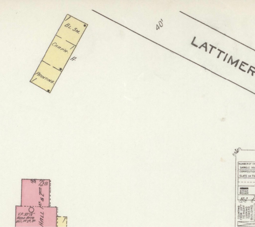
The Sanborn Fire Insurance maps are often the only early glimpse of buildings in rural towns over time. Christiansburg Industrial Institute moved from the Zion Hill location to the Lattimer Plantation site, north west of Christiansburg, at the turn of the 20th Century. This Sanborn Fire Insurance Map from Christiansburg, Montgomery County, Virginia was published by the Sanborn Map Company, dated Sep, 1913. The key to the maps is at the end.

1913 Christiansburg Industrial Institute

1913 Sanborn Fire Insurance Map (Courtesy of the Library of Congress)

The map is of Christiansburg Industrial Institute, situated north west of Cambria and north of Christiansburg courthouse. Note that frame constructed buildings are coded yellow and red for the solid brick building. The Baily Morris Building which housed the girls dorm, assembly hall, dinning hall and kitchen (close-up below) is heated by steam and lighted by electricity.

“Baily-Morris” Building

The Morris Hall Boys’ Dorm is both red and yellow, denoting built of a combination of building materials. The building is heated by hot water and lighted by electricity. Note that the buildings were supplied with water by 2,500 ft of pipes connected to the 10K gal water tank on the hill. The tank is filled by a Worthington Pump, moving water from a spring.

The girls and boys dorms were named for two Friends’ of the Freedmen of PA, Elliston P. Morris and Joshua L. Baily. They also donated money to construct the water system which was installed in 1907, before either Christiansburg or Blacksburg had a community water system. (A Vision of Education, Selected Writings of Edgar A. Long, Anna Fariello, Ed. Christiansburg Institute, Inc. 2021, pg 86,)

The Lattimer Mansion House, wood framed, was heated by stove and not connected to the water supply. The house was used as classrooms. Note the printing, carpenter and black smith shop close to the entrance road.

1913 Hill School & Schaeffer Memorial Baptist Church

1913 Sanborn Fire Insurance Map (Courtesy of the Library of Congress)

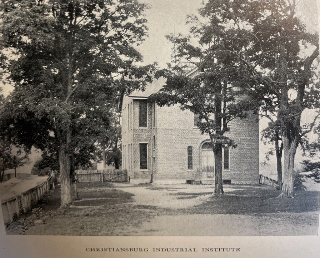
This map is of Zion Hill which is located on the ridge (now High Street) between Cambria and Christiansburg. The brick (red) “Public School” housed the Christiansburg Industrial Institute before that secondary school moved to the Lattimer Plantation property by the turn of 20th century. This brick school, built by 1885, was converted to a primary school for African American children after CII moved. As noted by the Sanborn map, the building was heated by stoves and lighted by electricity.

Image of the Hill School from The Story of a Consecrated Life, Commemorative of Rev. Charles S. Schaeffer by CH Harrison, 1900. High Street is visible.

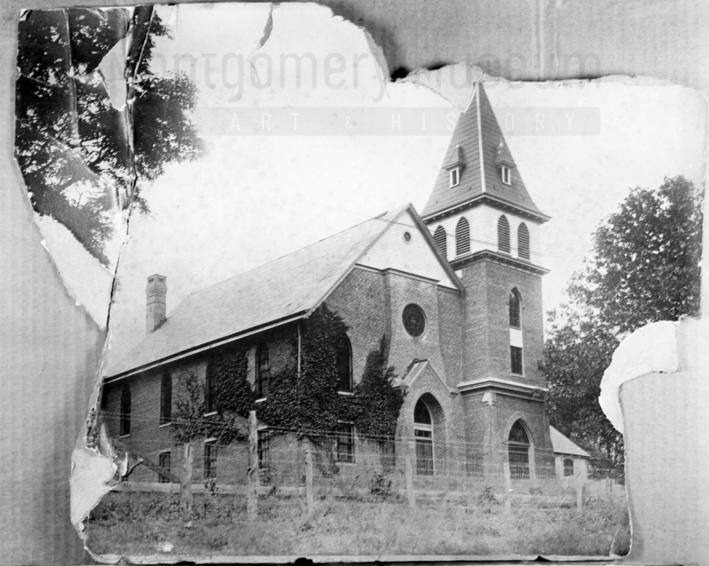
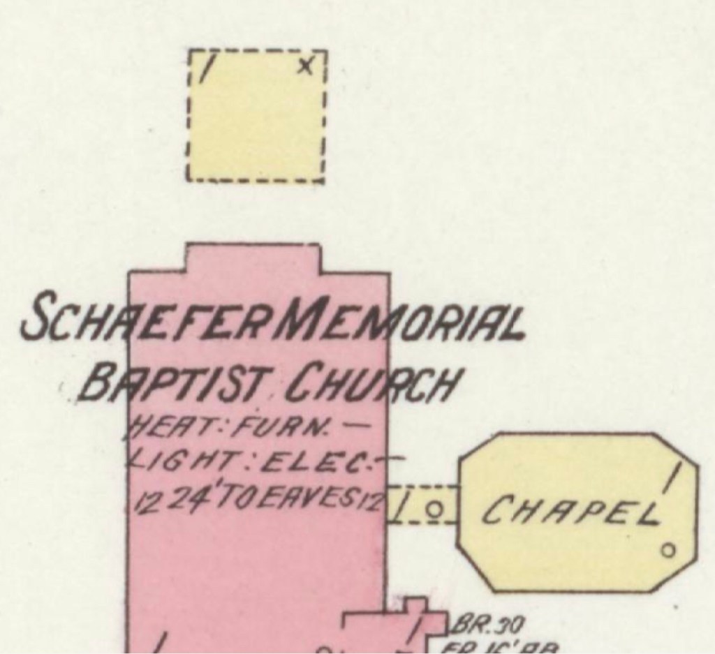
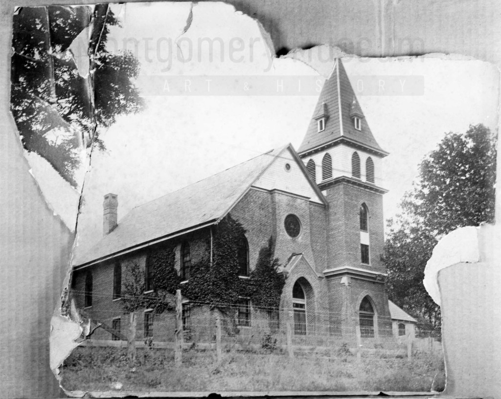
The Schaeffer Memorial Baptist Church is also of brick and built by 1885. Charles S Schaeffer’s memorial brass plaque were unveiled 1 October 1899, after he died in May of that same year. Note the frame chapel to the left (east) of the brick structure.

Image of Schaeffer Memorial Baptist Church from The Story of a Consecrated Life, Commemorative of Rev. Charles S. Schaeffer by CH Harrison, 1900. High Street is visible in the foreground.
Later photograph, courtesy of the D.D. Lester Collection, Montgomery Museum of Art & History

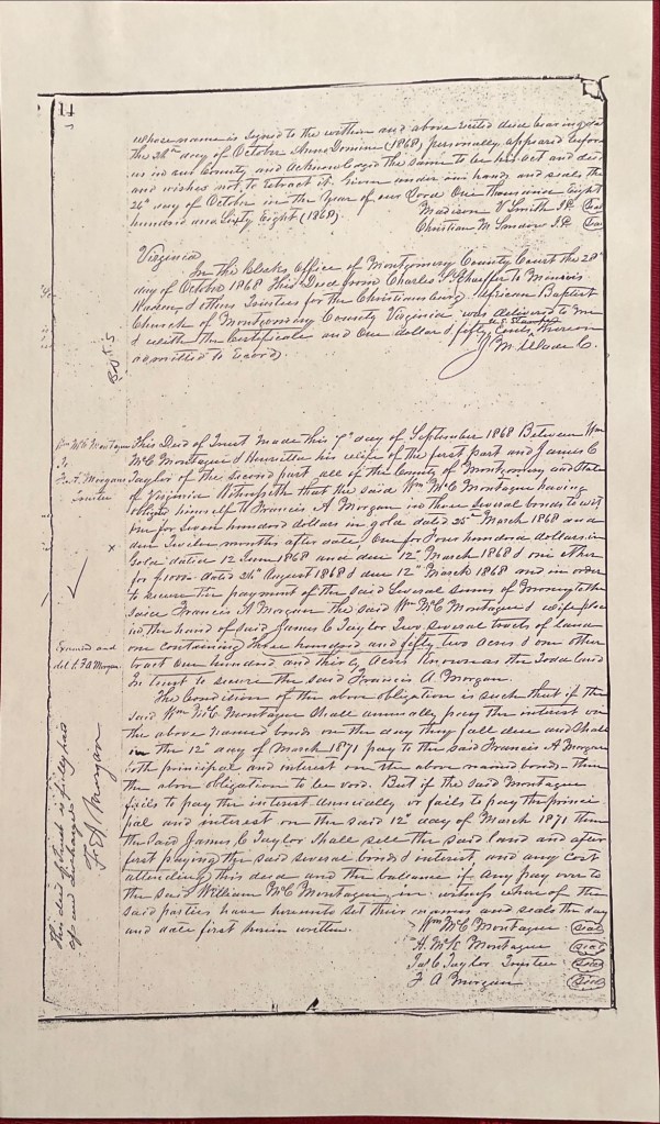
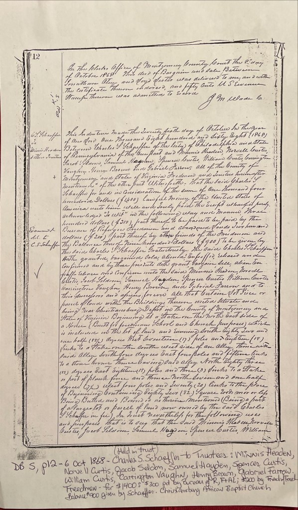
On the Sanborn map, note the small frame, 1 story building behind the church? This may be the first school/church building on Zion Hill. The deed (DB S, pg 12, Oct 1868) and Harrison, 1900 * note the existence of this building. The brick school on the 1913 Sanborn map was the third version of this school at this site. The second school on Zion Hill was a 2 story & frame building, used between 1974 and 1885. (The rented Campbell house was the first school but it was not located on Zion Hill.)*

The image of the small school/meeting house shows a one story frame building with hip-roof and double stove-pipes. The dressed limestone block foundation was typical in this area and seen on buildings dating from early 1800s to the turn of the 20th century.

Image of the first school house on Zion Hill from The Story of a Consecrated Life, Commemorative of Rev. Charles S. Schaeffer by CH Harrison, 1900. High Street is visible in the foreground.

* The images and much of the information about Zion Hill comes from The Story of a Consecrated Life, Commemorative of Rev. Charles S. Schaeffer by CH Harrison, 1900.

The last interesting note about the Sanborn map is that the church was 160 feet to the Fire Department. The map did not indicate a source of water.

Deeds to Zion Hill, between the Depot and Christiansburg, VA

Captain Charles S. Schaeffer arrived in Christiansburg soon after the emancipation of enslaved people of Southwestern Virginia. In April 1866 he was appointed as an agent of the Bureau of Refugees, Freedmen, and Abandoned Lands (referred to as the Freedman’s Bureau). Schaeffer was US soldier who asked for to be assigned as an agent in Southwestern Virginia. He was assigned to Giles and Montgomery Counties, with headquarters in Christiansburg, VA.

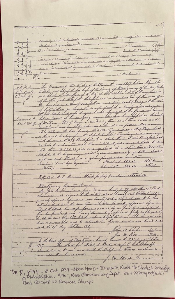
October 8, 1867, Hamilton D. and Elizabeth Wade sold Schaefer about 3.5 acres for $196 on a road leading from the Depot (Cambria*) to the town of Christiansburg (deed book R, pg 444). It is upon this land that Schaefer built a home of stone on the western portion and called it Zion Hill.

About one year later, October 6, 1868, Schaeffer deeded about a half an acre to the Trustees to be used as a school and the Christiansburg African Baptist Church (deed book S, pg 12). The Trustees: Minnis Headen, Norvell Curtis, Jacob Seldon, Samuel Hayden, Spencer Curtis, William Curtis, Carrington Vaughn, Henry Brown, and Gabriel Farrow. The cost of the land was $1,400. The Freedmen’s Bureau paid $300, the Friends’ of the Freedmen paid $200, & Schaeffer gifted the balance of $900. As noted in the deed a house was on the land, in use as a school and meeting house by the time of this deed. We believe this is the first school at this location. Schaeffer and the Trustees built two other structures with time.

Deed Book R, pg 444. Hamilton D. & Elizabeth Wade to Charles S. Schaeffer
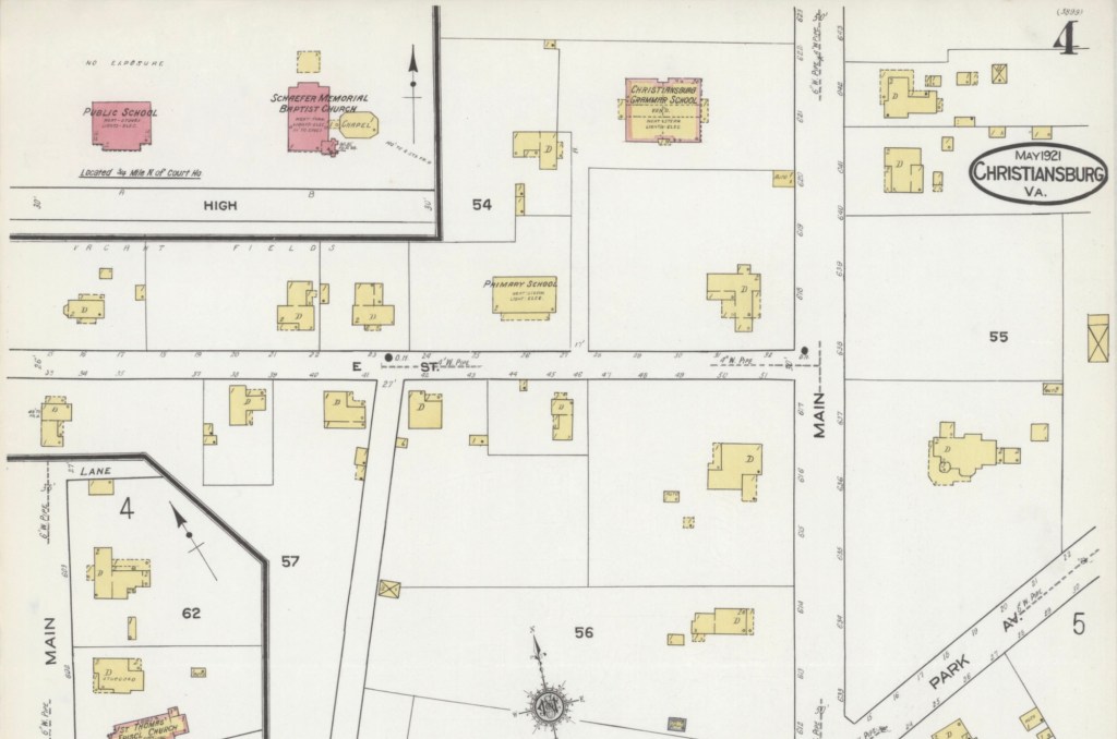
Zion Hill – 1921 Sanborn Fire Map of Christiansburg with the School and Baptist Church in red (brick) at the top, left.

*The Depot was Bangs which then was named Cambria in the late 1890s.

Photograph courtesy of the D.D. Lester Collection, Montgomery Museum of Art & History

Reports of Charles Stoever Schaeffer

Linda Killen transcribed the reports of Brevet-Captain Charles S. Schaeffer who held the post of agent for the Bureau of Refugee, Freedmen and Abandoned Lands during the early years of Reconstruction. More information about Schaeffer can be found at Christiansburg Institute, Inc.. Schaeffer sent this list of African American Freedmen to his reporting officer, Bvt. Brig. Genl. O. Brown, dated 15 March 1867 (page 18). Minnis Headen (Hadean) was listed on the deeds as Trustee for the Hill School and Christiansburg African Baptist Church.

  • “C. Minnis Hadean – Age 40 – Blacksmith – Christiansburg Va. – can read, write and cipher – one of the best colored men in the state.”
  • John Campbell – Age 40 – Farmer – Big Springs Depot Mont’y Co. Va – can read and write – owns property – was free before the war.
  • Peter Noulen (?) – Assistant to a Machinist – Depot of the Va. & Tenn. R.R. – Central Depot, [Radford], Mont’y Co. Va. – can read a little.
  • Sampson Gleaves – Age 35 – Farmhand – Christiansburg P.O. Lives one mile from town – Can read (and write a little).
  • Robert D. Jones – Age 30 – Farmer – Christiansburg P.O. Lives six miles from town – Can read and write.
  • Felix Johnson – Age 30 – Brick Layer – Christiansburg P.O. Lives in the direction of Blacksburg Va. – Can read and write.
  • John P. Taylor – Age 35 – Farmhand – Christiansburg P.O. Lives in the direction of the White Sulphur Springs – Can read & write.
  • Richard Taylor – Age 65 – Farmer & Preacher – Christiansburg P.O. – Lives near Blacksburg Mont’y Co. Va. – Cannot read nor write, but is quite intelligent.