Montgomery County’s Changing Borders & the African American Story

The Formation of Montgomery County, Virginia and Why it Matters to Regional African American History

When Virginia’s earliest European colonial settlers first pushed westward beyond the Blue Ridge Mountains, they entered the border lands already inhabited by Indigenous peoples for thousands of years. As Europeans laid claim to these territories in the 18th century, Virginia’s county boundaries began shifting rapidly to keep pace and the need for local governance.

At first, all of western Virginia was considered part of vast counties based far to the east. Augusta County, created in 1738, stretched from the Blue Ridge to the Mississippi River—a landmass so large it was nearly impossible to govern effectively. As settlement expanded, Augusta was gradually carved into smaller counties.

Botetourt County was created in 1770 out of Augusta, and just two years later, in 1772, Fincastle County was formed to cover the far southwest. But Fincastle itself was short-lived: in 1776, it was split into three new counties—Montgomery, Washington, and Kentucky (the latter eventually becoming the Commonwealth of Kentucky).

Thus, Montgomery County was officially established in 1776, named in honor of General Richard Montgomery, a Revolutionary War hero.

Like most early counties, Montgomery did not remain the same size for long. As population grew and communities demanded closer courts and local representation, Montgomery’s original boundaries were gradually reduced.

1790: Wythe County was formed from Montgomery. 1790: Parts of Montgomery contributed to the creation of Kanawha County (now in West Virginia). 1806: Giles County was carved from Montgomery, Monroe, Wythe, and Tazewell. 1806–1830s: Additional shifts continued, with Montgomery giving land to Floyd (1831), Pulaski (1839), and others.

By the mid-19th century, Montgomery County had taken on the approximate shape we recognize today.

Why this matters

Tracing these changing boundaries shows how the western border lands of Virginia evolved from a vast Indigenous landscape into the network of counties we know today. When we study Montgomery County’s formation and its changing borders, we are not only tracking political geography—we’re also uncovering how those shifts shaped the daily realities of enslaved people and freedmen. The “line on a map” often meant the difference between where families were recorded, where they could live, and how they could begin to claim freedom and opportunity.

County seats like Christiansburg were not only centers of trade and government but also the location of the slave market and the courthouse records that tracked the lives of enslaved people. After emancipation, those same courts became the places where freedmen registered marriages, secured contracts, and sought land. As county lines shifted, so too did the jurisdictions that controlled access to justice, opportunity, and community life.

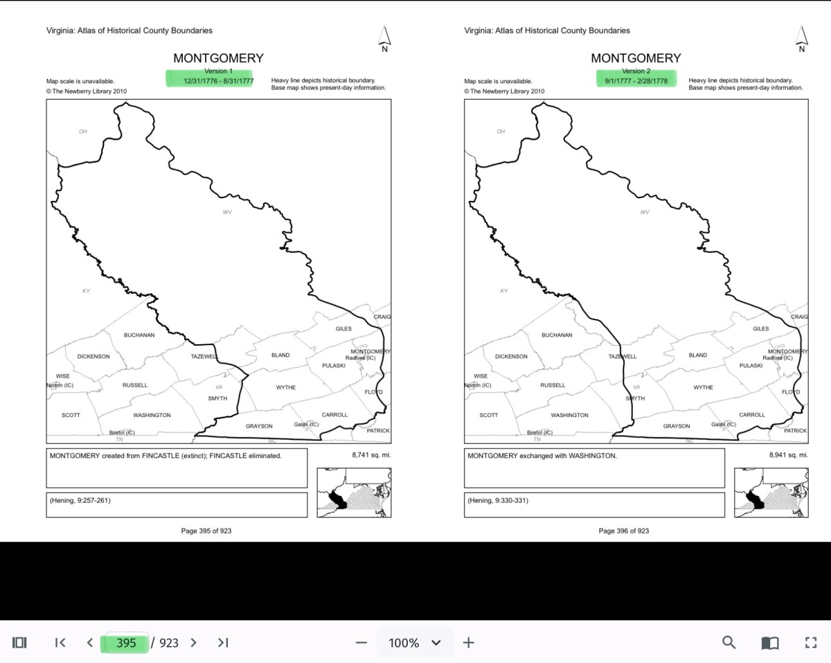
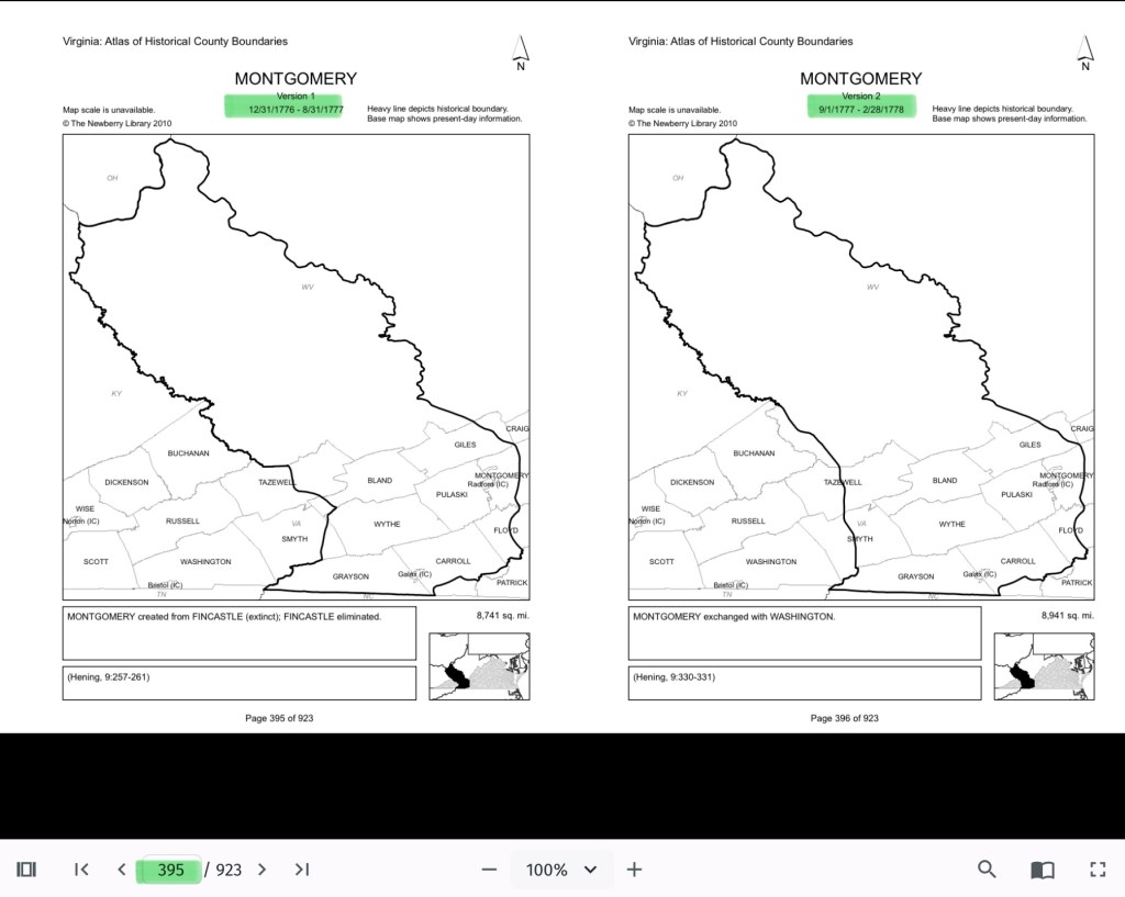
The flip book of maps below is a helpful resource to understand how the boundaries changed with time. Virginia Atlas of Historical County Boundaries. Begin on page 395.

Virginia Atlas of Historical County Boundaries

Further Discussion on How Shifting Boundaries Change Lives

Laws & Records

When county boundaries changed, so did the courthouse where records were kept. For enslaved people, this meant that bills of sale, wills, deeds, and manumission papers might end up filed under different counties as the boundaries shifted. After emancipation, the same was true for marriage licenses, labor contracts, and land purchases by freedmen. This scattering of records makes it both complicated when tracing family histories.

Shaping Community, Labor & Education

County lines determined where enslaved people were forced to labor, where patrols were organized, and where courts enforced slavery laws. After emancipation, those same boundaries shaped freedmen’s access to work, land, and schools. For example, as new counties like Giles or Pulaski were created from Montgomery, Freeman might find themselves suddenly in a different jurisdiction, dealing with a new local power structure.

Education also reflected these divisions. Freedmen near Christiansburg had better access to schools supported by the Freedmen’s Bureau, while those in rural reaches of the county received little help.

Courts and Law

During slavery, county seats (like Christiansburg) were centers of trade, law, and the slave market. Enslaved people were taken to county courts for sales, trials, and punishment. After emancipation, those same county seats became the centers where freedmen registered marriages, secured legal recognition, and later sought protection under Reconstruction policies.

Land, Freedom, and Mobility

For freedmen, land ownership was key to independence. But access to land varied widely from one county to another, depending on who owned large estates, which lands were subdivided, and how local officials treated Black landholders. County boundaries thus shaped the possibilities of building self-sustaining communities after emancipation.

More Maps

Montgomery County Resources

Montgomery County, Virginia Resources and the Formation of the County Over Time

National Register of Historic Places Application – 1989

National Register of Historic Places Application – 1989

This searchable document is a rich source of information about the county and its wider connections. For example, it notes that the New River boatmen once lived on Kent Farm, where they were enslaved by James Randle and Margaret Cloyd Kent prior to emancipation (see page 13). Additional details about Kentland and these freedmen can be found in the following postings: Historic Kentland and Historic Wake Forest

The names of some of the black boatmen of 19th-century Montgomery County include Frank Bannister (who was a boatman on the James River before the Civil War), Calvin Bannister, Roland Stuart, George Brown, and Lewis Smith.


Montgomery County Reconnaissance Level Survey, 1986

This report that was written by Gibson Worsham, Dan Pezzoni, Charlotte Worsham, David Roenizer, and others. It addresses the following: 1) Overview of the county’s history, 2) A comprehensive inventory of significant structures and sites in the county and 3) Maps delineating the location of said structures and sites. Similar to the report above, this is a wealth of information about the county.


More information can be found on this website: Gatherings Blacksburg History


The Formation of Montgomery County, Virginia and Why it Matters to African American History of the Region

When Virginia’s earliest European colonial settlers first pushed westward beyond the Blue Ridge Mountains, they entered the border lands already inhabited by Native peoples for thousands of years. As Europeans laid claim to these territories in the 18th century, Virginia’s county boundaries began shifting rapidly to keep pace and the need for local governance.
At first, all of western Virginia was considered part of vast counties based far to the east. Augusta County, created in 1738, stretched from the Blue Ridge to the Mississippi River—a landmass so large it was nearly impossible to govern effectively. As settlement expanded, Augusta was gradually carved into smaller counties.

Botetourt County was created in 1770 out of Augusta, and just two years later, in 1772, Fincastle County was formed to cover the far southwest. But Fincastle itself was short-lived: in 1776, it was split into three new counties—Montgomery, Washington, and Kentucky (the latter eventually becoming the Commonwealth of Kentucky).

Thus, Montgomery County was officially established in 1776, named in honor of General Richard Montgomery, a Revolutionary War hero.

Like most early counties, Montgomery did not remain the same size for long. As population grew and communities demanded closer courts and local representation, Montgomery’s original boundaries were gradually reduced.

  • 1790: Wythe County was formed from Montgomery.
  • 1790: Parts of Montgomery contributed to the creation of Kanawha County (now in West Virginia).
  • 1806: Giles County was carved from Montgomery, Monroe, Wythe, and Tazewell.
  • 1831: Montgomery giving land to Floyd
  • 1839: Montgomery giving land to Pulaski
  • 1892: City of Radford

By the mid-19th century, Montgomery County had taken on the approximate shape we recognize today.

Why This Matters

Tracing these changing boundaries shows how the western border lands of Virginia evolved from a vast Indigenous landscape into the network of counties we know today. When we study Montgomery County’s formation and its changing borders, we are not only tracking political geography—we’re also uncovering how those shifts shaped the daily realities of enslaved people and freedmen. The “line on a map” often meant the difference between where families were recorded, where they could live, and how they could begin to claim freedom and opportunity.

County seats like Christiansburg were not only centers of trade and government but also of the slave market and the courthouse records that tracked the lives of enslaved people. After emancipation, those same courts became the places where freedmen registered marriages, secured contracts, and sought land. As county lines shifted, so too did the jurisdictions that controlled access to justice, opportunity, and community life.

The flip book of maps below is a helpful resource to understand how the boundaries changed with time. Begin on page 395.

Virginia Atlas of Historical County Boundaries

Pulaski County Resource

Pulaski County Reconnaissance Survey, created by Gibson Worsham, Dan Pezzoni, and many others, is such a valuable resource. It provides vital insights into African American history in Southwest Virginia and the greater Central Appalachian region, helping us better understand the interconnected stories that shaped our communities.
Montgomery County, Virginia, has never existed in isolation.

The people who have lived here—whether by choice, through enslavement or servitude, or as Indigenous communities who established towns long before European arrival—moved across boundaries freely. They traveled, traded, fought, buried their dead, and carried out the everyday work of survival across what later became county lines.

This is why the Pulaski County Reconnaissance Survey, created by Gibson Worsham, Dan Pezzoni, and many others, is such a valuable resource. It provides vital insights into African American history in Southwest Virginia and the greater Central Appalachian region, helping us better understand the interconnected stories that shaped our communities.
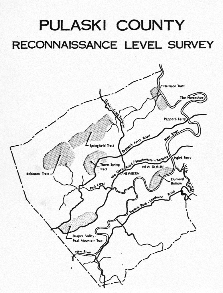
This report is fully searchable and contains valuable early documentation on African American schools, churches, and communities. It also includes a generalized map that highlights both early European settlements and land tracts. For example, Dunkard’s Bottom—now submerged beneath Claytor Lake—was once part of an early German settlement.

The report also identifies significant Scotch-Irish tracts such as Draper Valley/Peak Mountain, Harrison, Robinson, Springfield, and Thorn Spring. It notes the communities of Newbern and New Dublin, along with the region’s main transportation routes: Traders Path/Leadmine Road, the Great Road/Wilderness Road/Southwestern Turnpike, Peppers Ferry Road, and the Dublin/Giles Turnpike.

The report offers a clear explanation of the early Importation and Treasury Rights system used to claim land (see pages 23–24). For further detail, see F.B. Kegley, Kegley’s Virginia Frontier, Roanoke, VA: Southwest Virginia Historical Society, 1938. p. 59.

Read the full Pulaski County Reconnaissance Survey report ›

By Gibson Worsham, Dan Pezzoni, Leslie Naranjo-Lupoid, Joseph T Koelbel, Dan Rotenizer, Charlotte Worsham, Vicky Goad, CA Cooper-Ruska

Pulaski County Reconnaissance Level Survey Document, 1985 by Gibson Worsham, Dan Pezzoni and others.

The report contains interesting data about the enslaved, noted on page 44. Also, the churches and New River Village is discussed beginning on page 56.

In Pulaski the pattern of large landholding influenced the ownership of slaves. Whereas in Montgomery County there were 2,219 slaves, and in Pulaski only 1,589 in 1859, eight slaveholders had more than fifty slaves in Pulaski while only two landowners in Montgomery possessed as many. In both counties, however, the majority of owners possessed ten or fewer slaves. During the Civil War, the Confederacy began requisitioning slaves to work in the war effort. At the beginning of the war many slaves were requisitioned and shipped to Richmond to fortify the state capital. In the following three years slaves were requisitioned four times so that by 1865 the county found it could no longer comply as it was being drained of free and slave manpower, food supplies and money.

Map of Pulaski County noting the mines, more importantly the African American village of “New River”

Pulaski Timeline

Timeline was created for the 2030 Comprehensive Plan of Pulaski County

A Note on the Language in the County’s Comprehensive Plan

As part of Montgomery County’s 30-year Comprehensive Plan, a historical timeline was created. While the dates provided are generally accurate, the language used to describe Indigenous people and borderlands does not align with our values.

We want our readers to be aware that these depictions reflect the language of the plan’s authors—not the values or beliefs of this website. Our commitment is to present history in a way that acknowledges the dignity, presence, and contributions of all people who have lived in this region.

Note that the African American community of “New River” came to exist after emancipation.

Pulaski Newspapers

Virginia Tech Collection

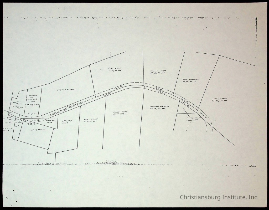
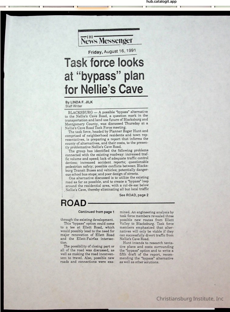
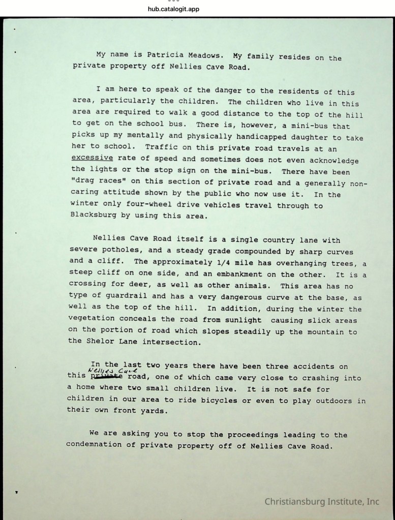
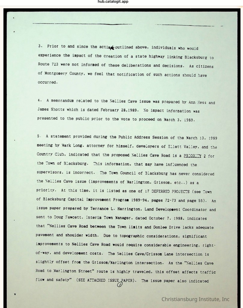
Nellie’s Cave Community: The Demise of a Historic Black Neighborhood

https://hub.catalogit.app/8896/folder/entry/98929bc0-ef3a-11ed-a57e-bf9a788efd8b

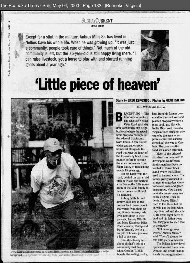
Southeast of the Town of Blacksburg, on the eastern side of the Allegheny Mountains, a community of African American families took root in the early 20th century when the Mills family purchased 40 acres from the Hoge family. For generations, these families farmed the land, raised children, and built their lives in this secluded karst landscape. The unpaved lane that served them was not called Nellie’s Cave Road until the 1980s, when Montgomery County officially named it. Before then, the residents knew it simply as Grissom Lane. The old farm road began at the Slusher family’s farm—located at the southeast corner of South Main Street and Country Club Drive—and ended where the terrain became too steep for a wagon to pass.

More to be posted …

Frederick Douglass and the Meaning of Independence

On July 5, 1852, Frederick Douglass delivered his powerful speech, “What to the Slave Is the Fourth of July?” to the Rochester Ladies’ Anti-Slavery Society at Corinthian Hall in Rochester, New York. In it, he confronted the meaning of Independence Day from the perspective of those still enslaved, asking what freedom could mean in a nation that denied it to millions.

On July 5, 1852, Frederick Douglass delivered his powerful speech, “What to the Slave Is the Fourth of July?” to the Rochester Ladies’ Anti-Slavery Society at Corinthian Hall in Rochester, New York. In it, he confronted the meaning of Independence Day from the perspective of those still enslaved, asking what freedom could mean in a nation that denied it to millions.

The copies of both the full version and excerpts are available.

Excerpt Versions

Full Versions

Audio Versions

Context and Biographical Information

Back Story Radio – excellent production and provides insightful context to the time and place.

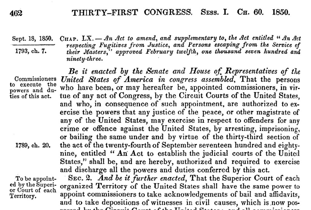
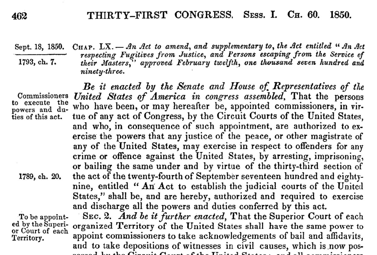
The Compromise of 1850 included the Fugitive Slave Act, a federal law signed just two years before Mr. Douglass’s 1852 speech. As historian Eric Foner has noted, this act demonstrates that pro-slavery states were willing to abandon their usual defense of states’ rights when it came to protecting the institution of chattel slavery. Eric Foner on the Fugitive Slave Act.

The U.S. Statutes at Large, Volume 9 (1845-1847), 29th through 31st Congress.

EdSiteMent , National Endowment for the Humanities, provides information, context and lesson plans.

Library of Congress, papers and documents of Frederick Douglass

Original Biographies that are available online

Timeline of Mr Douglass’ life, presented by the Library of Congress. Brief Summary Based on the Library of Congress

Frederick Douglass married Anna Murray in 1838. Together, they had five children: Rosetta (1839), Lewis Henry (1840), Frederick Jr. (dates vary, likely born around 1842–1843), Charles Remond (1844), and Annie (1849). The family moved to Rochester, New York in 1847, where Douglass continued his abolitionist work.

In 1859, following the failed John Brown raid, Douglass fled briefly to Canada to avoid arrest, returning in 1860—the same year his daughter Annie died. That year, Abraham Lincoln was elected president, and South Carolina became the first state to secede from the Union.

During the Civil War, slavery was abolished in Washington, D.C. in 1862, and the Emancipation Proclamation took effect in 1863, freeing enslaved people in Confederate states. That year, Douglass met with President Lincoln to advocate for Black soldiers and equal treatment.

On April 9, 1865, General Lee surrendered to Grant, effectively ending the Civil War. Lincoln was assassinated five days later. The 13th Amendment, abolishing slavery, was ratified later that year.

Douglass remained active during Reconstruction, fighting for civil rights and women’s suffrage. In 1870, the 15th Amendment guaranteed the right to vote regardless of race. That same year, after a suspicious fire at their Rochester home, the Douglass family moved to Washington, D.C., where Douglass was nominated for vice president by the Equal Rights Party, alongside presidential candidate Victoria Woodhull.

In 1874, Douglass became president of the Freedmen’s Savings Bank in a final effort to save the institution, which was failing and held the savings of many newly freed people. In 1875, Congress passed a Civil Rights Act to combat public discrimination, but in 1883 the U.S. Supreme Court rules the act was unconstitutional.

By 1877, Douglass had been appointed U.S. Marshal for the District of Columbia and later purchased a home in Anacostia (now Cedar Hill). Anna Murray Douglass, his wife of 43 years, died in 1881. He married Helen Pitts in 1884.

From 1889 to 1891, Douglass served as U.S. minister to Haiti and chargé d’affaires to Santo Domingo. He died unexpectedly in 1895.

Quotes From “What To A Slave Is the Fourth of July?”

Now, take the Constitution according to its plain reading, and I defy the presentation of a single proslavery clause in it.  On the other hand it will be found to contain principles and purposes, entirely hostile to the existence of slavery. . . . 

Great streams are not easily turned from channels, worn deep in the course of ages. They may sometimes rise in quiet and stately majesty, and inundate the land, refreshing and fertilizing the earth with their mysterious properties. They may also rise in wrath and fury, and bear away, on their angry waves, the accumulated wealth of years of toil and hardship. They, however, gradually flow back to the same old channel, and flow on as serenely as ever. But, while the river may not be turned aside, it may dry up, and leave nothing behind but the withered branch, and the unsightly rock, to howl in the abyss—sweeping wind, the sad tale of departed glory. As with rivers so with nations.

The Merry Tree

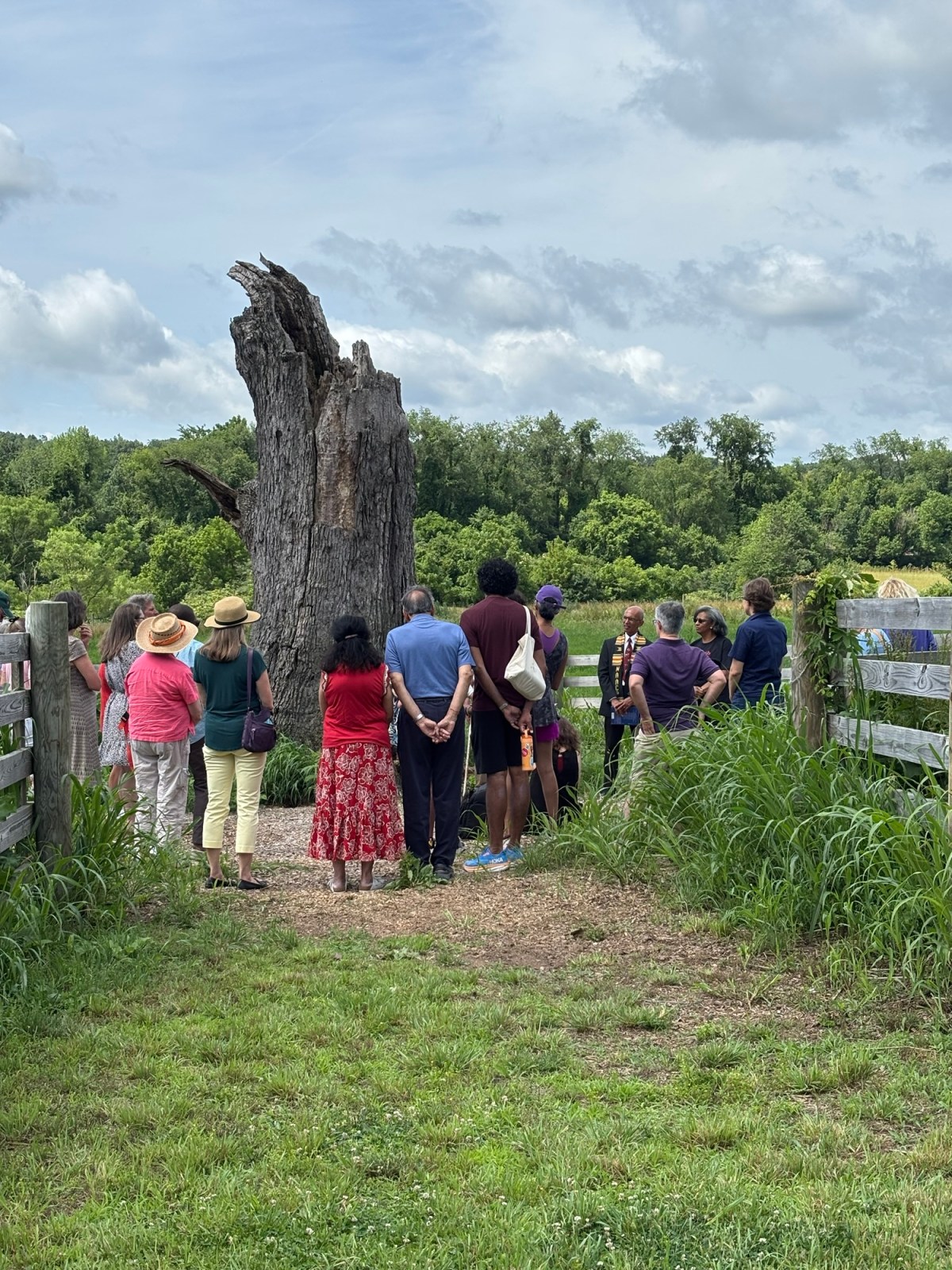
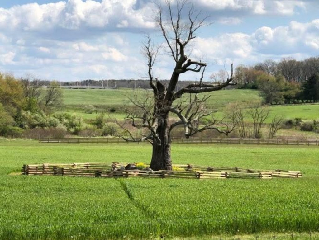
The Merry Tree, now a broken and weathered stump southeast of the Preston home, once stood as a silent witness to over a century of enslavement. It remains a sacred place where descendants return to honor their ancestors. We are gathering stories, photos, and memories connected to this tree. Let’s preserve its powerful legacy.

Help Us Tell the Story of the Merry Tree

For over a century, the Merry Tree stood as a silent witness to the lives of the 226 people enslaved by the Preston family at Smithfield, Blacksburg, Virginia. Planted near the time the Prestons built their home, this tree bore witness to generations of forced labor, family separation, resistance, and endurance. Though now reduced to a broken and weathered stump, the Merry Tree remains a place of deep meaning—especially for the descendants of those once enslaved, who return here to remember, honor, and reflect.

We are seeking to gather as much information, memory, and meaning as possible about this special tree. Did your family speak of it? Do you have photos, stories, or oral history connected to the Merry Tree? Whether you are a descendant, community member, or researcher, your voice matters in helping us preserve and understand the role this sacred place played in Black history in Montgomery County.

Please share what you know. Together, we can ensure the story of the Merry Tree—and those who stood beneath it—is never forgotten.

#MerryTree #BlackHistory #SmithfieldVoices #CommunityMemory #TruthTelling

https://themerrytree.vt.domains

https://news.vt.edu/articles/2022/03/unirel-merryoak.html

https://youtu.be/MRtNTU6f5Ao?si=M82B2-3mk2GNea19

https://fb.watch/Al2YW58dry/?fs=e

https://fb.watch/Al2_CTJG-s/?fs=e

https://news.vt.edu/videos/k/2024/08/1_tznvjyyu.html

https://www.wfxrtv.com/news/local-news/new-river-valley-local-news/merry-oak-tree-brings-dozens-together-to-remember-enslaved-families/

https://historicsmithfield.wordpress.com/2017/02/28/merry-oak/?fbclid=IwQ0xDSwLCMlZleHRuA2FlbQIxMQABHv0vjeN0Bf21sot8c_kdCGs34nl7HL1kqw3D79M5olBaYuk-obb_VAJ2ggBQ_aem_hTV02h4a8q1x_cCGxX_nBA

https://montcova.com/2024/08/02/historic-smithfield-dedicates-merry-oak-bench/

https://www.wvtf.org/news/2025-06-19/juneteenth-event-honors-226-people-who-were-enslaved-at-smithfield-plantation

https://virginiahumanities.org/events/2022/03/1872-forward-vt/

https://virginiahumanities.org/2022/08/more-than-a-fraction-the-power-of-the-merry-tree/

https://morethanafraction.com/uploads/1/3/2/3/132308734/drkmoseleyhobbs_cp.pdf

Witness Tree – Sycamore Guarding the Spring

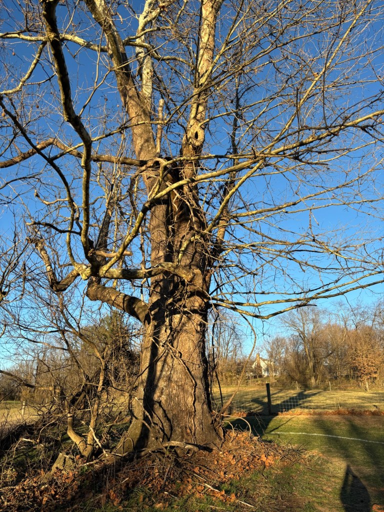
This enormous sycamore stands just east of the spring that once provided potable water for the people living on the Smithfield property. The spring lies a considerable distance from the house and closer to the old Merry Oak. One can only imagine the countless gallons of water enslaved people carried from that spring to the white house on the knoll over nearly a century. Like the Merry Tree, this sycamore may have held significance for the men, women, and children forced to labor here—its presence a silent witness to their daily lives.

Crayon Enlargement Portraits – Lost Faces

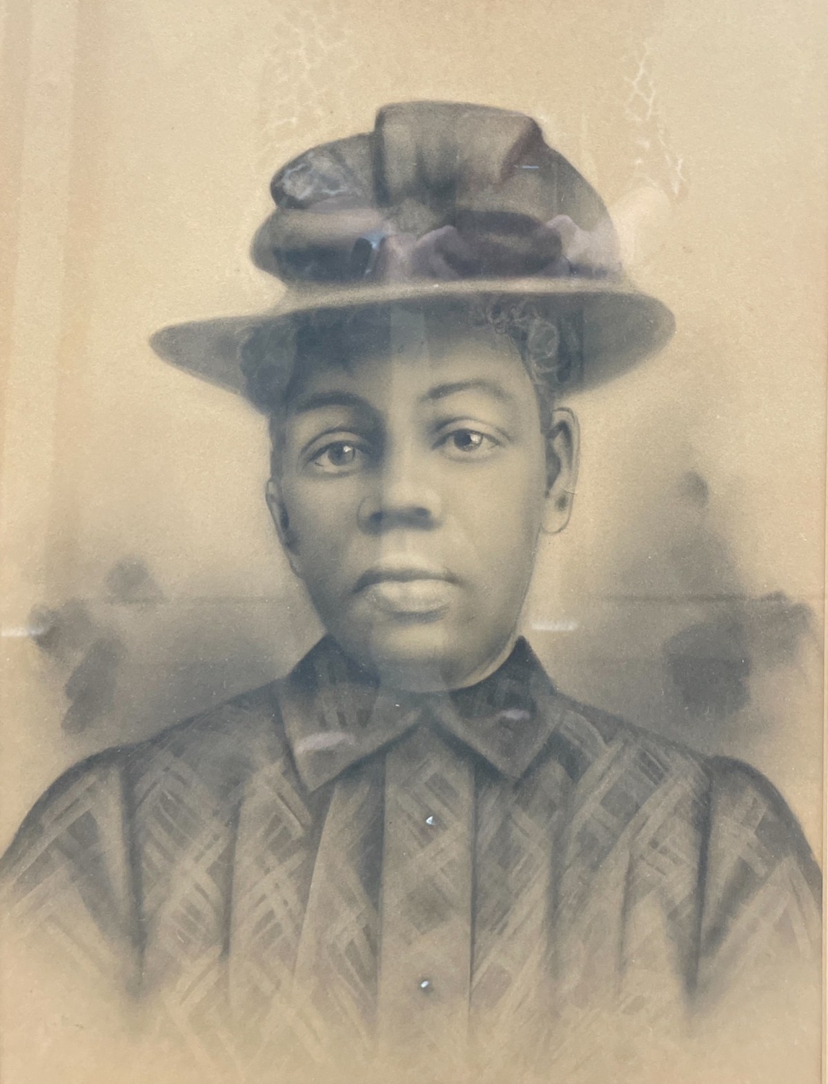
Crayon Enlargement Portraits were popular between the late 1890s and early 1900s. They provided an affordable way to capture and display large-format portraits, offering an alternative to the more expensive painted portraits of the time.

Crayon Enlargement Portraits were popular between the late 1890s and early 1900s. They provided an affordable way to capture and display large-format portraits, offering an alternative to the more expensive painted portraits of the time. The process involved taking a negative made by a local photographer and sending it to a specialist who used a solar enlarger to expose the image onto specially processed salted photographic paper. Because the enlargement process often emphasized imperfections on the negative plate, an artist would enhance the black-and-white print with pencil and crayon media, sometimes adding color.

The unidentified African American portraits featured on this website have been donated to local museums or found in antique shops. They are presented here in the hope of eventually identifying the individuals and preserving their stories.

Portrait of an unknown man (Courtesy of Montgomery Museum of Art and History)
Portrait of an unknown man, found in a New Town house, Blacksburg, Va (Courtesy of Montgomery Museum of Art and History)
Portrait of an unknown woman (Courtesy of Montgomery Museum of Art and History)
Portrait of an unknown man (Courtesy of Christiansburg Institute, Inc)

Resources

Genealogy of Slavery – Center for Studying Stricture of Race – Roanoke College

This website serves as an important resource for understanding the history and legacy of slavery in our region. It contains information collected from Roanoke County sources about more than 4,000 enslaved individuals.

https://www.roanoke.edu/a-z/center_for_studying_structures_of_race/projects_x71825

Genealogy of Slavery – Center for Studying Stricture of Race – Roanoke College

This website serves as an important resource for understanding the history and legacy of slavery in our region. It contains information collected from Roanoke County sources about more than 4,000 enslaved individuals. Many of the family names of enslaved African Americans recorded here also appear in neighboring Montgomery County, making this work deeply relevant to our local history. In addition, the family names of many individuals who enslaved others are found in the Roanoke primary sources.

The purpose of this page is to document and connect these shared names, with the hope of bringing to light the lives of those too often lost to history and deepening our understanding of the enduring legacy of slavery in Montgomery County and beyond.

More names will be added with time.

Family Names of Enslaved African Americans in Montgomery County

Brown

  • William Brown – enslaved by William Watts. “In IAS Book 4, the partition of the lands and other property of Edward Watts, William Brown is listed among the enslaved individuals that were bequeathed to Edward Watts’s daughter, Alice W. Morris. A value of $1,700.00 was placed on William Brown.”; Inventory, Appraisements, and Sales Book 4, Roanoke County Archives.

Calloway

Campbell

  • George Campbell – “George Campbell was listed in an indenture agreement: “…bind unto the said Lewis Zirkle a boy of colour named George Campbell until he arrives to the free age of twenty one which will be on the 25th day of June 1854.”
    In the Common Law book, it was ordered that the Overseers of the Poor bind out George, “a boy of color,” to Lewis Zinkle.”;
    Common Law Orders – A – May 1838 – May 1840, Roanoke County Archives.

Saunders/Sanders

Family Names of Enslavers in Montgomery County

Evans

  • Elizabeth Evans (List of first names of people they enslaved), “Elizabeth was listed in Michael Shepard’s property appraisement as having purchased enslaved people after Michael’s death. In the record, Elizabeth purchase” the enslaved people Joe, Nancy, and an unrecorded named child for $675.00.” She was possible daughter of Jonathan Evans. “Elizabeth’s son was William Evans and her husband was William W. Evans.”; Common Law Orders – B – June 1840 – July 1843, Roanoke County Archives

Kent

Kyle

Oliver

Wyatts

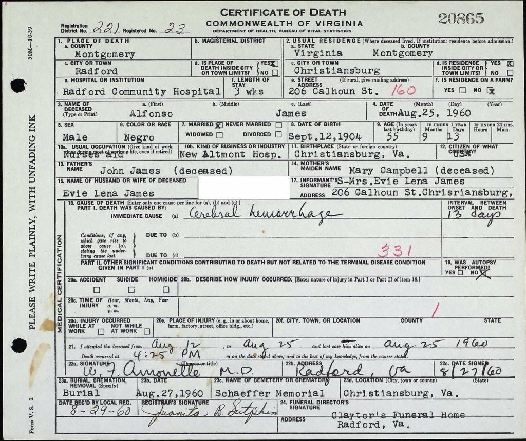
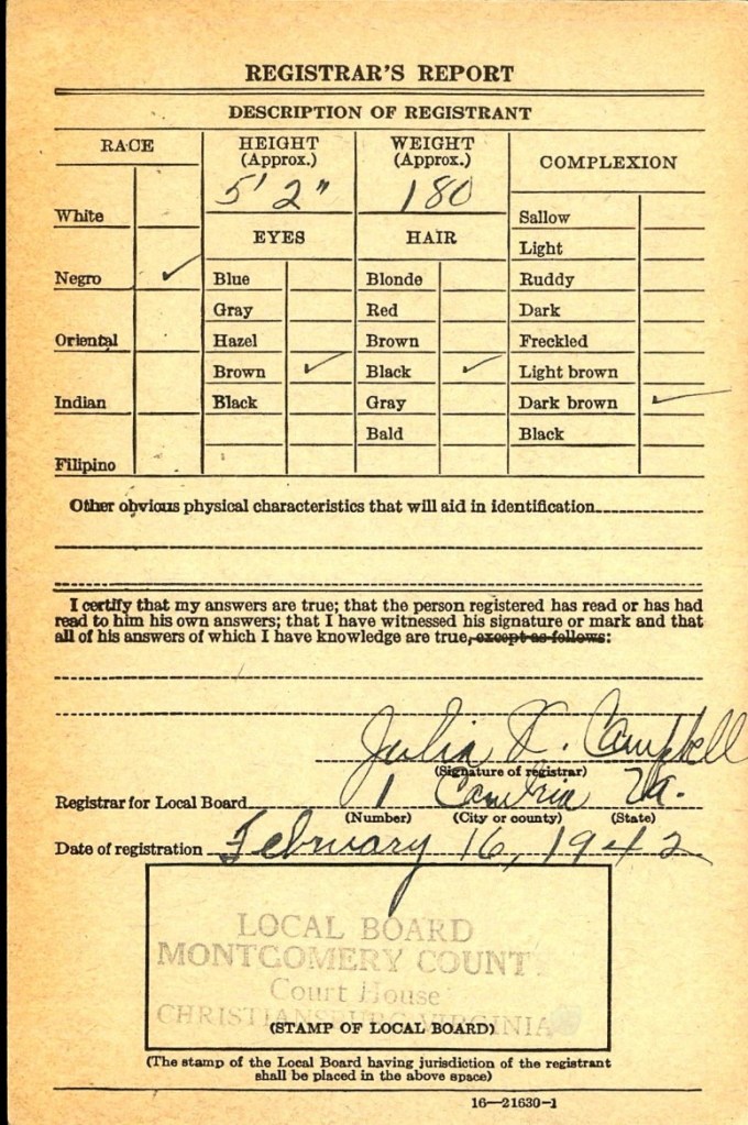
Alfonzo James: A Life Dedicated to Education and Community Service

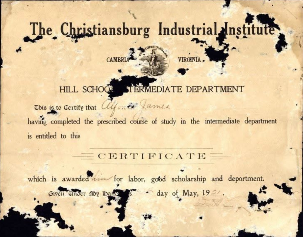
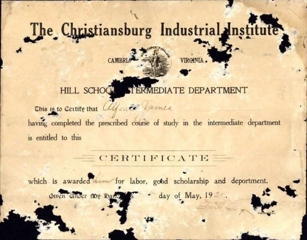
Alfonzo James, born in 1904, was the eldest of three children to John and Mary Campbell James. He graduated from the Hill School in Christiansburg in May 1921.

His father, John James, was born in Pennsylvania and, according to the 1900 U.S. Census, lived as a boarder with Principal Charles L. Marshall of the Christiansburg Institute at the age of 15. This household also included Edgar A. Long, his wife and daughter, Louis Brown (16 years old), and William Gray, a teacher.

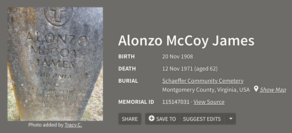
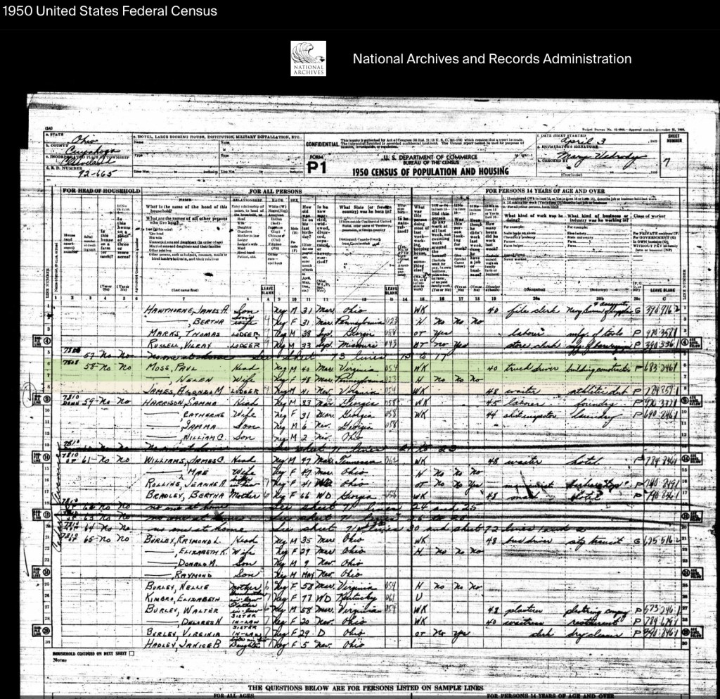
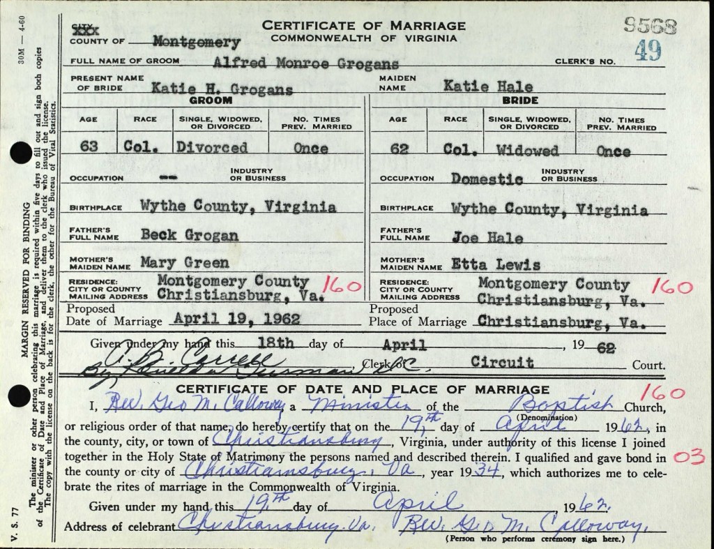
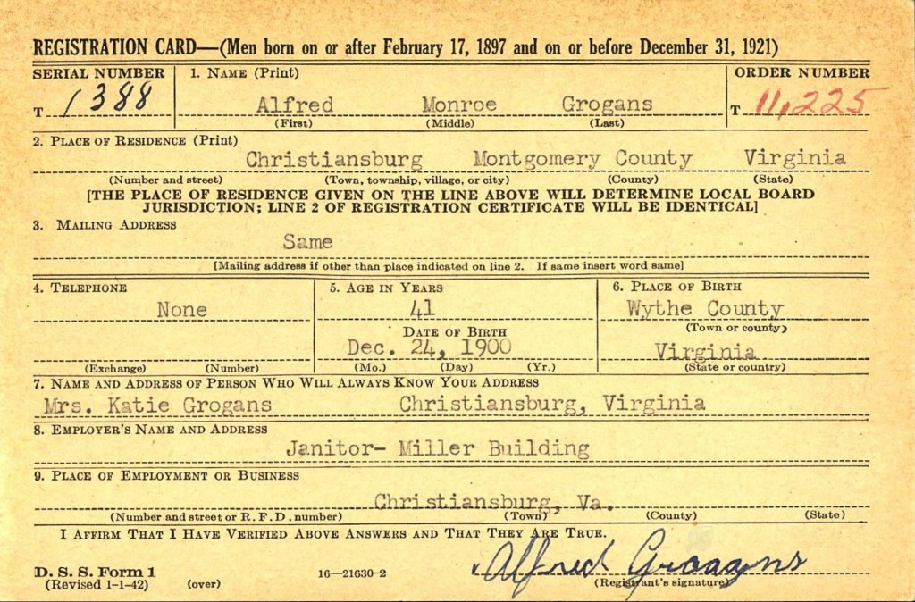
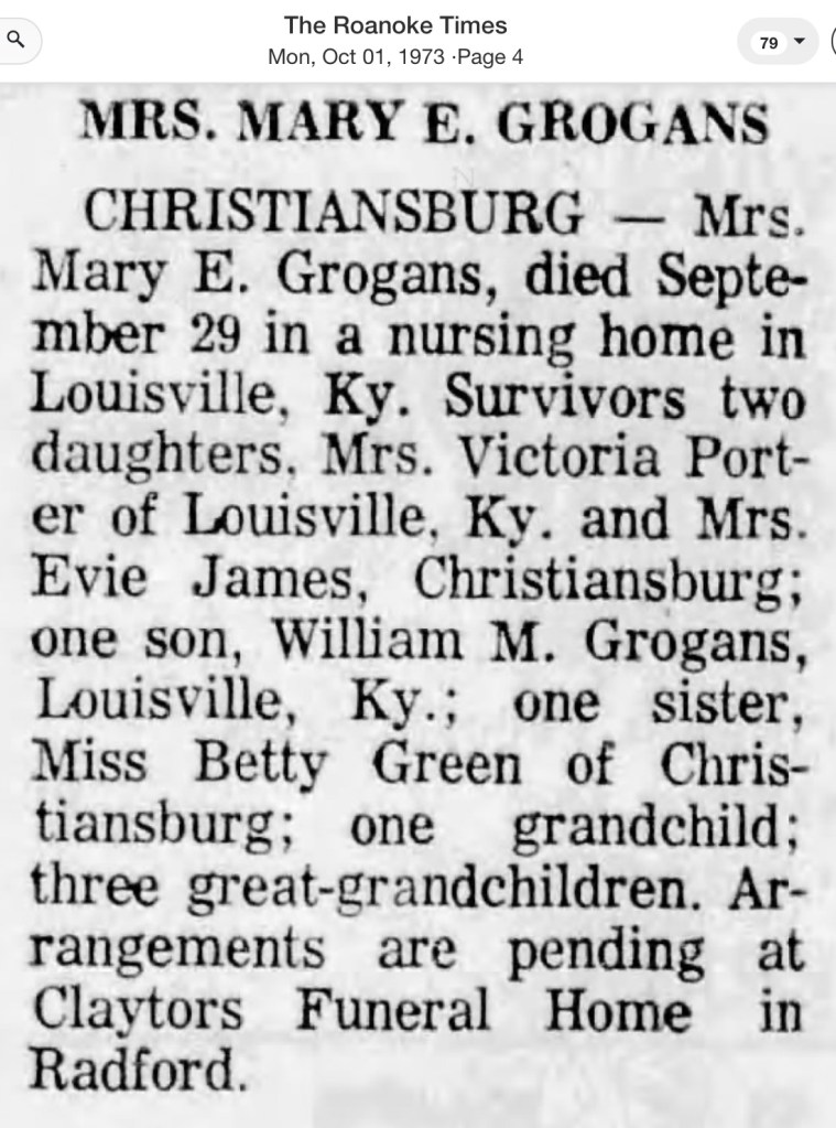
In the 1930 census, Alfonzo was recorded as a public school teacher. Over the years, he held various roles at the New Altamont Hospital in Christiansburg, working as a waiter and eventually as a nurse’s aide by the time of his passing in 1960. In 1946, he married Evie Lena Grogans. He was survived by his two brothers, Robert M. James and Alonzo McCoy James. Evie Grogans James passed away in 1977 and was a valued baker, recognized as Employee of the Month at Radford College.

Alfonzo’s diploma stands as a testament to his commitment to education and service. Preserving this certificate would honor his legacy and ensure that his contributions to the community are remembered.

Courtesy of Christiansburg Institute Digital Archive

Maggie Lena Walker & Beatrice Freeman Walker

Beatrice Freeman Walker (Interview, courtesy of Virginia Tech University Libraries)

On December 17, 2013, Ms Beatrice Walker provided an oral history for Virginia Tech’s University Special Collections, recorded at the St. Luke, Odd Fellows, and Household of Ruth Hall. Beatrice played a pivotal role in saving the building and is listed as a Trustee on the deed now held by the Town of Blacksburg.

Her interview offers critical insights not found in written records, shedding light on the significant but under-documented role of Maggie Lena Walker’s Independent Order of St. Luke within the African American community of Blacksburg. It also addresses the erasure of the New Town neighborhood driven by corporate greed and the persistence of institutional racism in 21st-century Blacksburg.

Beatrice shared that Mrs. Walker’s mother, Bessie Briggs Freeman, was an active scout for the St. Luke Council, traveling to Richmond and other communities to recruit new members. It is compelling to imagine Bessie collecting, transporting, and depositing membership dues into the St. Luke Penny Bank in Richmond, further linking the local Council to the broader financial and social empowerment network, especially for women, envisioned by Maggie Lena Walker.

Topics per Timestamp (approximate time and the information within brackets are for context and clarification, not provided by the interviewee)

  • 00:00 – Introducing Beatrice Freeman Walker: She was born in the region, possibly at Burrell Memorial Hospital in Roanoke. She noted that while Black patients could be treated at Showalter Hospital in Christiansburg, they were not allowed to stay overnight.

    Beatrice grew up with her parents at 202 Jackson Street in a neighborhood known as Jackson. In this area, African American families lived on one side of the street, with their homes facing Jackson Street, while White families lived on the opposite side, facing Penn Street. Black residents also lived on nearby streets, including Bennett, Roanoke, Clay, and Wharton. That was different from New Town which was a totally segregated Black neighborhood on both sides of the street.
  • 1:45 – The interviewer asked Mrs. Walker how her family came to settle in Blacksburg. She explained that her father [Alonzo Walker, Sr.]was originally from Statesville, North Carolina, but she was unsure of what brought him to Blacksburg. Mrs. Walker mentioned that she believed Black residents were allowed to live on Jackson Street beginning around 1867.
  • 1:52 – When asked how her family came to live in Blacksburg, Mrs. Walker explained that her father, Alonzo Freeman Sr., was born in Statesville, North Carolina. He eventually settled in Jacksonville in 1867, establishing roots that led to the family’s connection with the area.
  • 3:16 – As noted earlier in the interview, the Jackson and Bennett Street neighborhood was segregated. Mrs. Walker explained that while Black families faced Jackson Street, white families generally faced Penn Street. [he Siebold family had a Jackson Street address but, like the Effinger and Sites families, their homes faced Penn Street.]
    In addition to Jackson Street, Black residents also lived on Wharton, Clay, Roanoke, and Lee Streets. While Black and white children often played together, tensions typically arose among the parents.
  • 5:40 – Children were expected to contribute to their family by helping with chores for their parents and grandparents. Mrs. Walker’s father operated a cleaning business, while her mother, [Bessie Briggs Freeman] worked in private homes, including for Rev. Richardson of the white Episcopal Church located at the corner of Church and Jackson Streets, and for the Red Cross. When a Black parent passed away, her mother coordinated with the Red Cross to bring their soldier child home for the funeral. She also worked for Jim Devine at VPI and was responsible for preparing communion at the Christian and Episcopal Church. [Major General John M. Devine, ret. became Commandant of Cadets in 1952]
  • 7:14 – Bessie B. Freeman played a significant role in the Independent Order of St. Luke [specifically with St. Frances Council #235 of Blacksburg] by traveling throughout the region to recruit members for the organization. She journeyed with members from other St. Luke Councils in places like Richmond, South Boston, and Roanoke, who joined her in Blacksburg for these vital recruitment efforts. Mrs. Walker believed her mother and her companions traveled by car.

    Mrs. Walker explained that the St. Luke organization was founded by Mary Prout of Baltimore, Maryland, to assist newly freed individuals who were often left to die on roadways or faced significant challenges in securing basic necessities. [The organization provided critical support such as food, clothing, jobs, and life-and-death assistance.]

    Mrs. Walker discovered documents belonging to her mother related to St. Luke’s work and gave them to Terry Nichols [Blacksburg Museum].
  • 11:15 – She noted, “Most of the people in Blacksburg were St. Luke’s, not Odd Fellows, and that’s why the hall was built.” The St. Luke Council included both men and women, and their meetings were held upstairs in what was considered a sacred space. She also mentioned that the Masons and Eastern Star shared the use of the hall.
  • 12:14 – Downstairs, the hall hosted various events to raise funds, including dances, bingo parties, sock hops, weenie roasts, and even “man-only” weddings (held at both the hall and the church). Dinners were also organized to pay for building fund and support members traveling to Convocation in North Carolina or Union meetings in Richmond.
  • 14:18 – Mrs. Walker explained that, due to the small African American population in this rural area, the two churches in town—the AME and Baptist churches—collaborated on events such as picnics. Her mother was a member of the First Baptist Church on Clay Street, while her father belonged to St. Paul AME Church on Penn Street. The Baptist church held its services in the evening, while the AME church held morning services, allowing them to attend services at both churches.
  • 15:05 – The churches organized picnics at parks in places like Staunton, Natural Bridge, Mill Mountain Star, and Wytheville. On one occasion, their minister, Rev. Archibald Richmond, was arrested during a picnic at the Virginia State Park in Wytheville. The group was asked to move to the Black section of the park, but they refused. As a result, Rev. Richmond was arrested. He was released later the same day by members of the church.
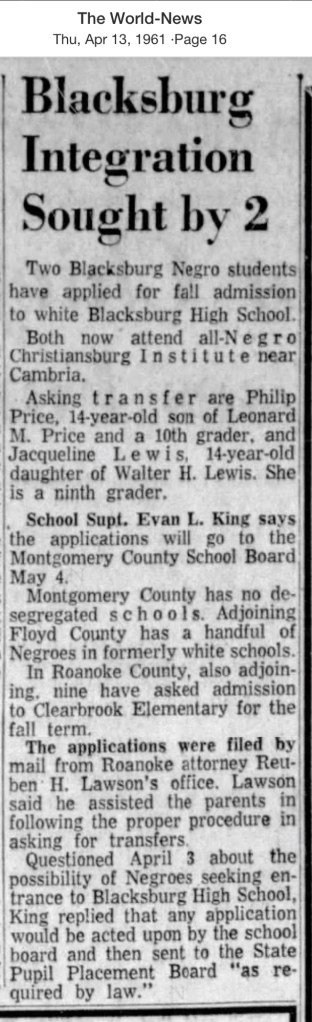
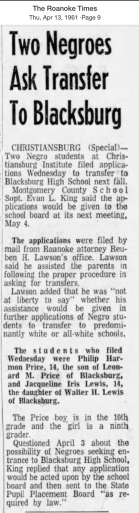
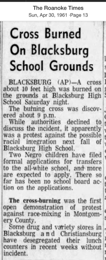
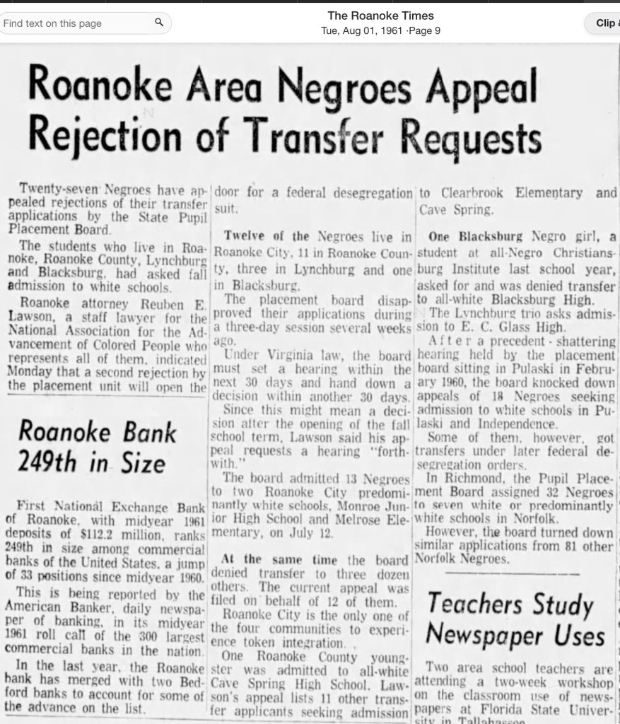
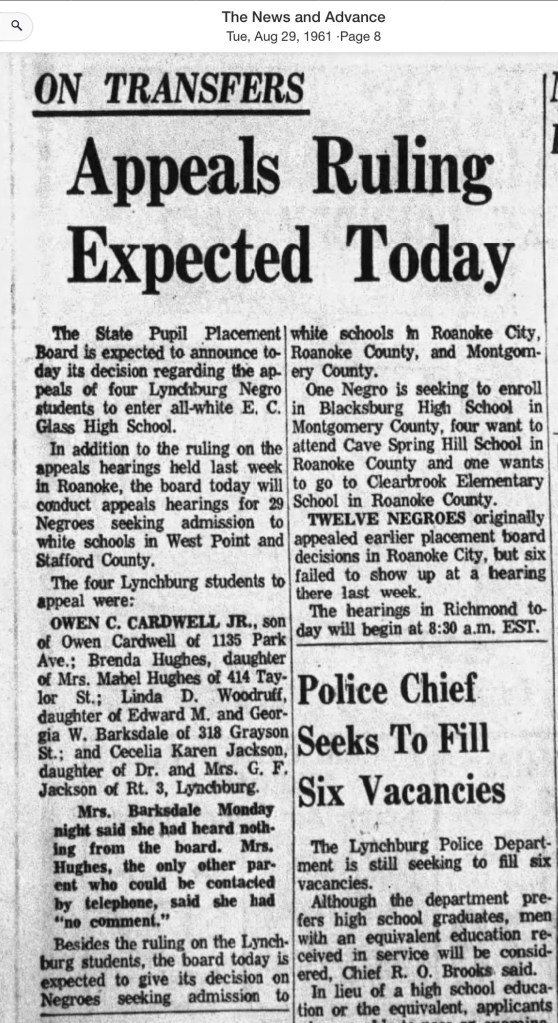
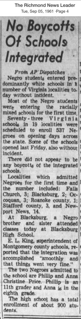
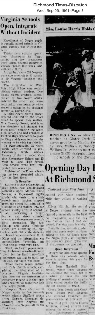
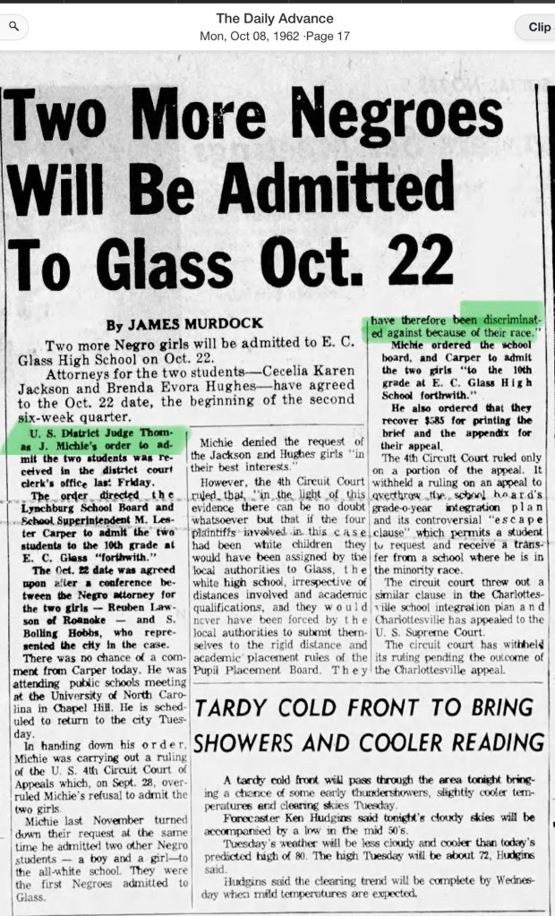
  • 17:15 – Another story of resistance involved a bus station sit-in led by Rev. Richmond. At the time, Black people were required to buy their bus tickets at the back door and were not allowed to wait or eat in the station. Rev. Richmond helped lead a sit-in to challenge this discriminatory practice. He also played a key role in integrating the schools. [In Montgomery County, Black children weren’t outright barred from attending high school, but each child had to apply to the school board for permission, often accompanied by a public petition. The bus station was where the Hokie House Bar and Restaurant is now located.]
  • 18:35 – Rev. Archie Richmond the leader of the St Paul AME and Rev. Ellison Smyth of the Blacksburg Presbyterian Church were both members of the NAACP in the area. They worked together to challenge local systemic racism, particularly in relation to the segregation of schools and public spaces.
  • 19:26 – Mrs Walker was a member of the St Paul AME church.
  • 19:45 – “The story of St. Luke’s hasn’t been told enough. All you hear about is the Odd Fellows, but you don’t hear anything about St. Luke’s… that’s the part that’s so interesting, St. Luke’s, because they were the ones who had the insurance.” Mrs. Walker also mentioned, “Maggie L. Walker is the one who created all kinds of opportunities for Black people to learn different trades and jobs.”

    Mrs. Walker’s sister, Nannie Bell Walker Snell, attended Bluefield State College for two years but didn’t enjoy it. Instead, she went on to attend Apex Cosmetology School in Richmond, which was part of St. Luke’s initiative to provide job training for women.
  • 21:45 – Maggie Lena Walker’s vision was, “A penny makes a dollar.” She became the first Black woman to serve as president of a bank. Members of St. Luke’s were required to contribute a minimum of 10 cents. The bank allowed individuals to borrow money to fund their children’s education and also offered life insurance.

    “It’s so interesting, but nobody knows about it because it hasn’t been told—like it should be told.”

    Mrs. Walker’s mother worked alongside Mr. Carrington from South Boston, who visited the area. Dorothy Turner became the Secretary after Maggie Walker’s death, and Ruth Hilton of Roanoke was also involved. She was busy. [*see information below about these people]
  • 26:49 – When reflecting on Blacksburg, Mrs. Walker expressed strong feelings about the town’s history. In 1998, the town’s branding was “Blacksburg: A Special Place for 200 Years,” but Mrs. Walker disagreed, stating, “It is not a special place, it is a greedy place.” She continued, “They just took the land from the Blacks. After one Black would leave, Whites take over and would have apartments the next year.”
  • 27:36 – “Just like my property was taken when my parents died. Fire department decided they wanted that land and sell or condemn.”
    Mrs. Walker explained that her family’s property stretched from Jackson Street to the creek, which made it highly sought after by the town. However, the family was unfairly treated during the sale, especially when they were offered a much lower price than the property’s true value.
  • 29:20 – The brick house next to the Freemans’ home [Sears family] was moved to Roanoke Street because the family also faced the same treatment.
  • 30.00 – Her father owned many pieces of property including Roanoke and a large tract of land known as Paradise View, which stretched from what is now Nellie’s Cave Road (formerly called Grissom Lane) to the area west of Woodland Hills subdivision. It served as a weekend retreat for Black families, offering space to play croquet and badminton, enjoy picnics, and relax. A house on the property was home to a white couple who maintained the grounds and assisted the weekend guests.

    She described the beauty of the area, remarking on the abundance of flowering trees throughout the town and the plentiful fruit, including the distinctive Green Gage plums.
  • 35:00 – Mrs. Walker recalled how segregation did not bother her, though shopkeepers would follow her whenever she entered a white-owned store, reflecting the racial challenges she faced. She worked for Mr. Kidd at Spudnuts Donut Shop, located next to the Lyric Theatre, which later became Carol Lee Donuts. If a white teenage girl spoke with a Black boy, the parents sent their daughter to St Albans, a mental health hospital. Shifting to descriptions of life at the time, she noted that most homes had large gardens, often with chickens and even a cow.

    After her father, Alonzo Sr., closed his cleaning business, he went to work for John Warren, the owner of Sanderson’s Cleaners on South Main Street. She mentioned that her father kept a shop ledger, which Lonnie might still have. In his business, he cleaned suits for $2, repaired clothing, and even sold suits that he purchased in Gainsborough.

    Mrs. Walker also remembered the skating rink on Airport Road, located next to a seafood restaurant, where dances were regularly held. On Barger Street, there were several Black-owned businesses, including Kip’s Shoe Repair Shop. Kip also owned another shop on the southwest corner of Jackson and Church streets. A Black owned clothes cleaners was located near the VPI cadet dorms.
  • 45:46 – “Hard to believe that Blacksburg has changed so much,” Mrs. Walker reflected, recalling many landmarks from the 1950s and 60s and comparing them to what she saw in 2013. She mentioned several notable places, including Dr. Roop’s house at the northeast corner of Jackson and Main Streets, Faculty Row, and the houses along North Main Street. She also remembered Mr. Sears’ barber shop, which was located to the right of the Lyric Theatre and later became Carol Lee Donuts. Other landmarks included Kip Wade’s shoe repair shop on Jackson Street, and Lewis [?] who ran a cleaners on the south side of East Roanoke Street near Woolwine.

    Families from that same neighborhood included the Pages, Warrens, Carrolls, Saunders, Colemans, and the Taylors from West Virginia, along with Chip Price, who provided taxi service. She also recalled the Clay Street dance hall, the Moon Glow, and Laura Anderson, who was 106 years old in 1976 and the oldest person in the county at that time.
  • 55:32 – In this part of the interview, Mrs. Walker recounted how the building was saved when someone brought the Town engineers’ condemnation notice to the public’s attention, sparking community action to preserve the structure. Christine Price, Ethyl Dobyns, and Mrs. Walker were all involved in the effort.
  • 1:00:43 – The hall has always been in use and never left unattended. Mr. Price, a local contractor, stored lumber in the hall, and later a woodworker converted the space into a workshop. In exchange for maintaining the building, these men were allowed to utilize it rent-free. However, when Mr. Price was overseeing the building, Mrs. Dobyns discovered that the original framed charter, pictures, chairs, and documents were scattered on the second floor, and several items, including one of the podiums, were missing.
  • 1:05:38 – The interviewer asked if desegregation brought any changes to the St. Luke and Odd Fellows organizations in Blacksburg. Mrs. Walker was emphatic in her response, stating that there was no change to the organization, implying that racial attitudes had not shifted. She noted that some of the Museum’s pamphlet was problematic.
  • 1:10:13 – Mr. Floyd Hobeson Meade trained a turkey to gobble every time the VPI football team scored a goal. Mrs. Walker mentioned his death in 1941 after he was struck by a car on Airport Road. Tragically, he died because the local hospital refused to treat Black patients, forcing Meade to be transported to Jefferson Hospital, which delayed his care and put him in greater peril.
  • 1:15:34 – The discussion turned to the segregation of the local theater, the Lyric. Mrs. Walker described how Black patrons were required to use a separate entrance that led to a designated balcony, highlighting the racial divisions that were enforced even in entertainment spaces.
  • 1:20:00 – Mrs. Walker was the youngest of four siblings, one of two girls alongside three brothers. Two of her siblings, Alonzo and Nannie Bell, attended the segregated Lucy Addison High School in Roanoke. Each Sunday afternoon, the family would visit their aunt in Roanoke, where Alonzo and Nannie Bell stayed during the school week. They returned home on Fridays to spend the weekend with the family. Alonzo became the principal of the Clay Street grade school.
  • 1:21:44 – Beatrice Freeman, Mrs. Walker’s mother, operated an ice cream parlor in a shop attached to their home, located just north of the house near the stream. Later, this shop was repurposed as a beauty salon run by Nannie Bell, Mrs. Walker’s older sister. Nannie Bell had trained at the renowned Apex Beauty School in Richmond.
  • 1:23:14 – Mrs. Walker attended the segregated Clay Street Grade School and was surprised to learn that the Blacksburg Museum was unaware of its history. She recalled how parents had to raise funds to purchase a heating furnace, as the local public school board failed to provide one—a basic necessity one might expect from a public institution. The school consisted of two rooms divided by a sliding door, allowing the space to accommodate both lower and upper grades. Two teachers taught the students, and a small kitchen was located at the back of the building.
  • 1:27:00 – The St. Luke regalia included a distinctive hat that newly initiated members were required to purchase within 90 days of joining.
  • 1:28:02 – Christiansburg Institute welcomed students from as far away as New York, Philadelphia, and Martinsville. However, Mrs. Walker and her siblings attended as day students, commuting daily by taxi.
  • 1:33:50 – Mrs Walker’s brother, Alonzo attended Bluefield State.
  • 1:36:10 – In 1943, during her senior year at Christiansburg Institute in Cambria—a regional African American high school serving Montgomery County, Radford, Pulaski, and Giles, with both boarding and day students—Mrs. Walker took the U.S. Civil Service exam. Upon passing, she accepted a job in Washington, D.C. in 1945. Her older sister, Nannie Bell, also worked in Washington as a coder. Prior to this, Mrs. Walker had attended business school in Roanoke after attending West Virginia State for a short time.
  • 1:41:57 – Nettie Anderson, daughter of Laura Anderson, was principal at the Clay Street grade school for African Americans.
  • 1:46:04 – Irving Peddrew III boarding with William and Jannie Hoge, Town racism.
  • 1:50:34 – Mrs. Walker explained why many children of Black families left the area in search of quality employment opportunities, noting that local jobs were often preferentially given to family members. She mentioned knowing Charlie L. Yates at VPI and described the various jobs she held in Blacksburg. Among these was her connection to the Tutwiler Hotel and Boarding House. Mrs. Walker’s children included Leo, William, and Delores.
  • 1:52:22 – The interviewer asked Mrs. Walker if she was familiar with the Montgomery and Pulaski Education Welfare Association, a Black organization active in 1948 that registered Black voters, including Warren Carroll. Mrs. Walker acknowledged that she was aware of the organization but was not personally involved.
  • 1:54:00 – The topic of Friendship Gardens, promoted by the local Black Garden Club, was discussed. Mrs. Walker was familiar with the initiative but did not participate.
  • 1:58:11 – The conversation shifted to the election of President Obama and the racism that surfaced across the nation during this historic event.
  • For the remainder of the recording, the interviewer asked Mrs. Walker if there was anything else she wanted to add. She expressed her concern that the history of St. Luke was excluded from the narrative presented by the Museum committee, which unsettled her. Over time, St. Luke was incorporated into the name of the hall alongside the Odd Fellows, but only after Mrs. Walker pushed back against Terry Nichols. She stressed that St. Luke was vital to the local African American community, so much so that its members performed ceremonial rites at funerals for their fellow members.

Notes of Context

In the interview Mrs Walker mentions three people who worked with her mother (time stamp 21:45). Mr J.S. Carrington is mentioned in the National Park Service Finding Aid, page 32, Series III: Insurance, subseries A: Deputy Commissions and Assignments, Box 04, for 1943, 1948, 1950. He was also listed on page 39, Box 07, Folder 34 under death claim investigations, 1956.

Dorothy V. Turner is mentioned on the same page, 1966.

National Park Service Finding Aid for the Right Worthy Grand Council, Independent Order of St Luke Records

Learn more about the St Frances #235 Council of Blacksburg, Virginia

Learn more about the Freeman Family