Small Business Owners, Educators and Inventors.
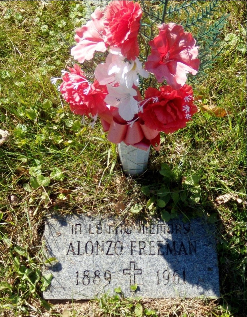
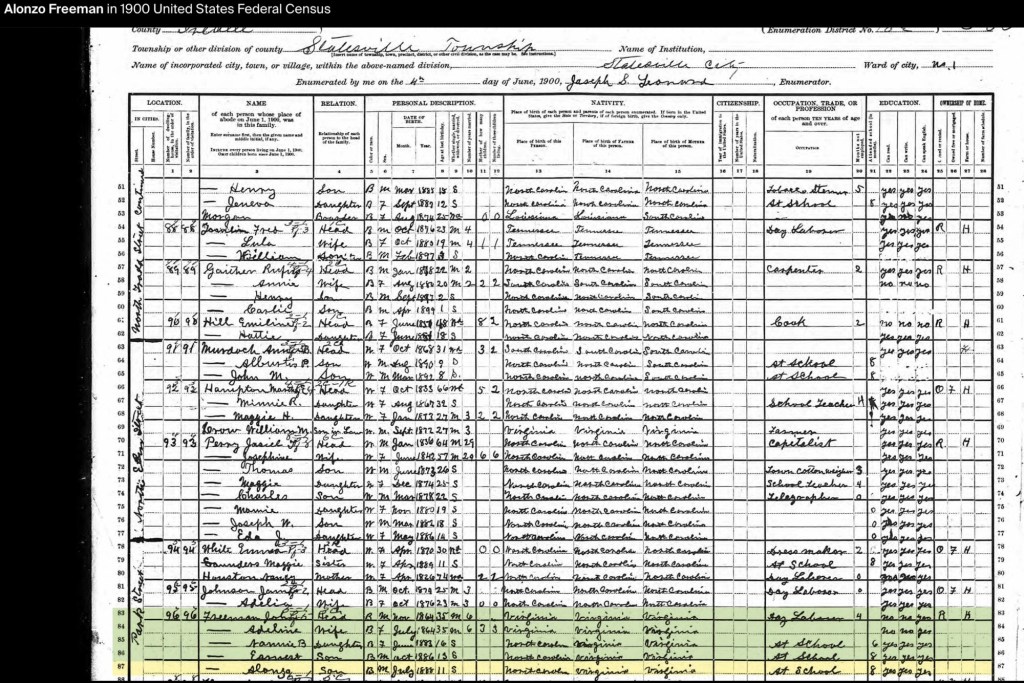
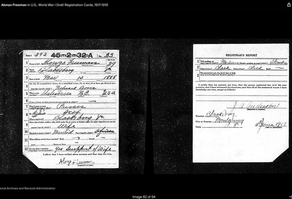
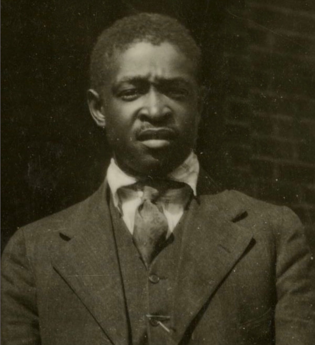
Alonzo Feadore (Fearno) Freeman, Sr. was born on March 10, 1889, in Statesville, North Carolina, to John (b. circa 1864) and Adeline Freeman (b. circa 1864). By the 1900 U.S. Census, John, a day laborer, and Adeline were living with their three children: Nannie B. (b. June 1883), Earnest (b. October 1886), and Alonzo Sr. (b. July 1888, student).

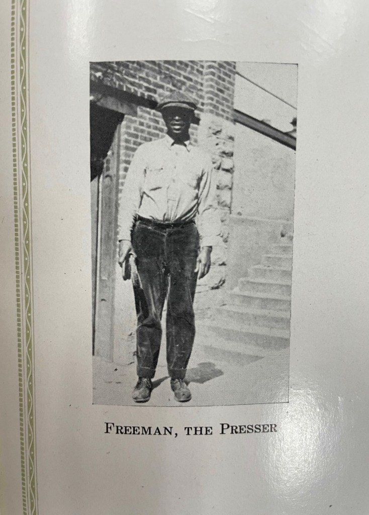
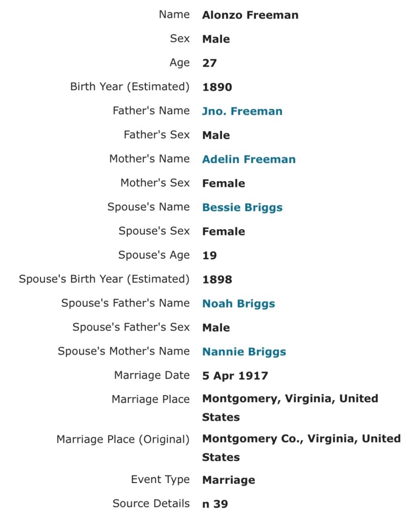
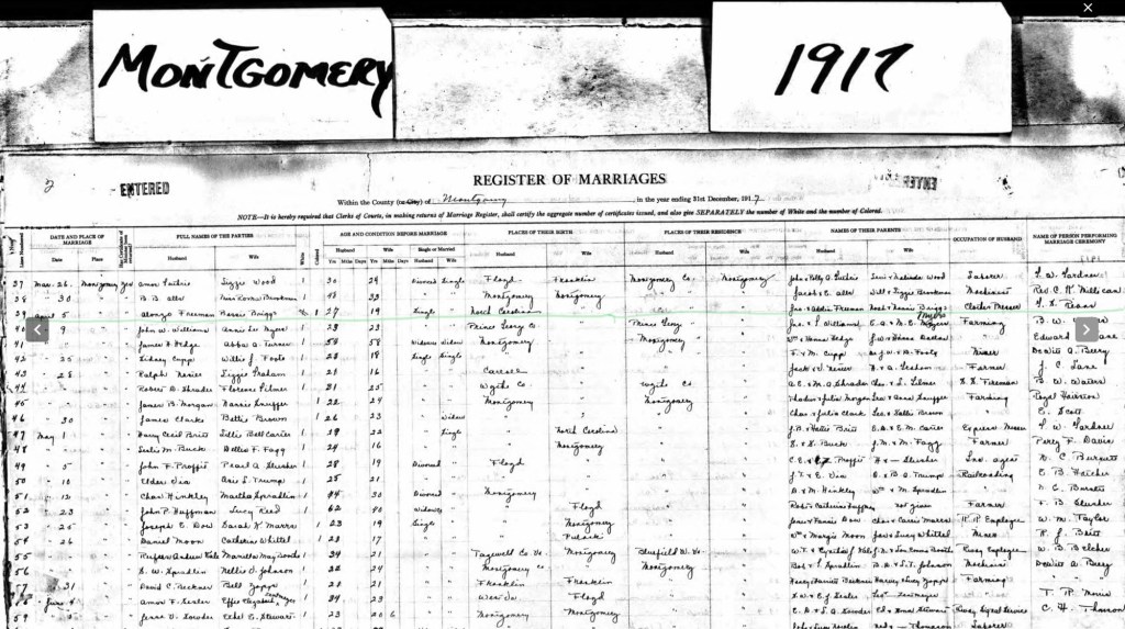
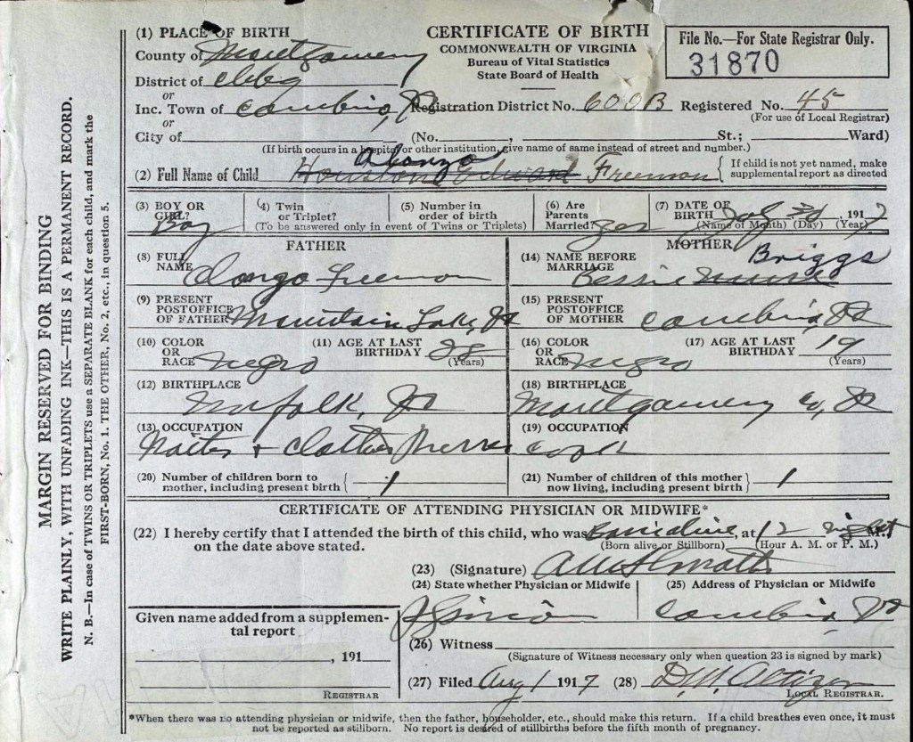
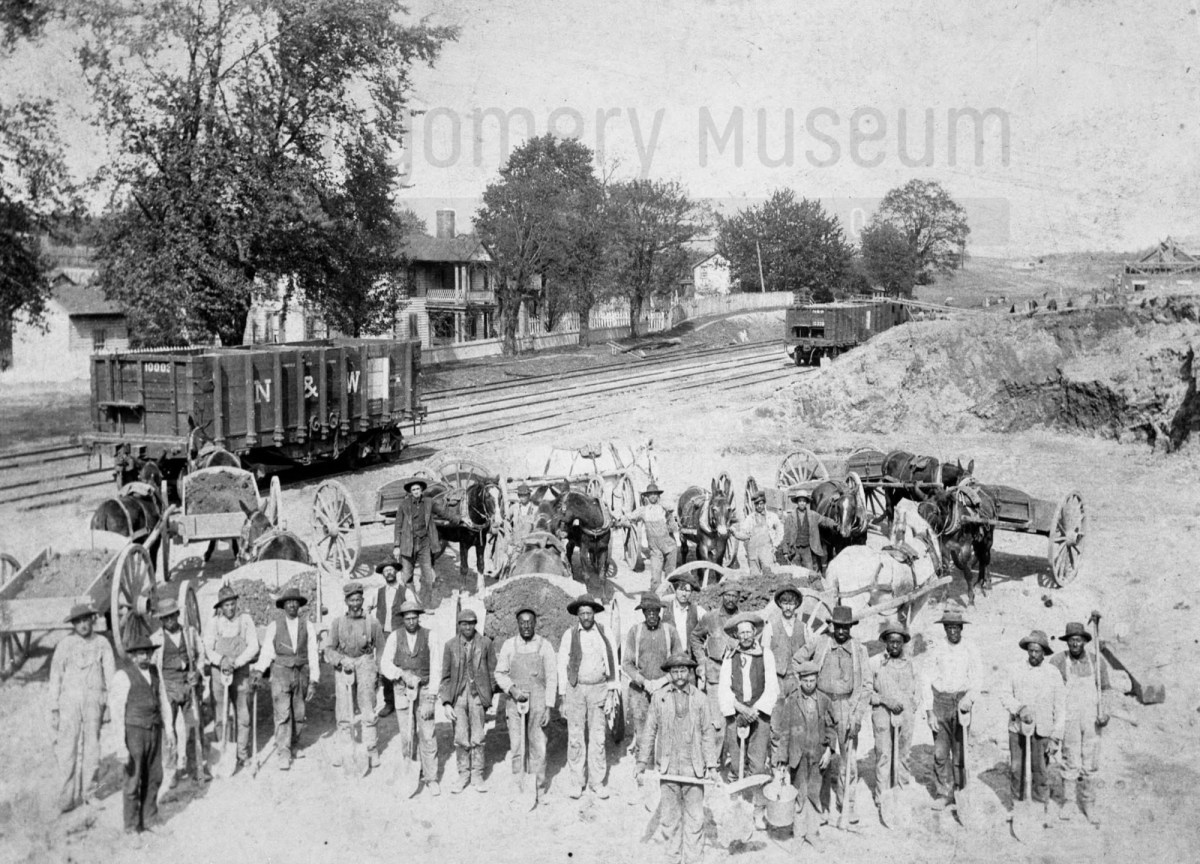
On April 5, 1917, Alonzo married Bessie Virginia Briggs (1899–1976) in Cambria, Virginia. Just a few months later, on July 31, 1917, their first son, Alonzo Freeman Jr., was born in Cambria, Virginia. According to his birth certificate, Alonzo Sr. worked as a waiter and clothes presser at Mountain Lake Resort, Virginia, while Bessie was a cook. During this time, they may have been living with Bessie’s mother and stepfather, who resided near the railroad tracks in Cambria.
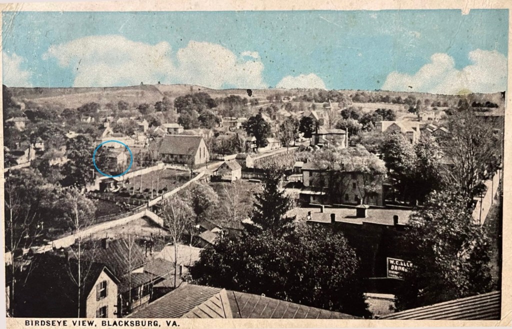
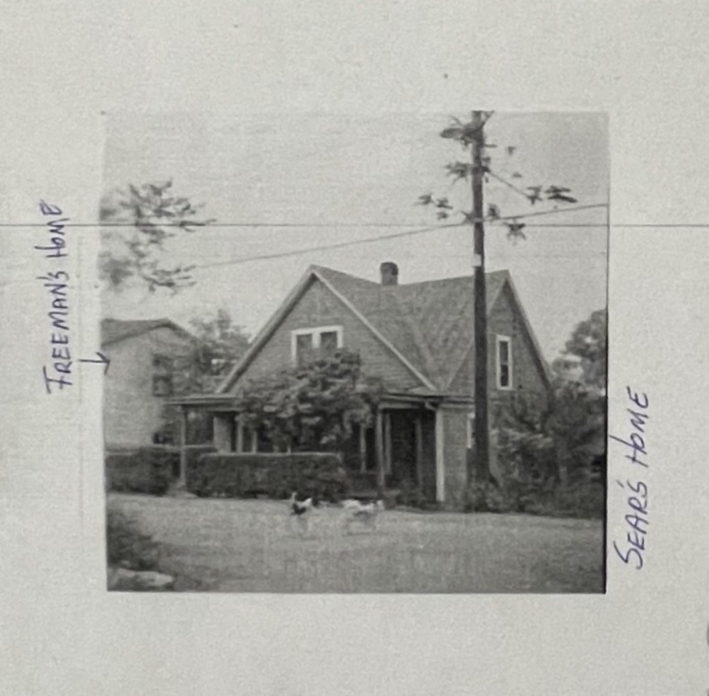
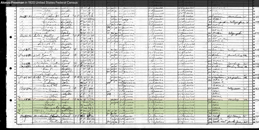
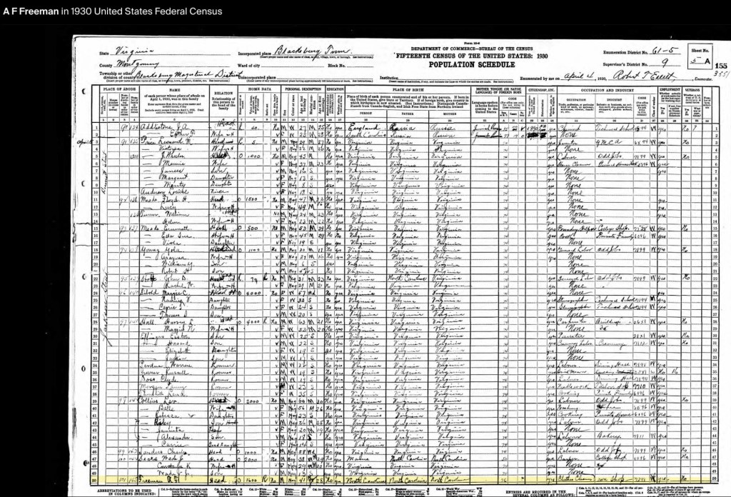
By the 1920 U.S. Census, the Freeman family had settled in Blacksburg, Virginia, on Jackson Street (originally Smithfield Road). Alonzo and Bessie were raising their two children, Alonzo Jr. and Nannie Bell (1919–1987). Also living in the household were Bessie’s siblings, Willie B. Muse and Edward Muse. At this point, Alonzo Sr. owned his home and operated his own pressing and cleaning shop. Their next-door neighbor was Nellie Anderson.
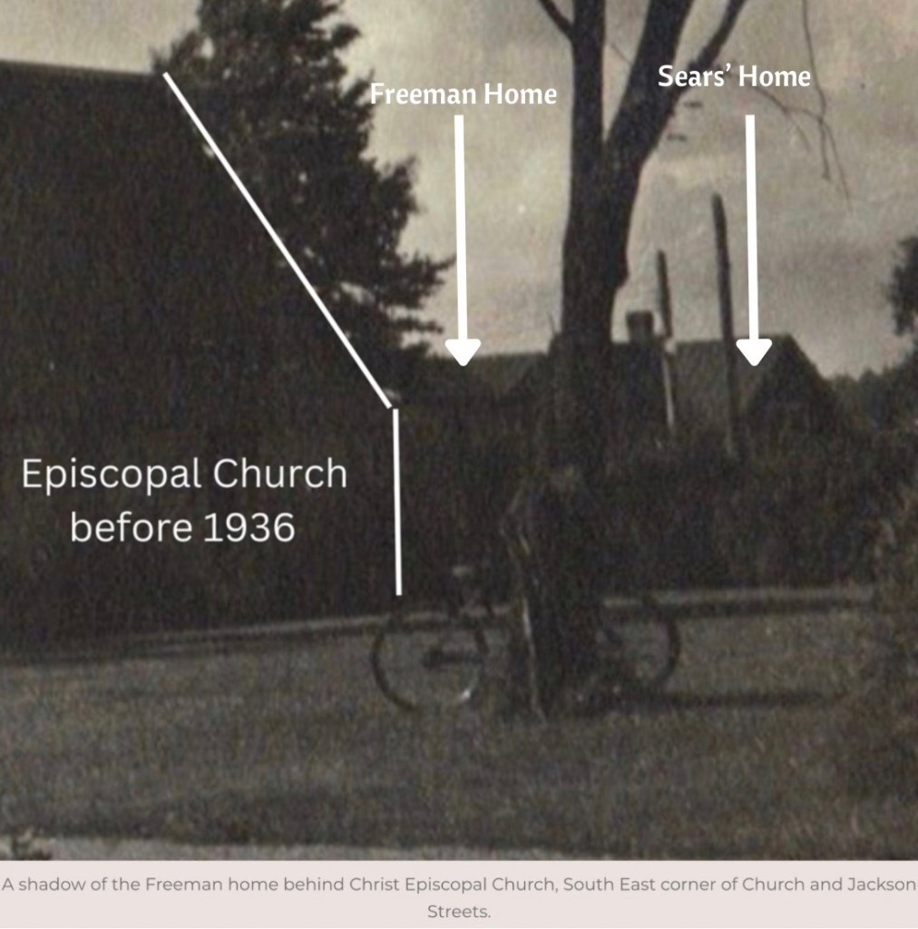
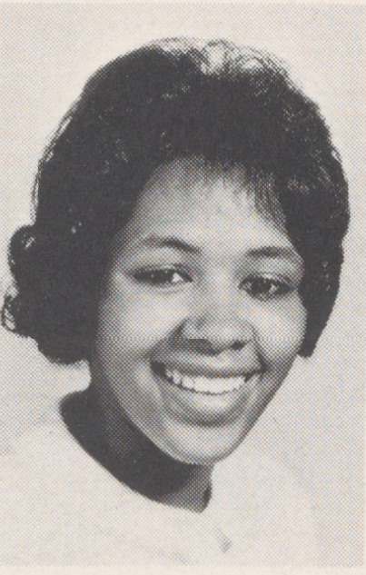
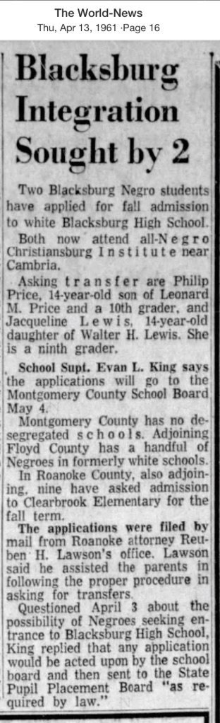
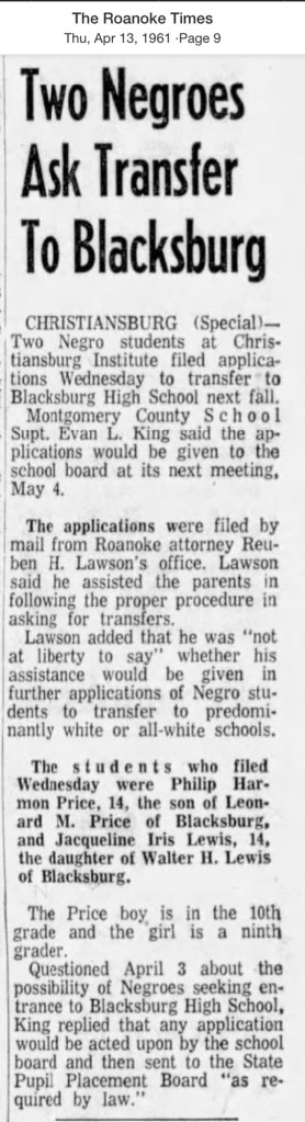
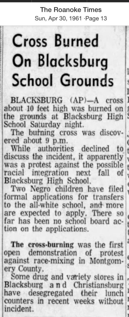
In the 1930s, the Freeman family were living in the same home, now valued at $1,600. They were part of a growing Black community on Jackson and Bennett Streets, surrounded by neighbors such as Wade Sears, Charles Saunders, Lev Collins, John Stolt, Yola Young, Emmett Meade, William Turner, Floyd Meade, Louise Anderson, and Leonard Price. The 1932 Blacksburg City Directory lists Alonzo Sr. as the proprietor of the Blacksburg Press Shop at 302 E. Jackson Street.
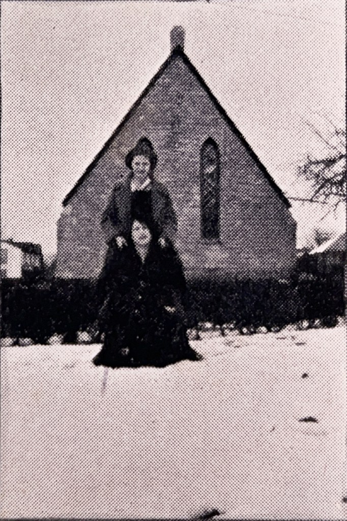
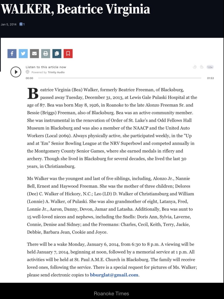
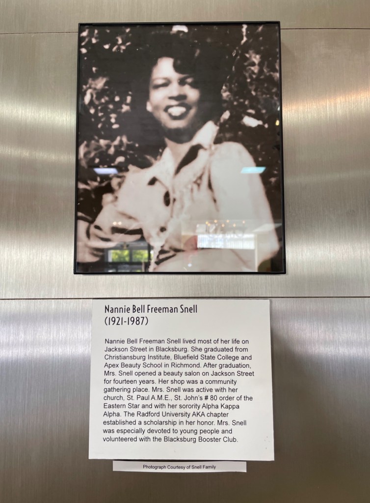
By this decade, the Freemans had expanded their family with three more children: Ernest Linwood (b. 1922), Haywood (1924–1984), and Beatrice (1926–2013). Alonzo Sr. continued to run his cleaning business—the first of its kind in Blacksburg—while Bessie worked for the Episcopal priest, Rev. Richard Martin, and his wife, Jean in the church’s office.
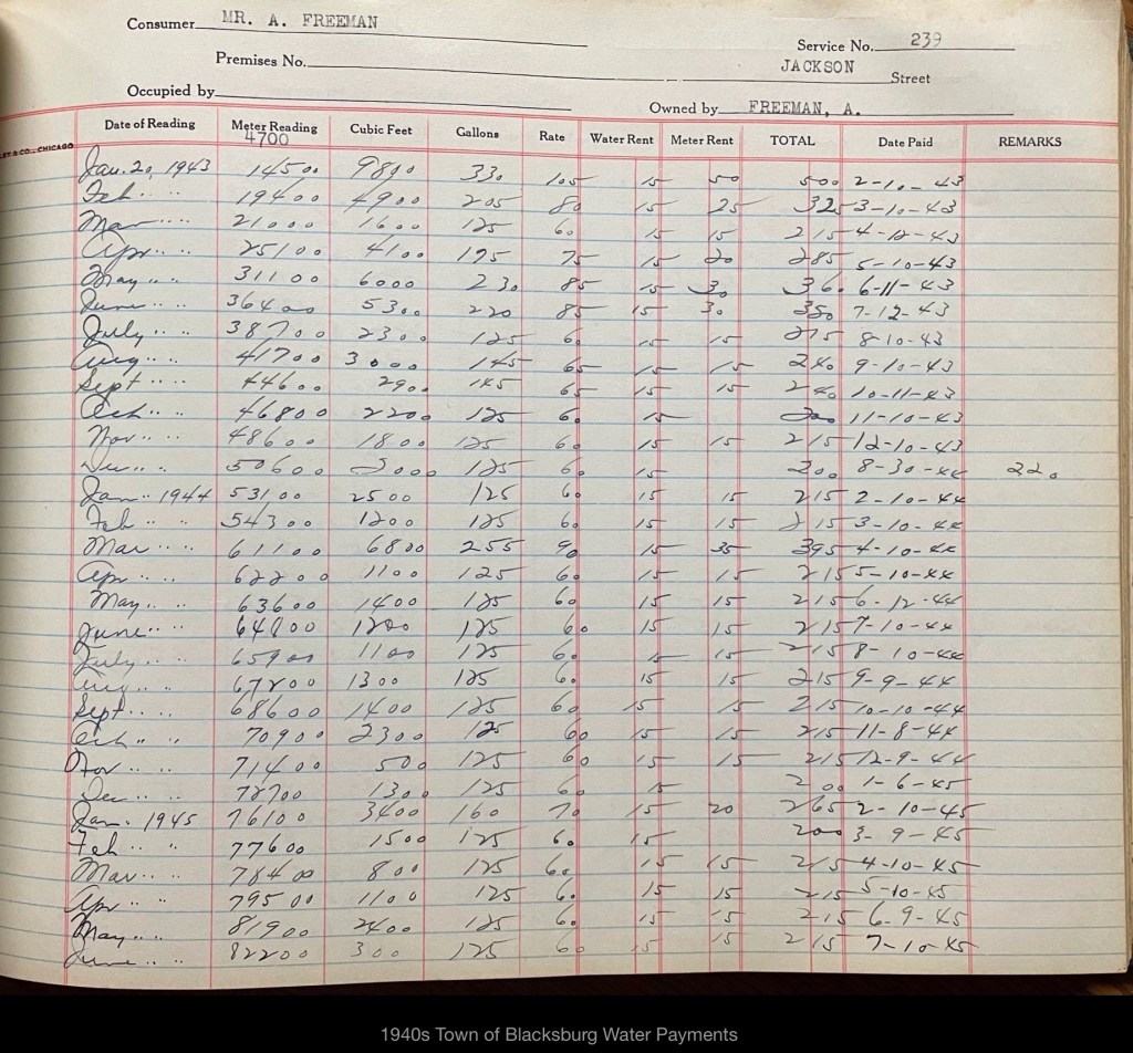
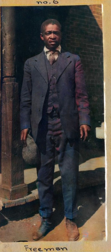
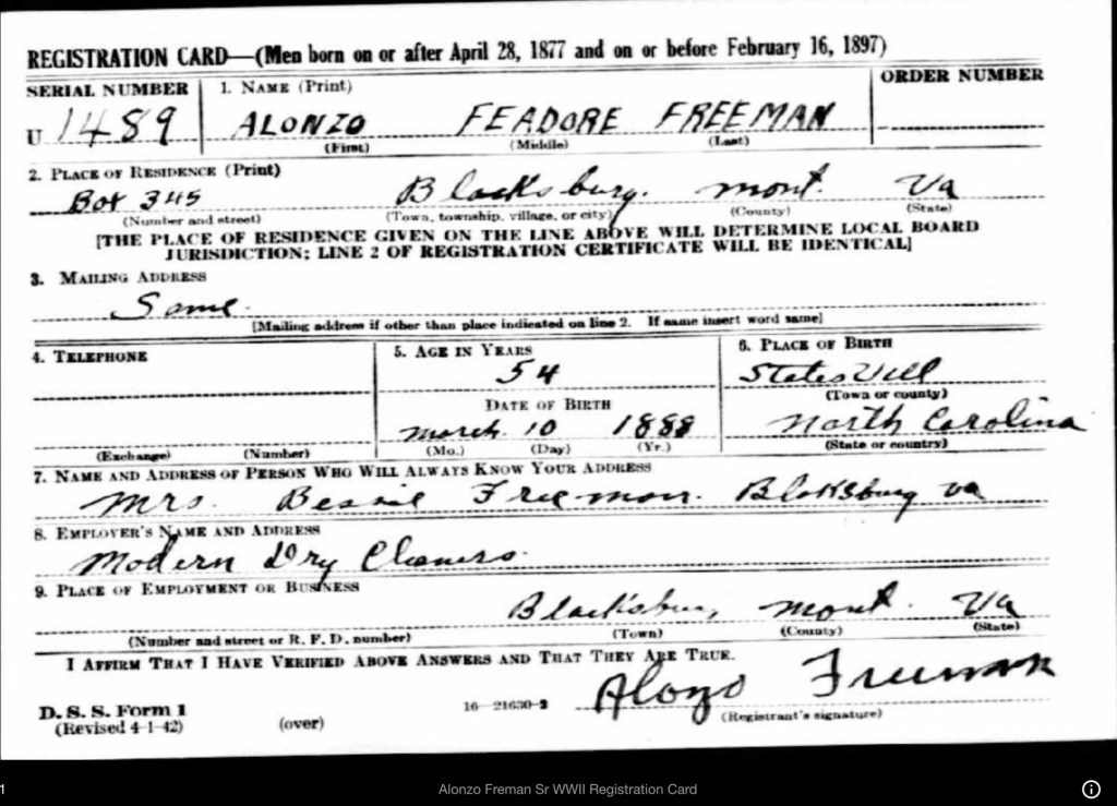
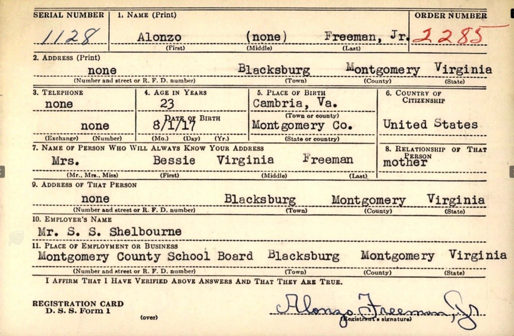
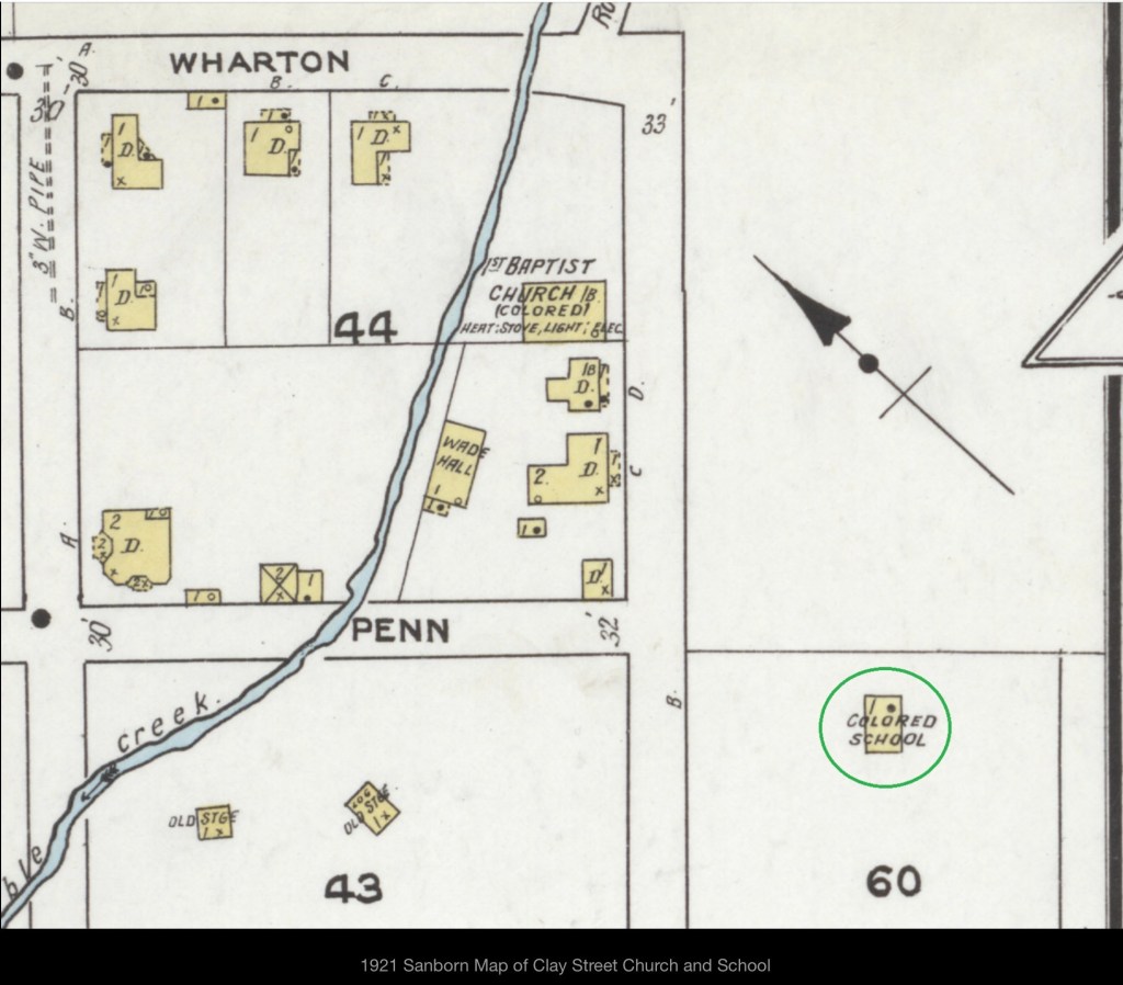
The 1940s marked a pivotal time for the Freeman family, as all the male members registered for the 1942 World War II Draft. These records provided Alonzo Sr.’s full name, Feadore, and documented his business, Modern Dry Cleaners (featured on an early 1950s map of Blacksburg). During this time, Alonzo Jr. served as the principal of the Clay Street Graded School, Linwood worked at the Radford Ordnance Works, and Haywood was employed by Ray Taylor.
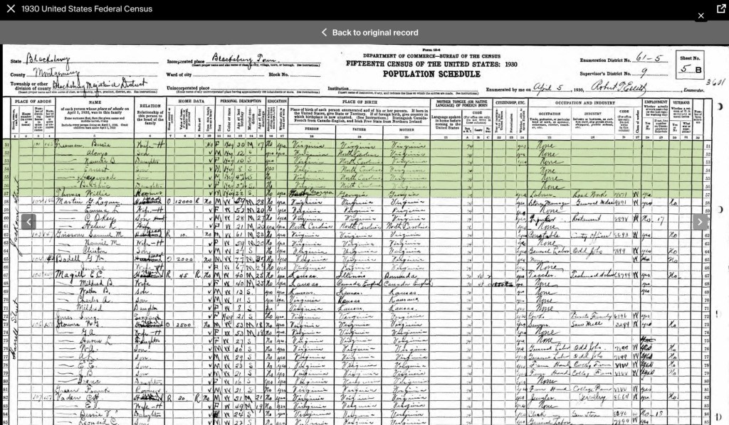
According to the 1940 U.S. Census, all of Alonzo and Bessie Freeman’s children were still living at home. Nannie Bell worked as a private housemaid, while Linwood was employed as a pin setter at the college bowling alley. Alonzo Sr. continued running his cleaning business, and Bessie worked as a private cook.
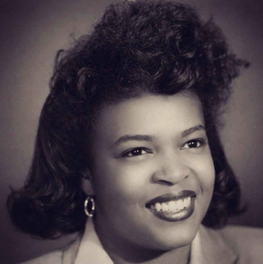
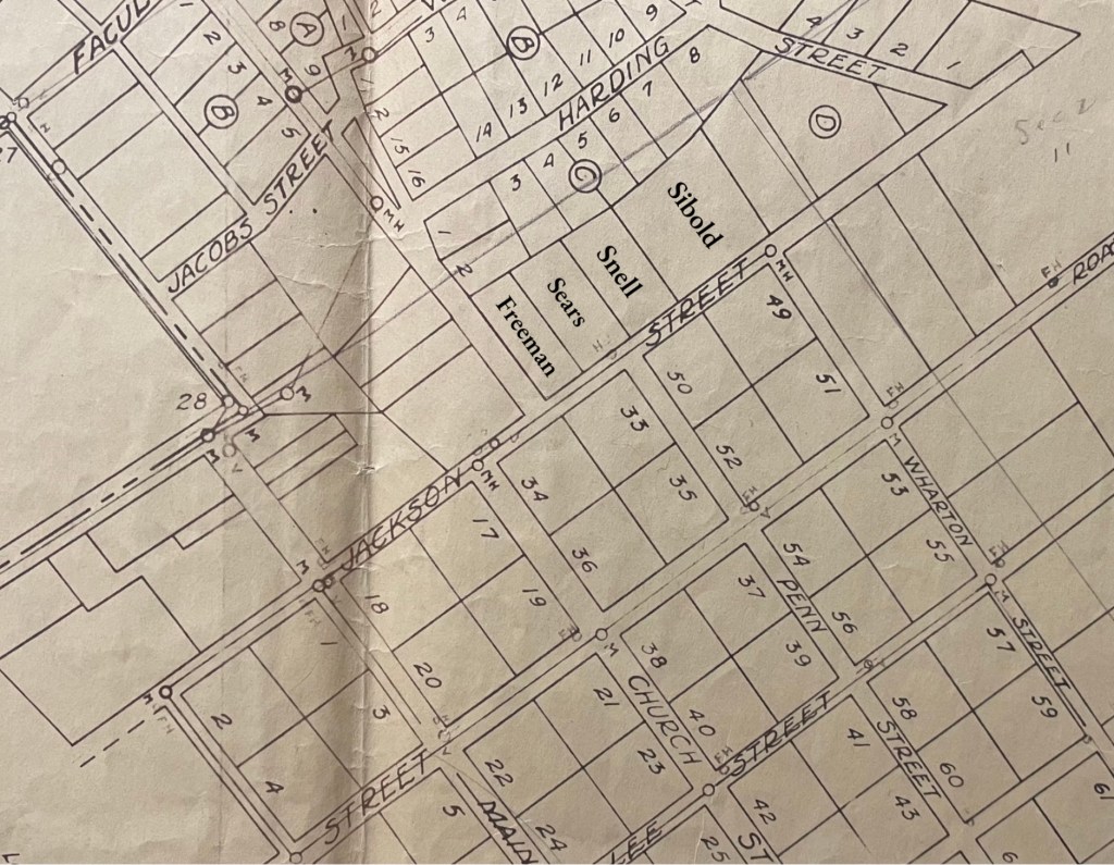
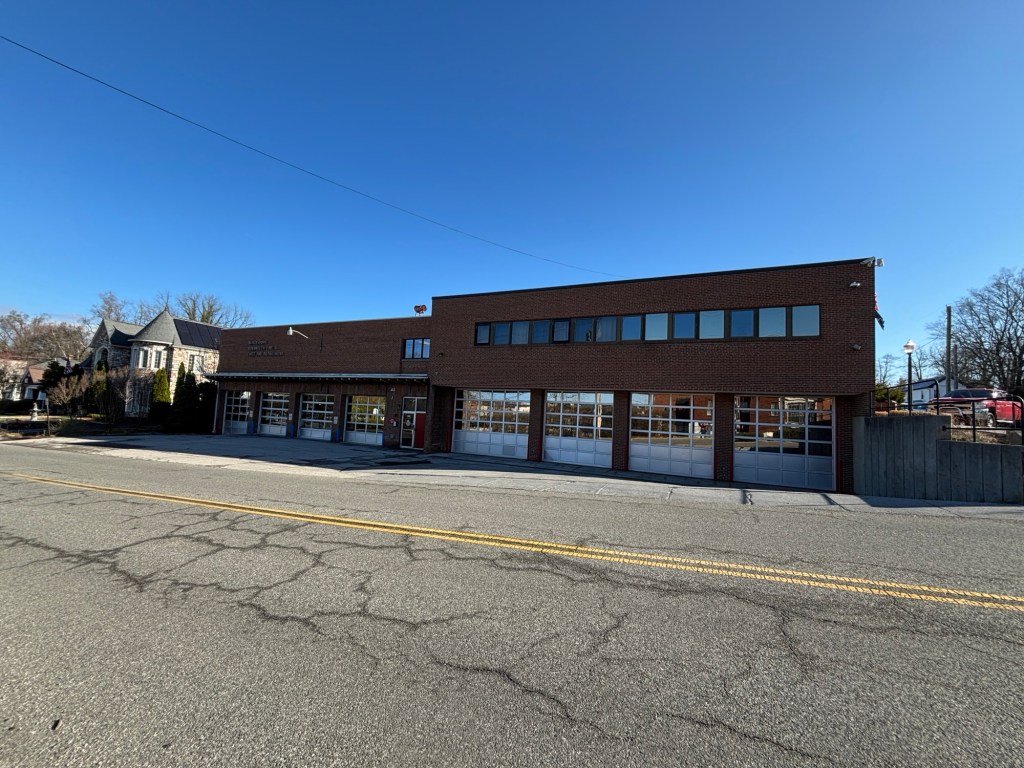
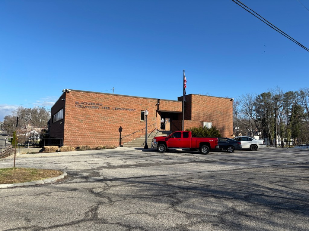
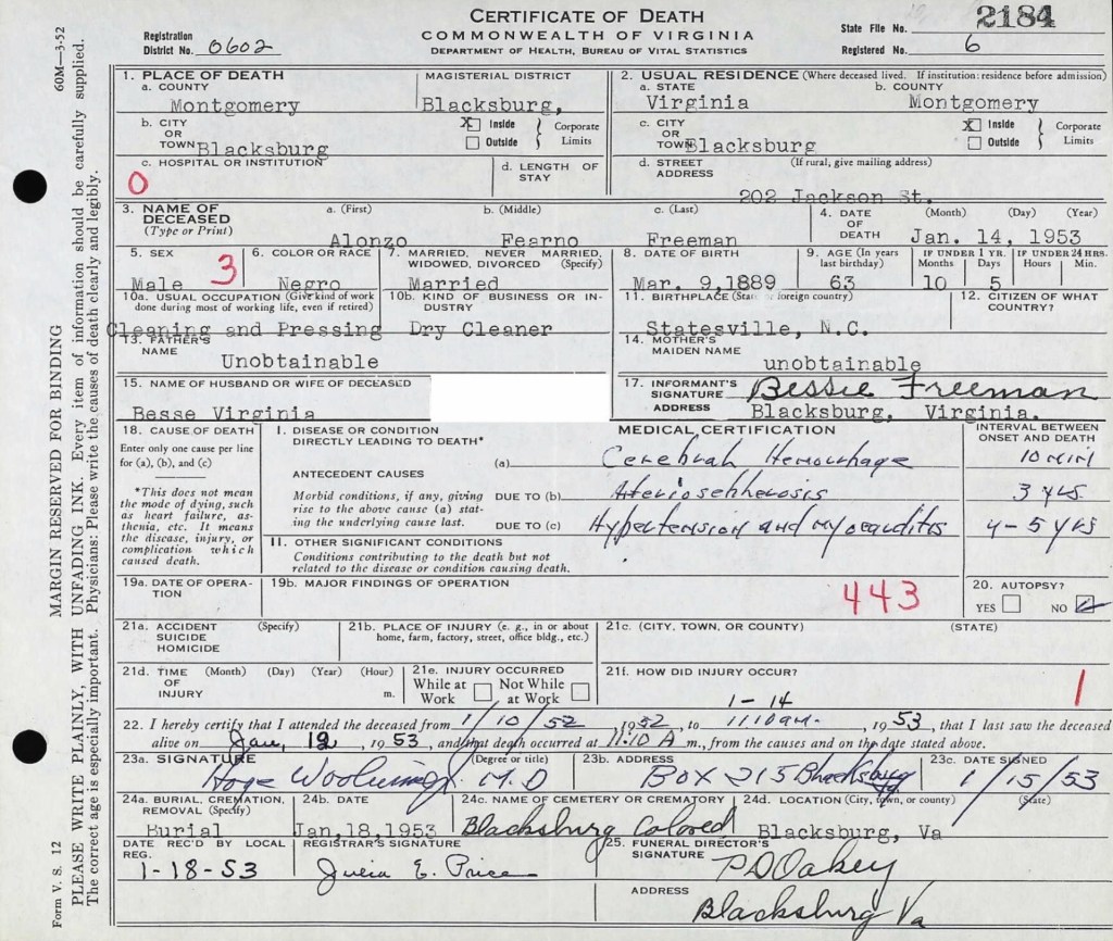
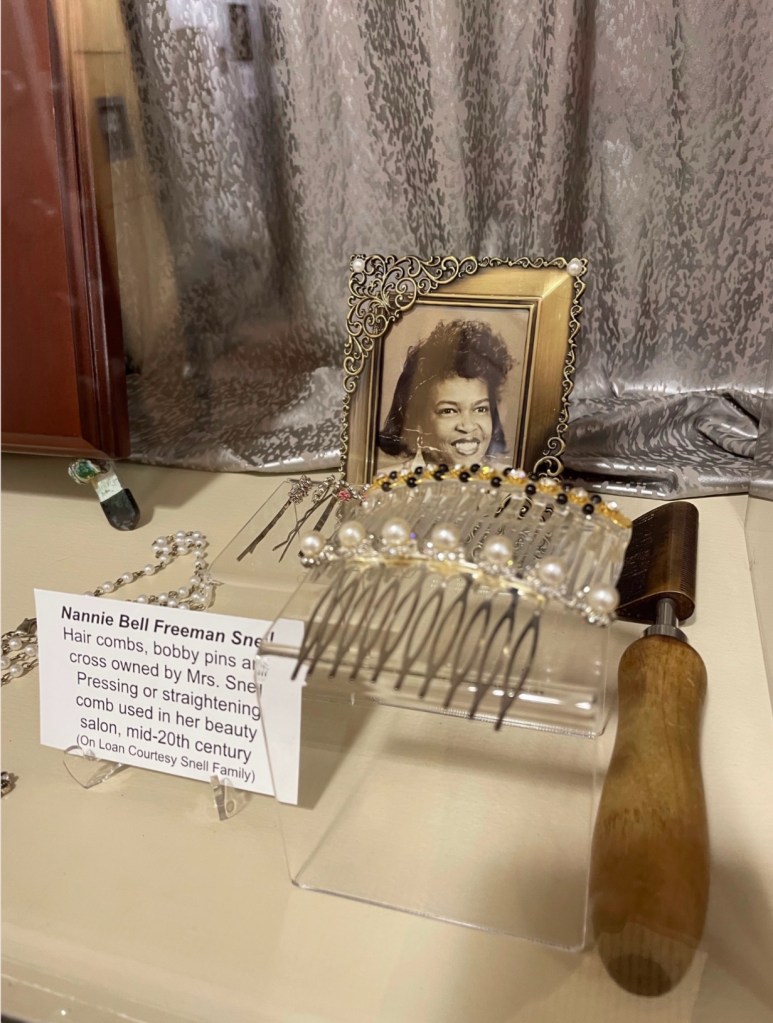
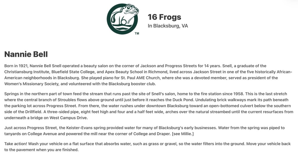
On November 19, 1947, Nannie Bell, now a beautician, married Sidney Grant Snell (1921–1975), a mechanic from Radford. The Snells raised six children and lived at 404 Jackson Street, just down the street from Nannie Bell’s parents, Alonzo and Bessie, who resided at 202 Jackson Street. Neither home remains standing today, but the Freeman residence was located at the same corner of Jackson and Progress Streets where the town’s 1958 firehouse now stands. Blacksburg named a frog to honor Nannie Bell.
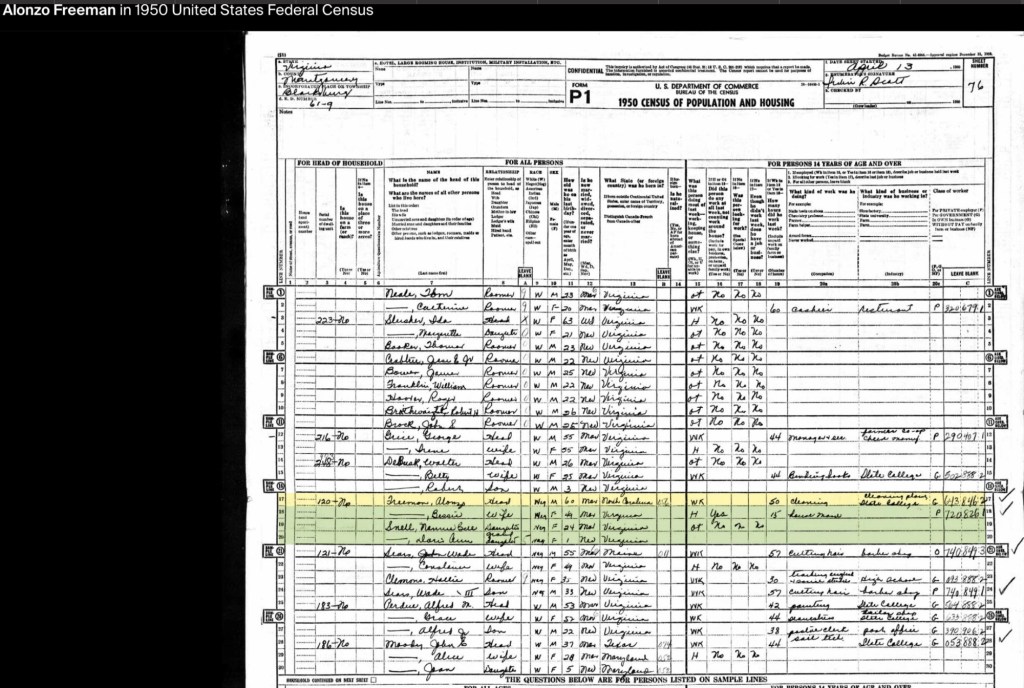
By the 1950 U.S. Census, Alonzo Sr., now in his 60s, was working at Virginia Polytechnic Institute’s Cleaning Plant. Nannie Bell and her daughter, Doris Ann, were living with her parents at the family home. By this time, all three Freeman sons had moved to Washington, D.C., with Linwood living alongside Haywood. Alonzo Jr. had married and was serving as the principal of the Clay Street segregated school before becoming the principal of an elementary school in Baltimore.
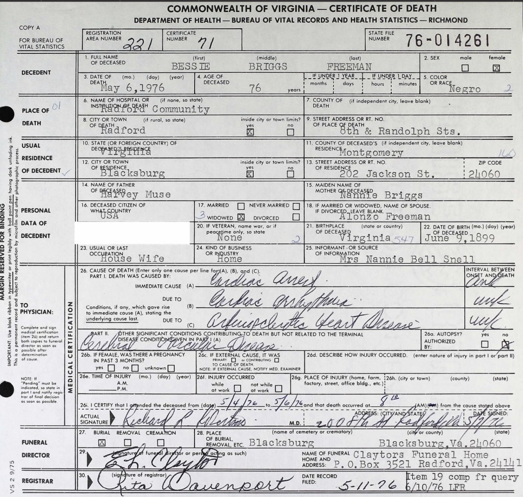
Bessie Virginia Briggs Freeman (1899 to 1976)
Bessie’s mother, Nancy Sweeney, was born in 1872 in Christiansburg, Virginia. Her father, Noah Briggs, was the son of George and Jane Briggs. Nancy and Noah were married on February 14, 1894. By the 1900 Census, the Briggs, Green, and Sweeney families—several generations of the same extended family—were living as neighbors in Cambria.
By the 1910 Census, Nancy Sweeney Briggs had married Harvey (Harry) Muse of Cambria, a laborer at the lime kiln. Together, they had four children: Willie B. (b. 1902), Grace (b. 1904), Connie (b. 1906), and Edward (1909–1950). Edward Muse later married Bessie Lynch (b. 1911), and they settled in New Town, where they raised five children: Jean (b. 1932), Constance (b. 1934), Shirley Ann (b. 1936), Edward Jr. (b. 1938), and Harold A. (b. circa 1940). By 1940, Edward Muse was working at the Virginia Polytechnic Institute Monogram Presser Plant alongside his neighbor, John Green, and Alonzo Freeman Sr.
In 2013, Beatrice Freeman Walker, the youngest daughter of Bessie and Alonzo Freeman, participated in an oral history interview now archived at Virginia Tech University Libraries. In this interview, she shared valuable insights into her mother’s work in the homes of prominent community members and her leadership in the Independent Order of St. Luke’s (St. Frances Council #235), which operated out of the shared building in New Town alongside the Odd Fellows and the Household of Ruth. Beatrice also highlighted her mother’s important role in coordinating the return of soldiers for family funerals through the Red Cross.
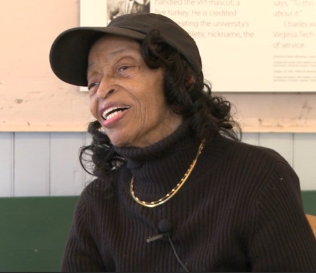
Additionally, the interview sheds light on her father, Alonzo Freeman Sr., and his contributions to the Black community in Blacksburg. Among these was his creation of a weekend retreat for African Americans, called Paradise View, located on land he owned off Grissom Lane—now known as Nellie’s Cave. Beatrice’s recollections provide a crucial window into the history of Black life in Blacksburg and the legacy of her parents.
Notes to Further Explore – Mountain Lake Connection
In her book Kentland at Whitethorne (Walpa Publishing, Blacksburg, VA, 1995), historian Patricia Givens Johnson mentions a “Mrs. Freeman,” who worked as a chambermaid at Mountain Lake Hotel shortly after emancipation. According to Johnson (p. 53), Mrs. Freeman married Bob Jackson, who had been enslaved by James Randal Kent (1792–1867), the owner of Kentland Plantation. Some of their children took the Jackson surname, while others retained the Freeman name. Johnson identifies their children as Flemish Jackson, Bessie, Bob, Qu, and Irene Freeman, noting that they were employed by the hotel well into the 1900s.
This connection warrants further research, but it raises an interesting possibility—when Alonzo Freeman married Bessie Briggs in 1917, he was working at Mountain Lake Hotel as a waiter and clothes presser. Could this employment have been influenced by family ties to the hotel? Further exploration may help clarify the Freeman family’s long-standing connection to Mountain Lake.
Alonzo the Inventor
https://patentimages.storage.googleapis.com/7c/8c/12/b8a6bcb44761f8/US1723980.pdf
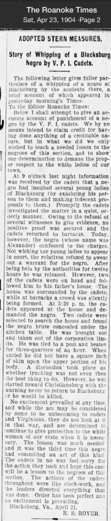
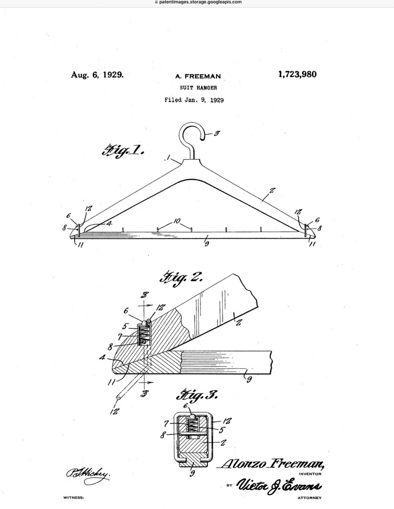
In the winter of 1929, in Blacksburg, Virginia, Alonzo Freeman did something remarkable. While running his clothes-cleaning business during the era of government sanctioned segregation, he took time to solve a practical problem he faced every day.
Working with coats, suits, and trousers, Freeman designed a better garment hanger. His invention included a removable bar for trousers and a simple latching mechanism that held the bar securely in place while still allowing it to be quickly removed.
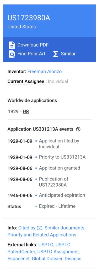
On January 9, 1929, Freeman filed for a patent with the United States Patent and Trademark Office. Later that year, on August 6, he was granted U.S. Patent 1,723,980.
Freeman’s hanger is a reminder that innovation often grows out of everyday work. Even in the face of segregation, Black entrepreneurs and tradesmen were imagining new ideas, improving tools, and shaping their communities.
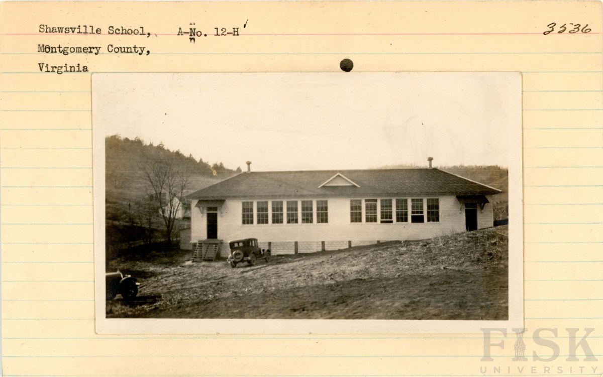
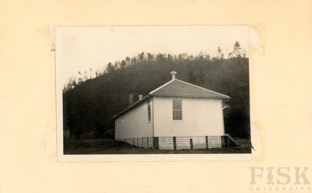
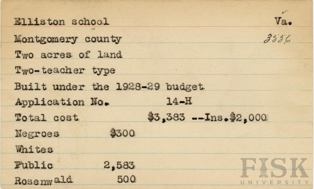
Gallery