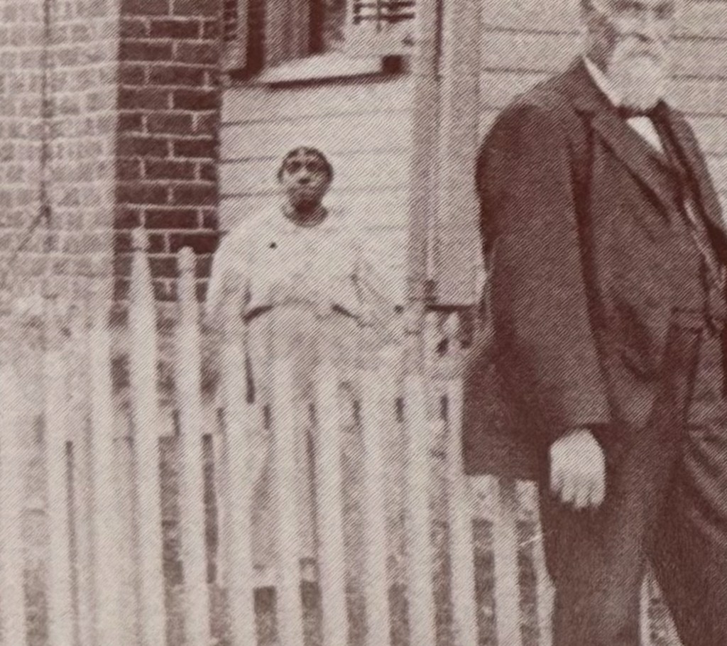
Behind the Lawrence family’s fence on Five Points Road in Riner stands an unidentified African American woman—her name unrecorded, her story unknown. She appears behind Canaan and Mollie Weaver Lawrence, whose wealth came from farming, commerce, and the post office in the late 1800s.
Searching for Her Name
In this photograph, taken in Riner, Virginia, a white family stands proudly in front of their home on Five Points Road, Riner, Virginia. Behind the fence, partially obscured, stands an unidentified African American woman—someone whose name and story have not yet been recorded.
She is pictured behind Canaan (1840–1905) and Mollie E. Weaver Lawrence (1838–1931), whose home and farm once stood at this site. Canaan, a Confederate veteran, was listed as a farmer, D.G. merchant, and postmaster in 1893—the sources of the family’s prosperity. Born in Floyd County, he moved to Auburn by the 1870 census. Mollie, born in Auburn, remained there her entire life.
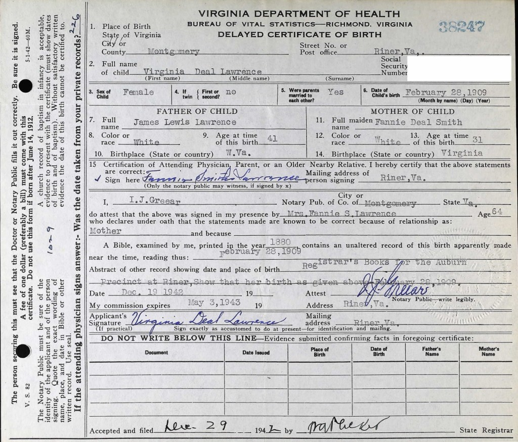
This photograph was shared by their granddaughter, Virginia Deal Lawrence, a longtime teacher at Auburn Elementary School, who preserved many family images and documents. Despite a search through census and local records, the woman’s name remains unknown.
We will continue to look through Virginia Deal’s papers and scrapbooks in hopes of finding a clue.
If you recognize this woman or know anything about the African American community connected to the Lawrence family, please contact us—we would be honored to record her name and story.
Please let us know if you can identify this woman behind the fence.Lawrence Family PhotoCanaan Lawrence1893 Canaan Lawrence was Postmaster of Riner, Va1895 Canaan Lawrence was the Postmaster in Riner, VaMollie Elizabeth Weaver Lawrence Virginia Deal Lawrence, granddaughter of Canaan and Mollie LawrenceThe Riner 1995 Calendar filled with Virginia Deal Lawrence’s photos
This searchable document is a rich source of information about the county and its wider connections. For example, it notes that the New River boatmen once lived on Kent Farm, where they were enslaved by James Randle and Margaret Cloyd Kent prior to emancipation (see page 13). Additional details about Kentland and these freedmen can be found in the following postings: Historic Kentland and Historic Wake Forest
The names of some of the black boatmen of 19th-century Montgomery County include Frank Bannister (who was a boatman on the James River before the Civil War), Calvin Bannister, Roland Stuart, George Brown, and Lewis Smith.
This report that was written by Gibson Worsham, Dan Pezzoni, Charlotte Worsham, David Roenizer, and others. It addresses the following: 1) Overview of the county’s history, 2) A comprehensive inventory of significant structures and sites in the county and 3) Maps delineating the location of said structures and sites. Similar to the report above, this is a wealth of information about the county.
The Formation of Montgomery County, Virginia and Why it Matters to African American History of the Region
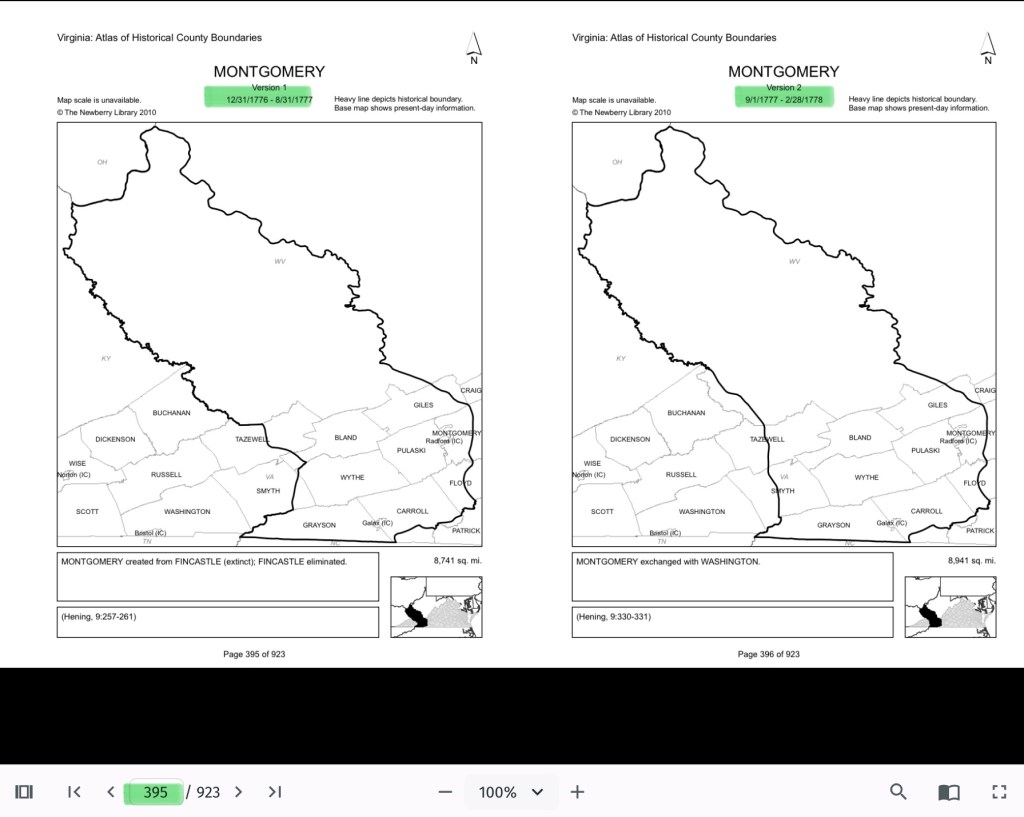
When Virginia’s earliest European colonial settlers first pushed westward beyond the Blue Ridge Mountains, they entered the border lands already inhabited by Native peoples for thousands of years. As Europeans laid claim to these territories in the 18th century, Virginia’s county boundaries began shifting rapidly to keep pace and the need for local governance.
At first, all of western Virginia was considered part of vast counties based far to the east. Augusta County, created in 1738, stretched from the Blue Ridge to the Mississippi River—a landmass so large it was nearly impossible to govern effectively. As settlement expanded, Augusta was gradually carved into smaller counties.
Botetourt County was created in 1770 out of Augusta, and just two years later, in 1772, Fincastle County was formed to cover the far southwest. But Fincastle itself was short-lived: in 1776, it was split into three new counties—Montgomery, Washington, and Kentucky (the latter eventually becoming the Commonwealth of Kentucky).
Thus, Montgomery County was officially established in 1776, named in honor of General Richard Montgomery, a Revolutionary War hero.
Like most early counties, Montgomery did not remain the same size for long. As population grew and communities demanded closer courts and local representation, Montgomery’s original boundaries were gradually reduced.
1790: Wythe County was formed from Montgomery.
1790: Parts of Montgomery contributed to the creation of Kanawha County (now in West Virginia).
1806: Giles County was carved from Montgomery, Monroe, Wythe, and Tazewell.
1831: Montgomery giving land to Floyd
1839: Montgomery giving land to Pulaski
1892: City of Radford
By the mid-19th century, Montgomery County had taken on the approximate shape we recognize today.
Why This Matters
Tracing these changing boundaries shows how the western border lands of Virginia evolved from a vast Indigenous landscape into the network of counties we know today. When we study Montgomery County’s formation and its changing borders, we are not only tracking political geography—we’re also uncovering how those shifts shaped the daily realities of enslaved people and freedmen. The “line on a map” often meant the difference between where families were recorded, where they could live, and how they could begin to claim freedom and opportunity.
County seats like Christiansburg were not only centers of trade and government but also of the slave market and the courthouse records that tracked the lives of enslaved people. After emancipation, those same courts became the places where freedmen registered marriages, secured contracts, and sought land. As county lines shifted, so too did the jurisdictions that controlled access to justice, opportunity, and community life.
The flip book of maps below is a helpful resource to understand how the boundaries changed with time. Begin on page 395.
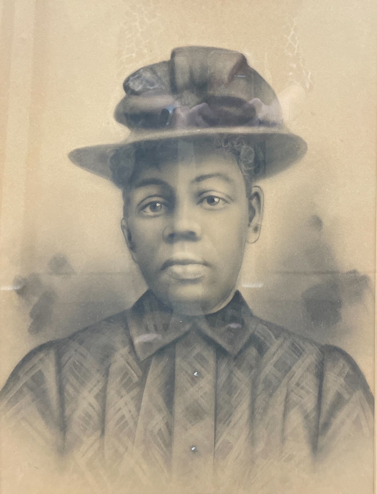
Crayon Enlargement Portraits were popular between the late 1890s and early 1900s. They provided an affordable way to capture and display large-format portraits, offering an alternative to the more expensive painted portraits of the time.
Crayon Enlargement Portraits were popular between the late 1890s and early 1900s. They provided an affordable way to capture and display large-format portraits, offering an alternative to the more expensive painted portraits of the time. The process involved taking a negative made by a local photographer and sending it to a specialist who used a solar enlarger to expose the image onto specially processed salted photographic paper. Because the enlargement process often emphasized imperfections on the negative plate, an artist would enhance the black-and-white print with pencil and crayon media, sometimes adding color.
The unidentified African American portraits featured on this website have been donated to local museums or found in antique shops. They are presented here in the hope of eventually identifying the individuals and preserving their stories.
Portrait of an unknown man (Courtesy of Montgomery Museum of Art and History)Portrait of an unknown man (Courtesy of Montgomery Museum of Art and History)Portrait of an unknown man, found in a New Town house, Blacksburg, Va (Courtesy of Montgomery Museum of Art and History)Portrait of an unknown woman (Courtesy of Montgomery Museum of Art and History)Portrait of an unknown man (Courtesy of Christiansburg Institute, Inc)Portrait of an unknown man (Courtesy of Christiansburg Institute, Inc)
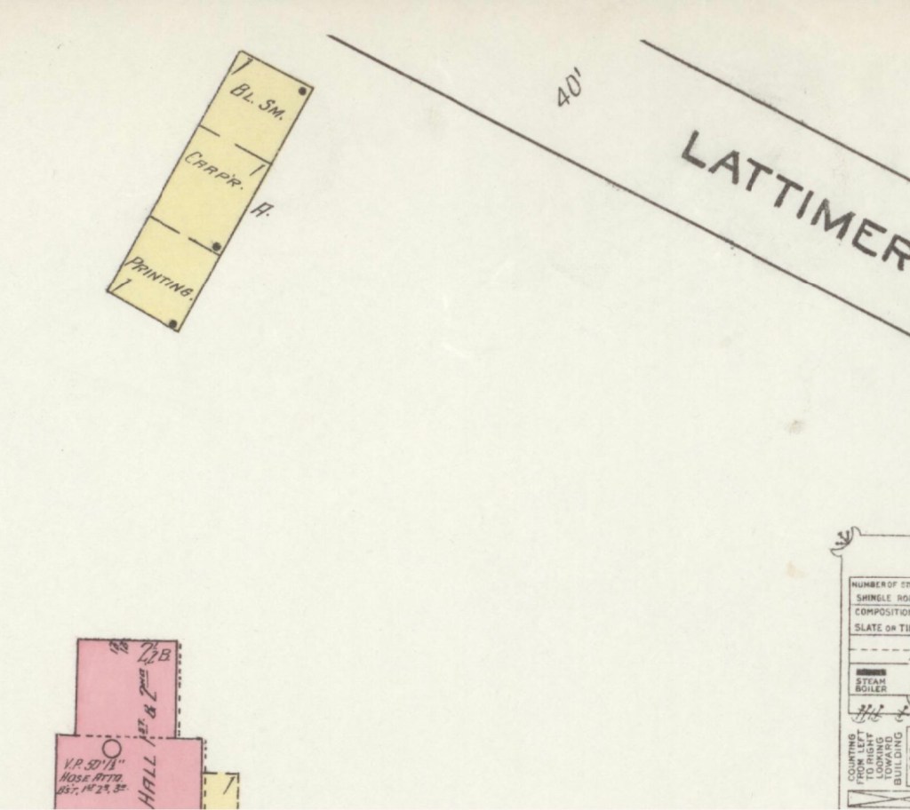
The Sanborn Fire Insurance maps are often the only early glimpse of buildings in rural towns over time. Christiansburg Industrial Institute moved from the Zion Hill location to the Lattimer Plantation site, north west of Christiansburg, at the turn of the 20th Century. This Sanborn Fire Insurance Map from Christiansburg, Montgomery County, Virginia was published by the Sanborn Map Company, dated Sep, 1913. The key to the maps is at the end.
The map is of Christiansburg Industrial Institute, situated north west of Cambria and north of Christiansburg courthouse. Note that frame constructed buildings are coded yellow and red for the solid brick building. The Baily Morris Building which housed the girls dorm, assembly hall, dinning hall and kitchen (close-up below) is heated by steam and lighted by electricity.
“Baily-Morris” Building
The Morris Hall Boys’ Dorm is both red and yellow, denoting built of a combination of building materials. The building is heated by hot water and lighted by electricity. Note that the buildings were supplied with water by 2,500 ft of pipes connected to the 10K gal water tank on the hill. The tank is filled by a Worthington Pump, moving water from a spring.
The girls and boys dorms were named for two Friends’ of the Freedmen of PA, Elliston P. Morris and Joshua L. Baily. They also donated money to construct the water system which was installed in 1907, before either Christiansburg or Blacksburg had a community water system. (A Vision of Education, Selected Writings of Edgar A. Long, Anna Fariello, Ed. Christiansburg Institute, Inc. 2021, pg 86,)
The Lattimer Mansion House, wood framed, was heated by stove and not connected to the water supply. The house was used as classrooms. Note the printing, carpenter and black smith shop close to the entrance road.
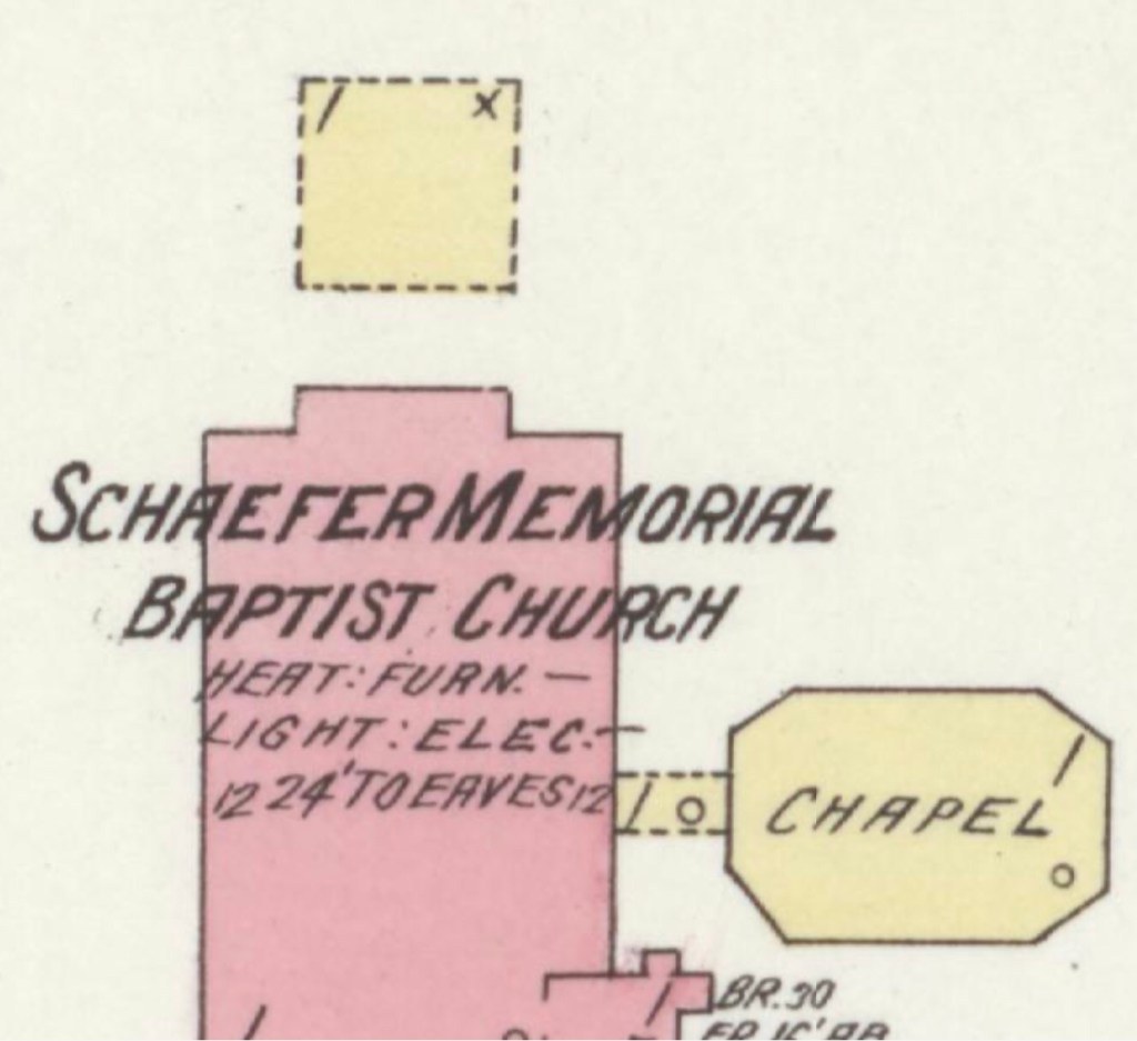
1913 Hill School & Schaeffer Memorial Baptist Church
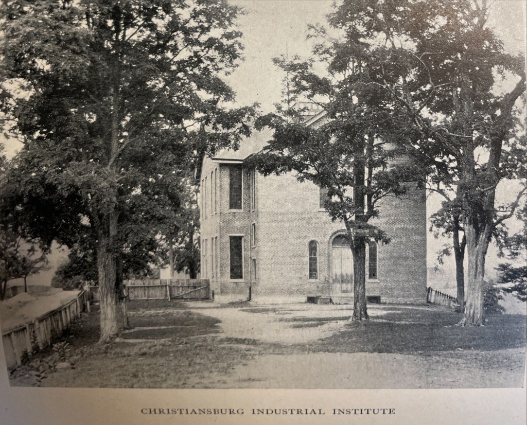
This map is of Zion Hill which is located on the ridge (now High Street) between Cambria and Christiansburg. The brick (red) “Public School” housed the Christiansburg Industrial Institute before that secondary school moved to the Lattimer Plantation property by the turn of 20th century. This brick school, built by 1885, was converted to a primary school for African American children after CII moved. As noted by the Sanborn map, the building was heated by stoves and lighted by electricity.
Image of the Hill School from The Story of a Consecrated Life, Commemorative of Rev. Charles S. Schaeffer by CH Harrison, 1900. High Street is visible.
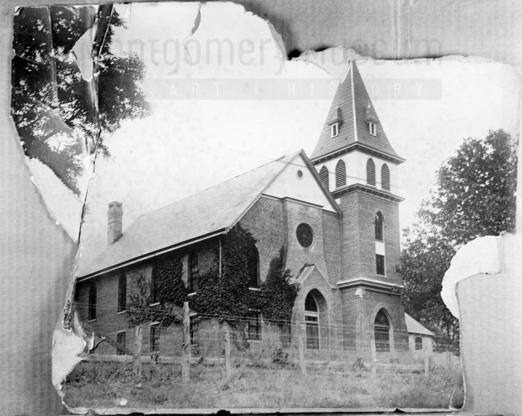
The Schaeffer Memorial Baptist Church is also of brick and built by 1885. Charles S Schaeffer’s memorial brass plaque were unveiled 1 October 1899, after he died in May of that same year. Note the frame chapel to the left (east) of the brick structure.
Image of Schaeffer Memorial Baptist Church from The Story of a Consecrated Life, Commemorative of Rev. Charles S. Schaeffer by CH Harrison, 1900. High Street is visible in the foreground. Later photograph, courtesy of the D.D. Lester Collection, Montgomery Museum of Art & History
On the Sanborn map, note the small frame, 1 story building behind the church? This may be the first school/church building on Zion Hill. The deed (DB S, pg 12, Oct 1868) and Harrison, 1900 * note the existence of this building. The brick school on the 1913 Sanborn map was the third version of this school at this site. The second school on Zion Hill was a 2 story & frame building, used between 1974 and 1885. (The rented Campbell house was the first school but it was not located on Zion Hill.)*
The image of the small school/meeting house shows a one story frame building with hip-roof and double stove-pipes. The dressed limestone block foundation was typical in this area and seen on buildings dating from early 1800s to the turn of the 20th century.
Image of the first school house on Zion Hill from The Story of a Consecrated Life, Commemorative of Rev. Charles S. Schaeffer by CH Harrison, 1900. High Street is visible in the foreground.
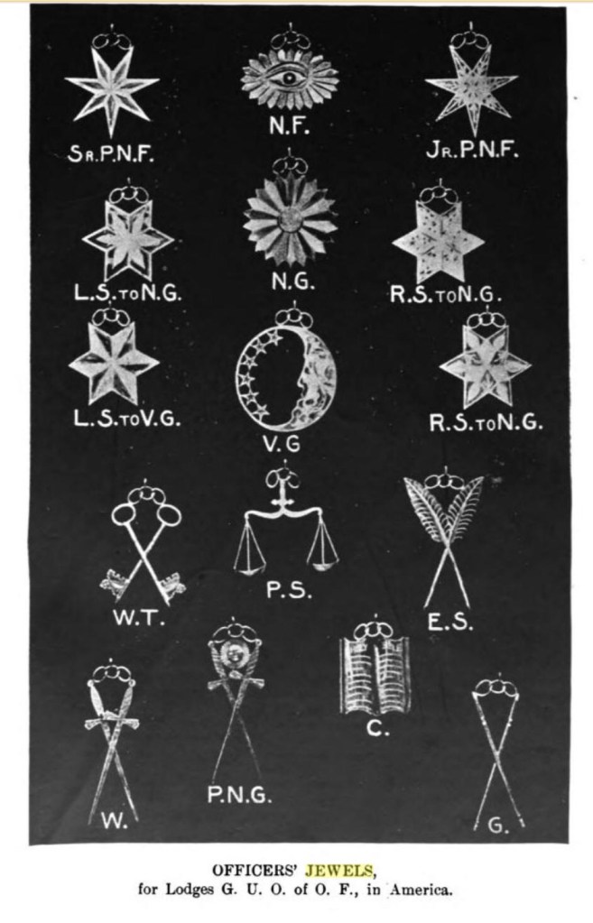
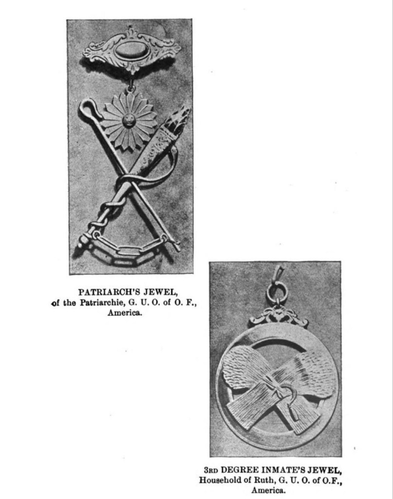
Past Noble Grand – Golden (heart in hand, crosses swords)
Noble Father – Excelsior, (Seeing-Eye in the night).
Past Noble Father (Permanent Noble Father), (7-pointed star).
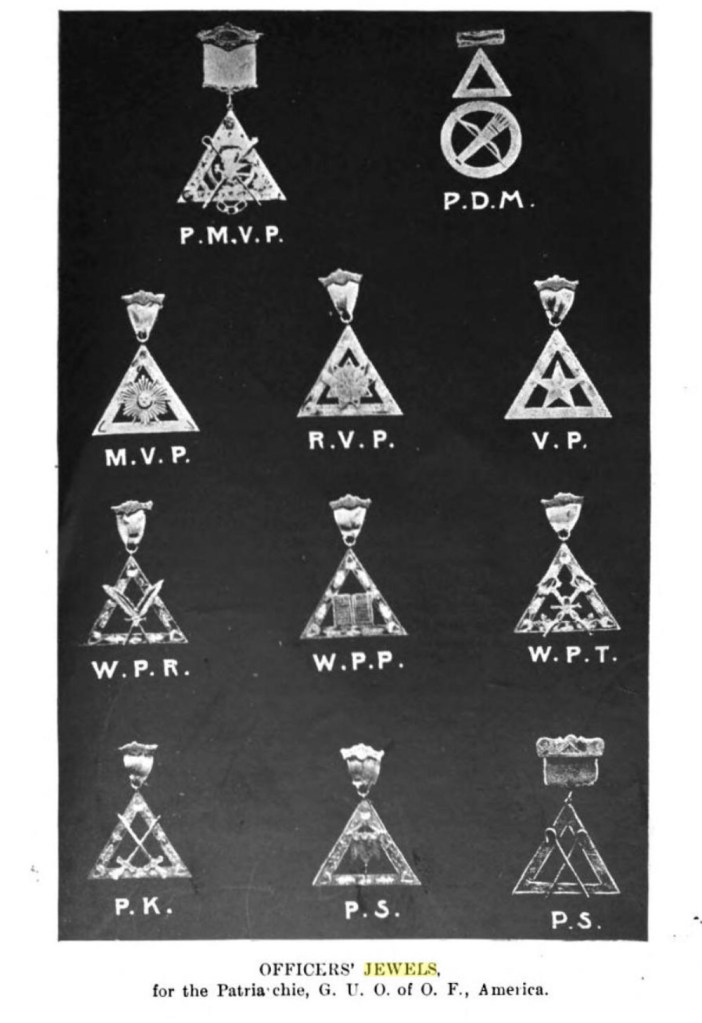
Understanding the Degrees, Titles and Symbols on the District Level
Grand Treasurer (crossed keys)
Grand Secretary – (crossed quill)
Warden (crossed axes)
Guards (crossed sword)
S.A. (skull & cross bones)
Master Worthy Grand (crossed batons)
District Grand Master – (crossed shepherd hooks)
Past Worthy Grand Master – wheat & scythe and 7-pointed star
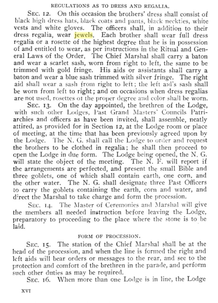
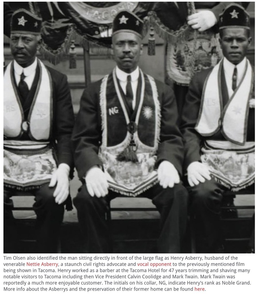
The structure of Grand United Order of Odd Fellows is reflected in the regalia worn by the members. This is an amazing image that was posted in the article from Tacoma, Washington, a long way from rural Blacksburg of the time. But the collars, staffs, swords and hats plus the proximity of the men to the Noble Grand leader provide a glimpse of the hierarchy. Note the two men on both sides of the GN. LS and RS stand for Left and Right Supporter. Grit City Magazine, Feb 2023
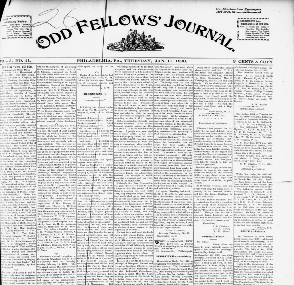
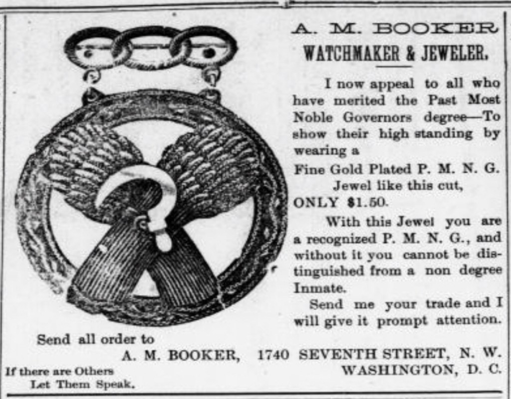
More Regalia Images from the Odd Fellows Journal, 1900.
Asbury, J. C. Odd Fellows’ Journal. (Philadelphia, Pa.), Vol. 3, No. 41, Ed. 1 Thursday, January 11, 1900; Philadelphia, Pennsylvania. (https://texashistory.unt.edu/ark:/67531/metapth523664/: accessed January 16, 2024),University of North Texas Libraries.
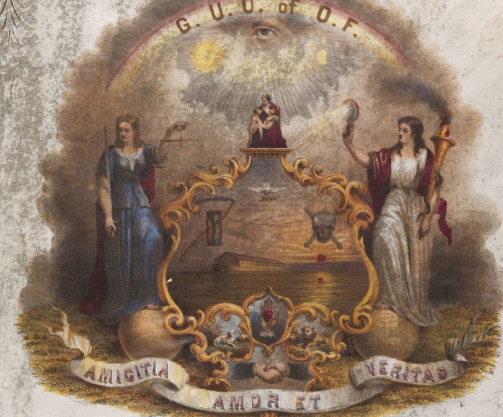
Iconography
Iconography that is associate with GUOOF is featured and explained by The Library of Philadelphia based on the 1843 chromolithograph created by D.B. Bowser (1820-1900), an African American artist. The symbols used include: “sickle & hourglass, dove, skull & crossbones, lamb, heart-in-hand, lion, seeing eye in the night sky and under a rainbow.”
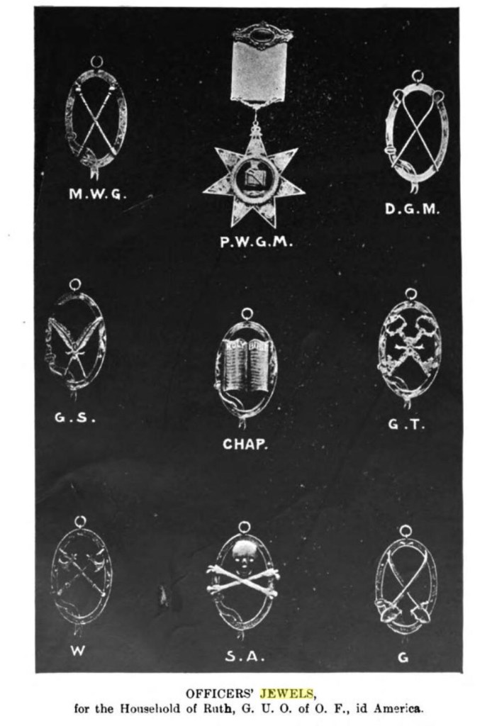
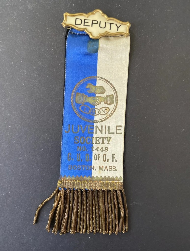
Juvenile Society, the Juvenile Branch of Odd Fellows.
The Grand United Order of Odd Fellows and the House of Ruth created the Juvenile Branch on September 13, 1897 for all children from age 3 to 16. Their parents did not have to be a member of the order. In support of families, the 4th Sunday of September was designated “Children’s Day.” The Juvenile Branch became known as the Juvenile Society.
Courtesy of Scottish Rite MuseumClip for a badge, frontBack
Independent Order of St Luke
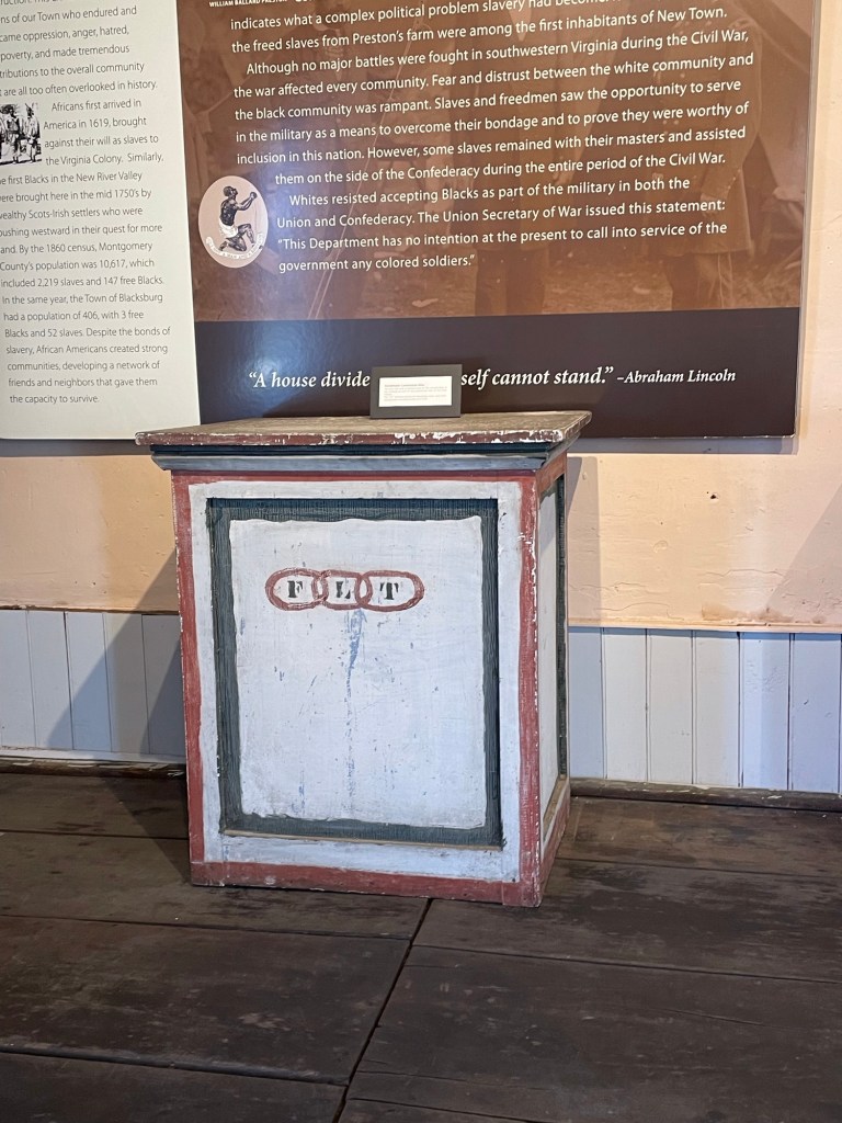
The St. Luke and Odd Fellows Hall, located on Gilbert Street in Blacksburg, stands as the sole remaining historic building from the once vibrant African American neighborhood of New Town. With two floors, it hosted both sacred ceremonies and administrative functions, contrary to the misconception that ceremonies were exclusive to the second floor. The Rules & Regulations book includes a diagram detailing the assigned places for desks and officers, clarifying this aspect.
Floding Company Manufactures Catalog and the KKK Uniform Manufacture
Courtesy of Virginia Tech Special Collections & University Archives
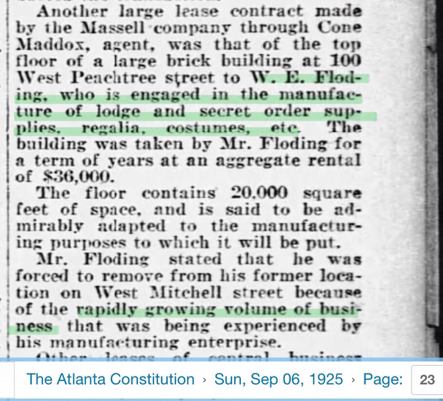
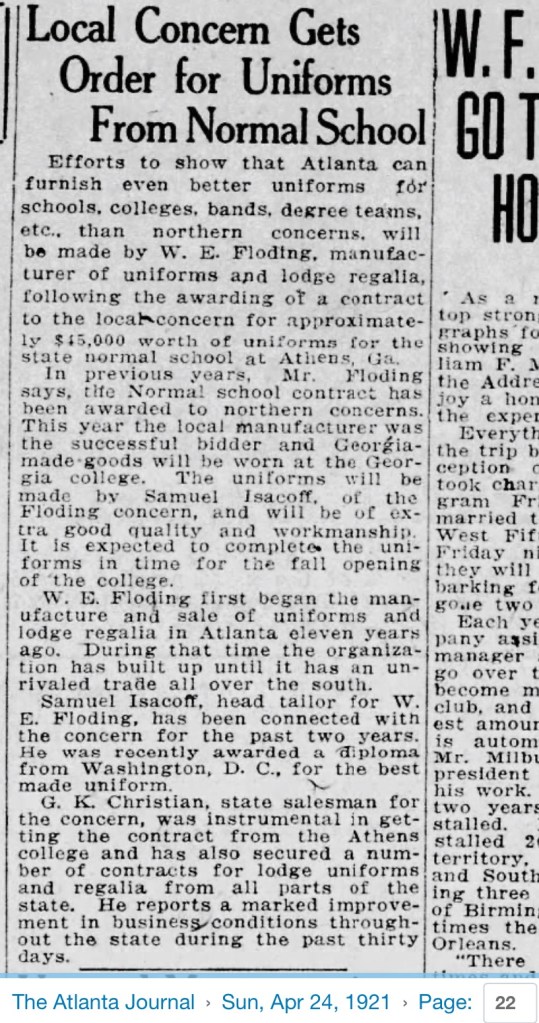
From 1875 to 1964, the Floding Regalia Company, based in Atlanta, produced regalia. Owned by W.E. Floding, the company supplied regalia to African American fraternal organizations and secretive costume to, most likely, the KKK.
In 1925 Mr Floding moving his manufacturing to a large space in Atlanta due to the expanding sales of secretive regalia and costume. However, Floding was also financially linked to Atlanta KKK activities under Edward Young Clarke, who was convicted of violating the Mann Act by assaulting and then transporting a woman across state lines. In 1927, Clarke and Rev. JR Straton were instrumental in creating a competing organization to the KKK, pledging operations to other states. Clarke, Imperial Wizard 1915-1922, was booted out of the KKK but started a parallel group. See clipping below.
Souvenir Medal from 14-20 September 1908 Atlantic City, NJ Gathering
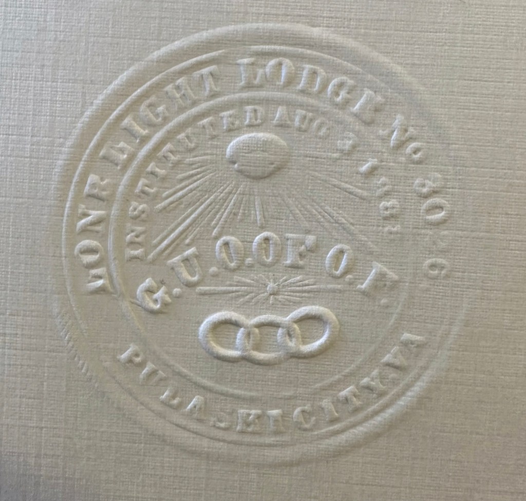
We have much to learn about this Lodge and the people who belonged. This lodge was created before the Roanoke City Lodge, known as Roanoke, #3225, dated 13 March 1890 and the Blacksburg’s Tadmore Light Lodge, #6184